Randonnée V.T.T. Gemeinde Tux - Geiseljoch - Photo
 michelek
michelek

Utilisateur

© OpenStreetMap contributors
Longueur
Longueur
12,8 km
Altitude max
Altitude max
2292 m
Dénivelé positif
Dénivelé positif
1106 m
Km-Effort
Km-Effort  
24 km
Altitude min
Altitude min
1257 m
Dénivelé négatif
Dénivelé négatif
75 m
Boucle
Boucle
Non
Date de création :
2014-12-10 00:00:00.0
Dernière modification :
2014-12-10 00:00:00.0

(0 Avis)

V.T.T.
V.T.T.
1h40
Difficulté : Difficile

Scannez ce code QR pour ouvrir la randonnée dans l'application SityTrail

Application GPS de randonnée GRATUITE

Logo SityTrail SityTrail

IGN / Instituts géographiques

Télécharger SityTrail sur l'App Store Télécharger SityTrail sur Google Play

Logo SityTrail SityTrail World

Le monde est à vous

Télécharger SityTrail sur l'App Store Télécharger SityTrail sur Google Play Télécharger SityTrail sur Huawei AppGallery

À propos

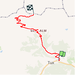
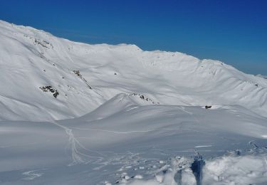
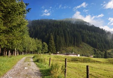
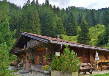
Randonnée V.T.T. de 12,8 km à découvrir à Tyrol, Bezirk Schwaz, Gemeinde Tux. Cette randonnée est proposée par michelek.

Description

Zillertal 2007

Profil altimétrique

Localisation

Pays :
Autriche
Région :
Tyrol
Département/Province :
Bezirk Schwaz
Commune :
Gemeinde Tux
Localité :
Unknown
Départ:(Dec)
Départ:(UTM)
708018 ; 5226902 (32T) N.

Randonnées à proximité

Randonnée A pied Gemeinde Tux - Wanderweg 57 - Photo
A pied
PRO

A pied

Facile
Gemeinde Tux, Tyrol, Bezirk Schwaz, Autriche
3,5 km | 5,6 km-effort
1h 16min
Non
Randonnée A pied Gemeinde Tux - AT-23 - Photo
A pied
PRO

A pied

Facile
Gemeinde Tux, Tyrol, Bezirk Schwaz, Autriche
4,6 km | 9,5 km-effort
2h 9min
Non
Randonnée A pied Gemeinde Tux - AT-33 - Photo
A pied
PRO

A pied

Facile
Gemeinde Tux, Tyrol, Bezirk Schwaz, Autriche
9,1 km | 17,1 km-effort
3h 53min
Non
Randonnée A pied Gemeinde Tux - AT-24 - Photo
A pied
PRO

A pied

Facile
Gemeinde Tux, Tyrol, Bezirk Schwaz, Autriche
4,6 km | 6,2 km-effort
1h 23min
Non
Randonnée A pied Gemeinde Tux - AT-21 - Photo
A pied
PRO

A pied

Facile
Gemeinde Tux, Tyrol, Bezirk Schwaz, Autriche
4,8 km | 8,8 km-effort
1h 59min
Non
Randonnée A pied Gemeinde Tux - AT-322 - Photo
A pied
PRO

A pied

Facile
Gemeinde Tux, Tyrol, Bezirk Schwaz, Autriche
8,2 km | 19,4 km-effort
4h 25min
Non
Randonnée A pied Gemeinde Tux - AT-28 - Photo
A pied
PRO

A pied

Facile
Gemeinde Tux, Tyrol, Bezirk Schwaz, Autriche
3,9 km | 5,4 km-effort
1h 12min
Non
Randonnée Marche Gemeinde Tux - Autriche - Tuxtal - Photo
Marche
nicolasbarbarin

Marche

Difficile
Gemeinde Tux, Tyrol, Bezirk Schwaz, Autriche
11,3 km | 24 km-effort
6h 1min
Oui
Randonnée Marche Gemeinde Finkenberg - 02-Gamshuette-Friesenberghaus - Photo
Marche
fpolini

Marche

Très difficile
Gemeinde Finkenberg, Tyrol, Bezirk Schwaz, Autriche
13,6 km | 28 km-effort
5h 51min
Non


Fermer
Mes abonnements