Randonnée Marche Saint-Maximin - Apremon 270920 - Photo
 bellangerxavier
bellangerxavier

Utilisateur

© OpenStreetMap contributors
Longueur
Longueur
54 km
Altitude max
Altitude max
203 m
Dénivelé positif
Dénivelé positif
851 m
Km-Effort
Km-Effort  
66 km
Altitude min
Altitude min
14 m
Dénivelé négatif
Dénivelé négatif
836 m
Boucle
Boucle
Non
Date de création :
2020-09-27 08:06:24.0
Dernière modification :
2020-09-27 11:49:31.022

(0 Avis)

Marche
Marche
2h20
Difficulté : Inconnu

Scannez ce code QR pour ouvrir la randonnée dans l'application SityTrail

Application GPS de randonnée GRATUITE

Logo SityTrail SityTrail

IGN / Instituts géographiques

Télécharger SityTrail sur l'App Store Télécharger SityTrail sur Google Play

Logo SityTrail SityTrail World

Le monde est à vous

Télécharger SityTrail sur l'App Store Télécharger SityTrail sur Google Play Télécharger SityTrail sur Huawei AppGallery

À propos

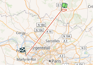
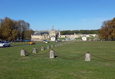
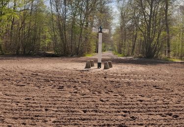
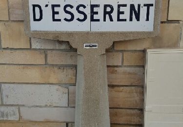
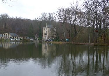
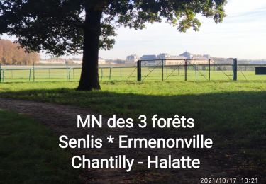
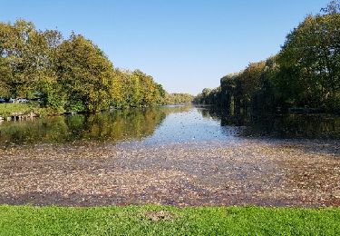
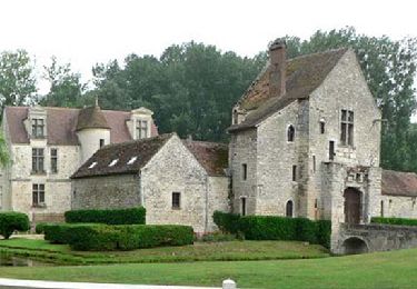
Randonnée Marche de 54 km à découvrir à Hauts-de-France, Oise, Saint-Maximin. Cette randonnée est proposée par bellangerxavier.

Description

Facile et mouillé


Profil altimétrique

Localisation

Pays :
France
Région :
Hauts-de-France
Département/Province :
Oise
Commune :
Saint-Maximin
Localité :
Unknown
Départ:(Dec)
Départ:(UTM)
461348 ; 5450214 (31U) N.

Randonnées à proximité

Randonnée Marche Apremont - apremont 60300 - Photo
Marche
dartoisclaude

Marche

Difficile
(1)
Apremont, Hauts-de-France, Oise, France
20 km | 23 km-effort
4h 49min
Oui
Randonnée Marche Chantilly - chantilly Gouvieux - Photo
Marche
Jacques Salfati

Marche

Facile
Chantilly, Hauts-de-France, Oise, France
20 km | 0 m-effort
5h 59min
Oui
Randonnée Marche Avilly-Saint-Léonard - randonnée en forêt de chantilly - Photo
Marche
jumetz philippe

Marche

Très facile
Avilly-Saint-Léonard, Hauts-de-France, Oise, France
12,1 km | 13,2 km-effort
2h 54min
Oui
Randonnée Marche Saint-Leu-d'Esserent - CRAB : Saint Leu d'Esserent - Photo
Marche
PatRando

Marche

Facile
Saint-Leu-d'Esserent, Hauts-de-France, Oise, France
24 km | 28 km-effort
6h 7min
Oui
Randonnée V.T.T. Chantilly - Dans la forêt de Chantilly - Photo
V.T.T.
tracegps

V.T.T.

Moyen
Chantilly, Hauts-de-France, Oise, France
19,7 km | 22 km-effort
1h 30min
Oui
Randonnée Marche Chantilly - Dans la forêt de Chantilly - Photo
Marche
tracegps

Marche

Moyen
Chantilly, Hauts-de-France, Oise, France
19,7 km | 22 km-effort
5h 0min
Oui
Randonnée Marche Chantilly - JG Chantilly Toudouze  ecuries Ctx - Photo
Marche
jol60

Marche

Facile
Chantilly, Hauts-de-France, Oise, France
4,6 km | 5,1 km-effort
1h 10min
Oui
Randonnée Marche Chantilly - La vallée de la Nonette  - Photo
Marche
viam19

Marche

Facile
Chantilly, Hauts-de-France, Oise, France
16,9 km | 18,7 km-effort
4h 7min
Oui
Randonnée Marche Chantilly - La Table Ronde de Montgrésin_Trace_12,1 km - Photo
Marche
Pousscailleux

Marche

Très facile
Chantilly, Hauts-de-France, Oise, France
12,1 km | 13,5 km-effort
2h 59min
Oui


Fermer
Mes abonnements