![](/images/other/stat-length.png)
![Randonnée Marche Ouzous - Le PIBESTE en AL & RET Fait le 22/12/2020 - Photo](https://media.geolcdn.com/t/1900/400/ext.pjpeg?maxdim=2&url=https%3A%2F%2Fmedia.geolcdn.com%2Ff%2F11506186-d111-4d92-a1b5-5b47aa12c6b9.jpg)
Le PIBESTE en AL & RET Fait le 22/12/2020
mitch1952
Utilisateur
![Longueur](/images/other/stat-length.png)
Longueur
12,1 km
![Altitude max](https://static1.geolcdn.com/siteimages/upload/files/1508320355ic_sort_altitude_max_24dp.png)
Altitude max
1340 m
![Dénivelé positif](https://static1.geolcdn.com/siteimages/upload/files/1508320355ic_sort_den_pos_24dp.png)
Dénivelé positif
807 m
![Km-Effort](/images/other/stat-length.png)
Km-Effort
23 km
![Altitude min](https://static1.geolcdn.com/siteimages/upload/files/1508320355ic_sort_altitude_min_24dp.png)
Altitude min
578 m
![Dénivelé négatif](https://static1.geolcdn.com/siteimages/upload/files/1508320355ic_sort_den_neg_24dp.png)
Dénivelé négatif
807 m
![Boucle](https://static1.geolcdn.com/siteimages/upload/files/16400158638029165_repeat_loop_refresh_sync_direction_icon.png)
Boucle
Oui
Date de création :
2020-12-22 07:27:08.314
Dernière modification :
2022-06-07 12:59:55.019
![Marche](https://static1.geolcdn.com/sitytour/trail-icons/101.png)
5h00
Difficulté : Moyen
![Scannez ce code QR pour ouvrir la randonnée dans l'application SityTrail](https://capi.geolives.com/qq0zvz2zws4bq2lad0pu/sitytour/trails/2623863/qr.png?size=200)
Application GPS de randonnée GRATUITE
À propos
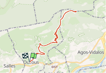
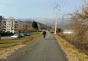
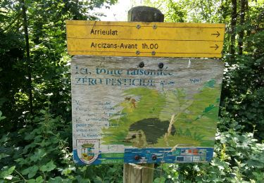
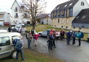
Randonnée Marche de 12,1 km à découvrir à Occitanie, Hautes-Pyrénées, Ouzous. Cette randonnée est proposée par mitch1952.
Description
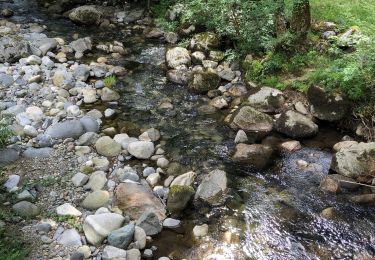
Le sentier est exposé plein sud. En été préférer une montée à la fraiche.
Durée 5 h 00 PN et arrêt compris.
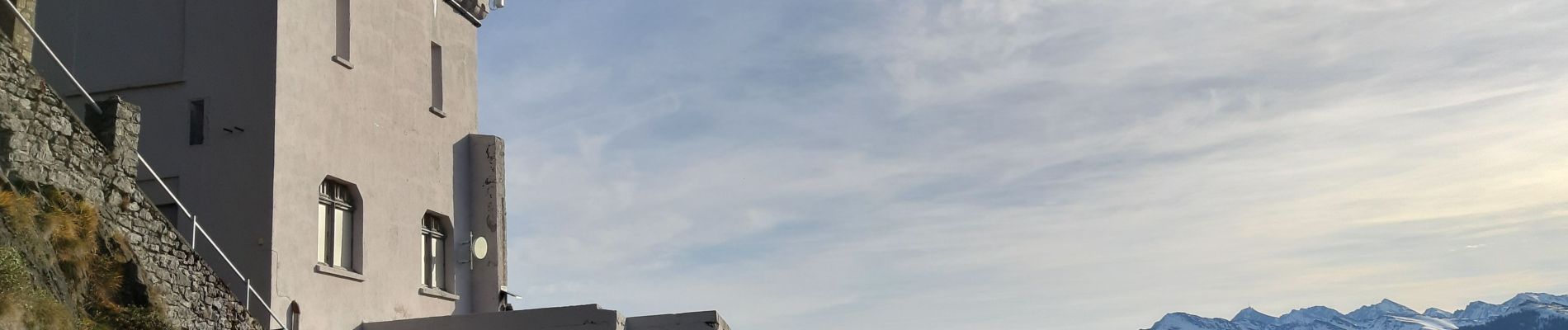
Belle Vue sur la vallée d'ARGELEZ GAZOST, LOURDES et Chaine de montagne environnante
Localisation
Pays :
France
Région :
Occitanie
Département/Province :
Hautes-Pyrénées
Commune :
Ouzous
Localité :
Unknown
Départ:(Dec)
Départ:(UTM)
735630 ; 4768202 (30T) N.
Commentaires
Randonnées à proximité
![Randonnée Marche Argelès-Gazost - Le Mont de Gez en circuit - Argelès Gazost - Photo](https://media.geolcdn.com/t/375/260/ext.jpg?maxdim=2&url=https%3A%2F%2Fservices.sitytrail.com%2FGeolivesWS%2FDownloadMedia.ashx%3FTrailID%3D172309%26Media%3D13627_4.jpg)
![Marche Marche](https://static1.geolcdn.com/sitytour/trail-icons/101.png)
Le Mont de Gez en circuit - Argelès Gazost
Marche
Moyen
(1)
Argelès-Gazost,
Occitanie,
Hautes-Pyrénées,
France
![](/images/other/stat-length.png)
11,8 km | 20 km-effort
4h 30min
![](https://static1.geolcdn.com/siteimages/upload/files/16400158638029165_repeat_loop_refresh_sync_direction_icon.png)
Oui
![Randonnée Vélo électrique Argelès-Gazost - CABALIROS 30 JUIN 2023 - Photo](https://media.geolcdn.com/t/375/260/ext.jpg?maxdim=2&url=https%3A%2F%2Fmedia.geolcdn.com%2Ff%2Fd00efa13-e401-495e-87f8-f59eb1442703.jpg)
![Vélo électrique Vélo électrique](https://static1.geolcdn.com/sitytour/trail-icons/205.png)
CABALIROS 30 JUIN 2023
Vélo électrique
Moyen
Argelès-Gazost,
Occitanie,
Hautes-Pyrénées,
France
![](/images/other/stat-length.png)
39 km | 57 km-effort
4h 47min
![](https://static1.geolcdn.com/siteimages/upload/files/16400158638029165_repeat_loop_refresh_sync_direction_icon.png)
Oui
![Randonnée Marche Argelès-Gazost - ARGELES La boucle de l arrieulat - Photo](https://media.geolcdn.com/t/375/260/ext.jpg?maxdim=2&url=https%3A%2F%2Fmedia.geolcdn.com%2Ff%2Fcee8eb17-b22b-4615-9318-bf7446bdbe22.jpg)
![Marche Marche](https://static1.geolcdn.com/sitytour/trail-icons/101.png)
ARGELES La boucle de l arrieulat
Marche
Difficile
Argelès-Gazost,
Occitanie,
Hautes-Pyrénées,
France
![](/images/other/stat-length.png)
10,3 km | 14,6 km-effort
3h 4min
![](https://static1.geolcdn.com/siteimages/upload/files/16400158638029165_repeat_loop_refresh_sync_direction_icon.png)
Oui
![Randonnée Marche Argelès-Gazost - ARGELES-GAZOST chateau et lac d'Arcizans depuis l'Arieulat faitG - Photo](https://media.geolcdn.com/t/375/260/ext.jpg?maxdim=2&url=https%3A%2F%2Fmedia.geolcdn.com%2Ff%2Feeeb07d3-6aac-46aa-9d84-fcb3c307f0c5.jpg)
![Marche Marche](https://static1.geolcdn.com/sitytour/trail-icons/101.png)
ARGELES-GAZOST chateau et lac d'Arcizans depuis l'Arieulat faitG
Marche
Facile
Argelès-Gazost,
Occitanie,
Hautes-Pyrénées,
France
![](/images/other/stat-length.png)
7,9 km | 11,8 km-effort
4h 56min
![](https://static1.geolcdn.com/siteimages/upload/files/16400158638029165_repeat_loop_refresh_sync_direction_icon.png)
Oui
![Randonnée Marche Argelès-Gazost - ARGELES Mont de Gez G3 fait - Photo](https://media.geolcdn.com/t/375/260/ext.jpg?maxdim=2&url=https%3A%2F%2Fmedia.geolcdn.com%2Ff%2F653c1198-5439-4c4b-acf2-a53537be36e4.jpg)
![Marche Marche](https://static1.geolcdn.com/sitytour/trail-icons/101.png)
ARGELES Mont de Gez G3 fait
Marche
Moyen
Argelès-Gazost,
Occitanie,
Hautes-Pyrénées,
France
![](/images/other/stat-length.png)
10,2 km | 18,3 km-effort
5h 39min
![](https://static1.geolcdn.com/siteimages/upload/files/16400158638029165_repeat_loop_refresh_sync_direction_icon.png)
Oui
![Randonnée Marche Ouzous - Ouzous pibeste-fait - Photo](https://media.geolcdn.com/t/375/260/ext.jpg?maxdim=2&url=https%3A%2F%2Fstatic1.geolcdn.com%2Fsiteimages%2Fupload%2Ffiles%2F1553511878bg_sport_marche.png)
![Marche Marche](https://static1.geolcdn.com/sitytour/trail-icons/101.png)
Ouzous pibeste-fait
Marche
Moyen
(1)
Ouzous,
Occitanie,
Hautes-Pyrénées,
France
![](/images/other/stat-length.png)
11,3 km | 22 km-effort
4h 29min
![](https://static1.geolcdn.com/siteimages/upload/files/16400158638029165_repeat_loop_refresh_sync_direction_icon.png)
Oui
![Randonnée Marche Ouzous - Pic du Pibeste - Photo](https://media.geolcdn.com/t/375/260/ext.jpg?maxdim=2&url=https%3A%2F%2Fstatic1.geolcdn.com%2Fsiteimages%2Fupload%2Ffiles%2F1553511878bg_sport_marche.png)
![Marche Marche](https://static1.geolcdn.com/sitytour/trail-icons/101.png)
Pic du Pibeste
Marche
Moyen
(1)
Ouzous,
Occitanie,
Hautes-Pyrénées,
France
![](/images/other/stat-length.png)
13 km | 25 km-effort
6h 9min
![](https://static1.geolcdn.com/siteimages/upload/files/16400158638029165_repeat_loop_refresh_sync_direction_icon.png)
Oui
![Randonnée Marche Salles - Escala du Prat du Rey - Photo](https://media.geolcdn.com/t/375/260/ext.jpg?maxdim=2&url=https%3A%2F%2Fstatic1.geolcdn.com%2Fsiteimages%2Fupload%2Ffiles%2F1553511878bg_sport_marche.png)
![Marche Marche](https://static1.geolcdn.com/sitytour/trail-icons/101.png)
Escala du Prat du Rey
Marche
Moyen
(1)
Salles,
Occitanie,
Hautes-Pyrénées,
France
![](/images/other/stat-length.png)
11,3 km | 22 km-effort
4h 24min
![](https://static1.geolcdn.com/siteimages/upload/files/16400158638029165_repeat_loop_refresh_sync_direction_icon.png)
Oui
![Randonnée Marche Ayzac-Ost - Argeles_Gazost - Photo](https://media.geolcdn.com/t/375/260/ext.jpg?maxdim=2&url=https%3A%2F%2Fmedia.geolcdn.com%2Ff%2F4400e712-e038-4658-bd18-0b95d28cfee8.jpg)
![Marche Marche](https://static1.geolcdn.com/sitytour/trail-icons/101.png)
Argeles_Gazost
Marche
Facile
Ayzac-Ost,
Occitanie,
Hautes-Pyrénées,
France
![](/images/other/stat-length.png)
8,8 km | 11,9 km-effort
3h 10min
![](https://static1.geolcdn.com/siteimages/upload/files/16400158638029165_repeat_loop_refresh_sync_direction_icon.png)
Oui