Randonnée Marche Poigny-la-Forêt - ADAL 20140415 Poigny la foret - Photo

ADAL 20140415 Poigny la foret

 VVerley
VVerley

Utilisateur

© OpenStreetMap contributors
Longueur
Longueur
18,9 km
Altitude max
Altitude max
183 m
Dénivelé positif
Dénivelé positif
238 m
Km-Effort
Km-Effort  
22 km
Altitude min
Altitude min
134 m
Dénivelé négatif
Dénivelé négatif
238 m
Boucle
Boucle
Oui
Date de création :
2014-12-10 00:00:00.0
Dernière modification :
2014-12-10 00:00:00.0

(2 Avis)

Marche
Marche
4h54
Difficulté : Moyen

Scannez ce code QR pour ouvrir la randonnée dans l'application SityTrail

Application GPS de randonnée GRATUITE

Logo SityTrail SityTrail

IGN / Instituts géographiques

Télécharger SityTrail sur l'App Store Télécharger SityTrail sur Google Play

Logo SityTrail SityTrail World

Le monde est à vous

Télécharger SityTrail sur l'App Store Télécharger SityTrail sur Google Play Télécharger SityTrail sur Huawei AppGallery

À propos

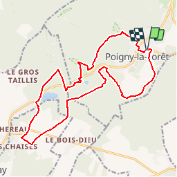
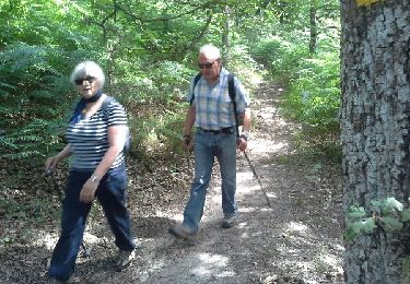
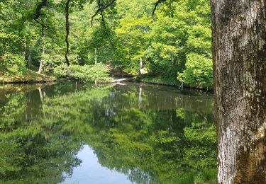
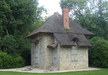
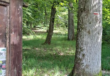
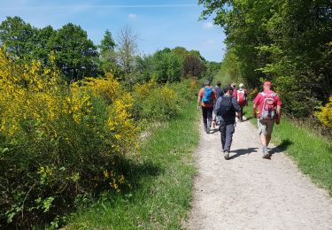
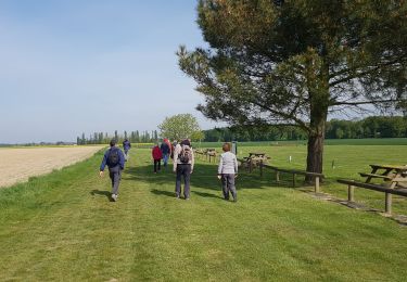
Randonnée Marche de 18,9 km à découvrir à Île-de-France, Yvelines, Poigny-la-Forêt. Cette randonnée est proposée par VVerley.

Description

Randonnée ADAL allure modérée du Mardi 15 Avril 2014.
Très beau parcours .

Profil altimétrique

Photos

Localisation

Pays :
France
Région :
Île-de-France
Département/Province :
Yvelines
Commune :
Poigny-la-Forêt
Localité :
Unknown
Départ:(Dec)
Départ:(UTM)
408583 ; 5392418 (31U) N.

Commentaires

Veuillez vous connecter pour laisser un commentaire ou une note


Belle randonnée, et facile


Randonnées à proximité

Randonnée Marche Saint-Léger-en-Yvelines - Yvelines_Croix-Vilpert=>Rochers-d'Angennes=>Petit-Etang-Neuf - Photo
Marche
BMorin91470

Marche

Moyen
(1)
Saint-Léger-en-Yvelines, Île-de-France, Yvelines, France
21 km | 25 km-effort
3h 35min
Oui
Randonnée V.T.T. Rambouillet - _Les étangs de Hollande - Photo
V.T.T.
GUIDE+

V.T.T.

Moyen
(2)
Rambouillet, Île-de-France, Yvelines, France
29 km | 33 km-effort
2h 9min
Oui
Randonnée Marche Poigny-la-Forêt - Sortie du 25/06/2015 - Photo
Marche
microb

Marche

Moyen
(1)
Poigny-la-Forêt, Île-de-France, Yvelines, France
12,5 km | 14,6 km-effort
3h 13min
Oui
Randonnée Marche Poigny-la-Forêt - poigny - Photo
Marche
galou29

Marche

Très facile
(1)
Poigny-la-Forêt, Île-de-France, Yvelines, France
13,9 km | 15,7 km-effort
3h 11min
Oui
Randonnée Marche Gazeran - 20190714 boucle Gazeran - Photo
Marche
patb54

Marche

Très difficile
(1)
Gazeran, Île-de-France, Yvelines, France
25 km | 30 km-effort
6h 28min
Oui
Randonnée Marche Rambouillet - _Les fabuleux trésors du Parc de Rambouillet - Photo
Marche
GUIDE+

Marche

Moyen
Rambouillet, Île-de-France, Yvelines, France
6,8 km | 7,9 km-effort
1h 30min
Oui
Randonnée Marche Poigny-la-Forêt - Rochers d'Angennes Yvelines - Photo
Marche
mallovon

Marche

Moyen
Poigny-la-Forêt, Île-de-France, Yvelines, France
6,3 km | 7,6 km-effort
1h 58min
Oui
Randonnée Marche Rambouillet - 2022-05-01_EtangCoupeGorge_MaresDeVilpert - Photo
Marche
BMorin91470

Marche

Facile
Rambouillet, Île-de-France, Yvelines, France
11,2 km | 12,3 km-effort
2h 34min
Oui
Randonnée Marche Rambouillet - 2022-05-01_ EtangCoupeGorge_EtangsDeHollande - Photo
Marche
BMorin91470

Marche

Facile
Rambouillet, Île-de-France, Yvelines, France
14,9 km | 16,4 km-effort
3h 19min
Oui


Fermer
Mes abonnements