


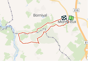

12,8 km | 15 km-effort


Utilisateur


Application GPS de randonnée GRATUITE
 SityTrail
IGN / Instituts géographiques
SityTrail World
Le monde est à vous
Randonnée Marche de 6,7 km à découvrir à Wallonie, Brabant wallon, Nivelles. Cette randonnée est proposée par samlrando.
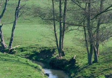
Superbe balade entre champs, vallée encaissée bordée de la Thines et Bois de l'Hôpital, magnifiquement fleuri de jonquilles en Mars-Avril. Un peu de dénivelés qui procurent de bien belles vues.

Marche

Marche

Marche

Marche

Marche
Marche

Marche
Marche
Marche nordique