


Joué-lès-Tours - 12.9km 100m 2h25 - 2021 04 03

Orcal37
Utilisateur GUIDE
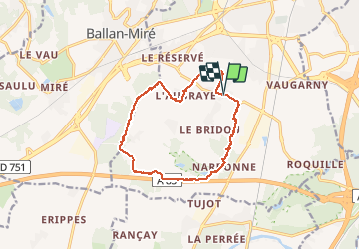

Longueur
12,9 km

Altitude max
107 m

Dénivelé positif
102 m
Km-Effort
14,2 km

Altitude min
77 m

Dénivelé négatif
102 m
Boucle
Oui
Date de création :
2021-04-03 12:44:49.518
Dernière modification :
2021-04-06 12:51:05.863
2h25
Difficulté : Facile

Application GPS de randonnée GRATUITE
 SityTrail
IGN / Instituts géographiques
SityTrail Plus
Le monde est à vous
À propos
Randonnée Marche de 12,9 km à découvrir à Centre-Val de Loire, Indre-et-Loire, Joué-lès-Tours. Cette randonnée est proposée par Orcal37.
Description
Joué-lès-Tours - variante PR - 12.9km 100m 2h25 - 2021 04 03
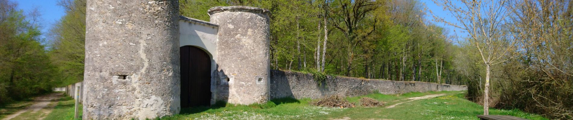
Photos


Localisation
Pays :
France
Région :
Centre-Val de Loire
Département/Province :
Indre-et-Loire
Commune :
Joué-lès-Tours
Localité :
Unknown
Départ:(Dec)
Départ:(UTM)
322322 ; 5244165 (31T) N.
Commentaires