Randonnée Marche Montenoy - MONTENOY - LE COL DE VASSUCHAMP - Photo

MONTENOY - LE COL DE VASSUCHAMP

© OpenStreetMap contributors
Longueur
Longueur
12,4 km
Altitude max
Altitude max
419 m
Dénivelé positif
Dénivelé positif
301 m
Km-Effort
Km-Effort  
16,4 km
Altitude min
Altitude min
227 m
Dénivelé négatif
Dénivelé négatif
304 m
Boucle
Boucle
Oui
Date de création :
2021-05-04 12:18:22.698
Dernière modification :
2021-05-05 11:52:22.913

(0 Avis)

Marche
Marche
4h33
Difficulté : Facile

Scannez ce code QR pour ouvrir la randonnée dans l'application SityTrail

Application GPS de randonnée GRATUITE

Logo SityTrail SityTrail

IGN / Instituts géographiques

Télécharger SityTrail sur l'App Store Télécharger SityTrail sur Google Play

Logo SityTrail SityTrail World

Le monde est à vous

Télécharger SityTrail sur l'App Store Télécharger SityTrail sur Google Play Télécharger SityTrail sur Huawei AppGallery

À propos

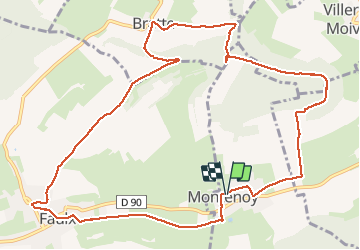
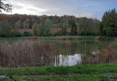
Randonnée Marche de 12,4 km à découvrir à Grand Est, Meurthe-et-Moselle, Montenoy. Cette randonnée est proposée par jean-marie.parachini.

Description

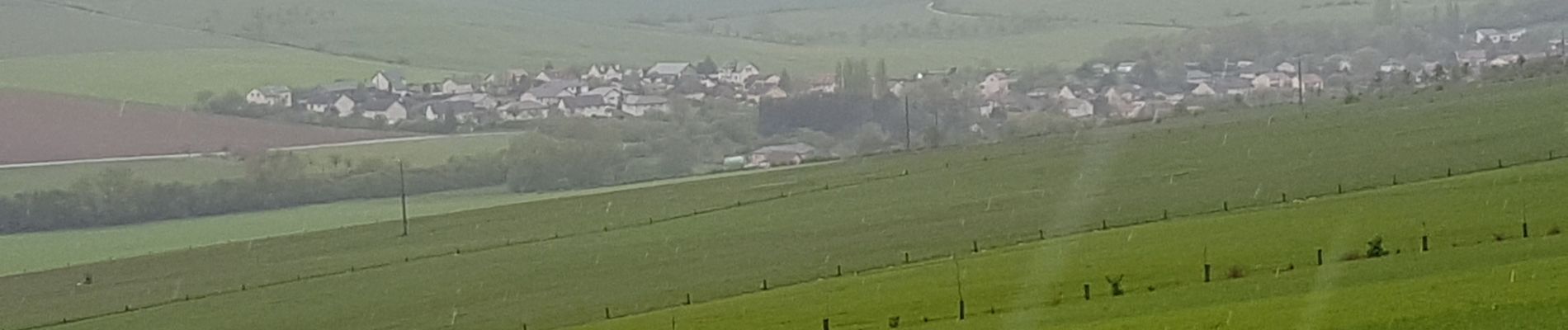
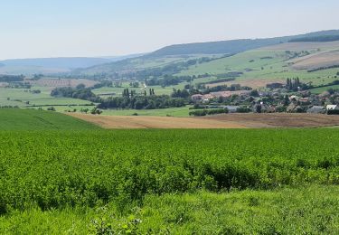
randonnée dans la vallée de la Mauchère entre Montenoy Bratte et Faulx.

Profil altimétrique

Photos

Localisation

Pays :
France
Région :
Grand Est
Département/Province :
Meurthe-et-Moselle
Commune :
Montenoy
Localité :
Unknown
Départ:(UTM)
296533 ; 5408343 (32U) N.

Randonnées à proximité

Randonnée A pied Lay-Saint-Christophe - Circuit L - Photo
A pied
PRO

A pied

Facile
Lay-Saint-Christophe, Grand Est, Meurthe-et-Moselle, France
14,7 km | 18,5 km-effort
4h 11min
Oui
Randonnée A pied Bouxières-aux-Dames - Circuit moyenne ceinture - Photo
A pied
PRO

A pied

Facile
Bouxières-aux-Dames, Grand Est, Meurthe-et-Moselle, France
3,8 km | 5,3 km-effort
1h 12min
Oui
Randonnée Marche Leyr - LEYR - LE PLATEAU DE LA ROCHETTE - Photo
Marche
jean-marie.parachini

Marche

Facile
Leyr, Grand Est, Meurthe-et-Moselle, France
12,1 km | 15,5 km-effort
5h 59min
Oui
Randonnée Marche Bouxières-aux-Chênes - tour crany 29/5/2019 - Photo
Marche
Morel54

Marche

Très facile
(1)
Bouxières-aux-Chênes, Grand Est, Meurthe-et-Moselle, France
11,1 km | 14 km-effort
3h 42min
Oui
Randonnée A pied Faulx - Circuit L : Variant Faulx - Photo
A pied
PRO

A pied

Facile
Faulx, Grand Est, Meurthe-et-Moselle, France
6,3 km | 6,9 km-effort
1h 34min
Non
Randonnée Marche Leyr - Leyr Villers les Moivrons - Photo
Marche
jean-marie.parachini

Marche

Moyen
Leyr, Grand Est, Meurthe-et-Moselle, France
32 km | 42 km-effort
6h 38min
Non
Randonnée Marche Leyr - Leyr - plateau de la Rochette - Photo
Marche
jean-marie.parachini

Marche

Facile
Leyr, Grand Est, Meurthe-et-Moselle, France
11,8 km | 15,1 km-effort
6h 4min
Oui
Randonnée Marche Lay-Saint-Christophe - Lay Saint Christophe  - Photo
Marche
JJG54

Marche

Moyen
Lay-Saint-Christophe, Grand Est, Meurthe-et-Moselle, France
12,3 km | 15,2 km-effort
2h 52min
Oui
Randonnée Marche Leyr - Leyr 15 000m +432m - Photo
Marche
DanielROLLET

Marche

Très difficile
Leyr, Grand Est, Meurthe-et-Moselle, France
15 km | 21 km-effort
4h 42min
Oui


Fermer
Mes abonnements