


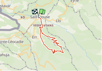

11,8 km | 18,2 km-effort


Utilisateur


Application GPS de randonnée GRATUITE
 SityTrail
IGN / Instituts géographiques
SityTrail World
Le monde est à vous
Randonnée Marche de 16,2 km à découvrir à Occitanie, Pyrénées-Orientales, Saillagouse. Cette randonnée est proposée par ThonyM.
Les 700m sur les premiers 7 km. Tres belle vues sur Saillagouse


Marche

Marche

Marche

Marche

Marche
Marche
Marche
Marche

Trail
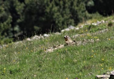
Randonnée sympa avec retour par la forêt, de bien beaux papillons observables tout au long du trajet.