Randonnée Cheval Le Malzieu-Forain - MAJ 21 DRAILLE EN MARGERIDE 2eme partie vers Saugues - Photo

MAJ 21 DRAILLE EN MARGERIDE 2eme partie vers Saugues

 Lozère Cheval
Lozère Cheval

Utilisateur

© OpenStreetMap contributors
Longueur
Longueur
50 km
Altitude max
Altitude max
1482 m
Dénivelé positif
Dénivelé positif
1120 m
Km-Effort
Km-Effort  
64 km
Altitude min
Altitude min
928 m
Dénivelé négatif
Dénivelé négatif
1125 m
Boucle
Boucle
Oui
Date de création :
2021-07-14 14:03:03.077
Dernière modification :
2021-08-05 18:52:29.349

(0 Avis)

Cheval
Cheval
--
Difficulté : Très facile

Scannez ce code QR pour ouvrir la randonnée dans l'application SityTrail

Application GPS de randonnée GRATUITE

Logo SityTrail SityTrail

IGN / Instituts géographiques

Télécharger SityTrail sur l'App Store Télécharger SityTrail sur Google Play

Logo SityTrail SityTrail World

Le monde est à vous

Télécharger SityTrail sur l'App Store Télécharger SityTrail sur Google Play Télécharger SityTrail sur Huawei AppGallery

À propos

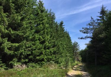
Randonnée Cheval de 50 km à découvrir à Occitanie, Lozère, Le Malzieu-Forain. Cette randonnée est proposée par Lozère Cheval.

Description

A rajouter à la première partie du circuit

Profil altimétrique

Points d'intérêt

Point d'intérêt Paulhac-en-Margeride - Auberge le Bon Accueil - Photo
Lozère Cheval
PAULHAC-EN-MARGERIDE 

Localisation

Pays :
France
Région :
Occitanie
Département/Province :
Lozère
Commune :
Le Malzieu-Forain
Localité :
Unknown
Départ:(UTM)
531846 ; 4972986 (31T) N.

Randonnées à proximité

Randonnée A pied Paulhac-en-Margeride - La Molle - Photo
A pied
guitounette

A pied

Facile
(2)
Paulhac-en-Margeride, Occitanie, Lozère, France
8,5 km | 12 km-effort
2h 42min
Oui
Randonnée Marche Grèzes - TOUR DU MONTCHOUVET 43 - circuit pédestre les noisettes sauvages - Photo
Marche
jeff66

Marche

Difficile
Grèzes, Auvergne-Rhône-Alpes, Haute-Loire, France
18,1 km | 25 km-effort
4h 13min
Oui
Randonnée Randonnée équestre Le Malzieu-Forain - Etoile Première boucle  Pré hiver 25 km - Photo
Randonnée équestre
Lozère Cheval

Randonnée équestre

Facile
Le Malzieu-Forain, Occitanie, Lozère, France
25 km | 36 km-effort
1h 4min
Non
Randonnée Marche Le Malzieu-Forain - Lozere - Le Villard-Le-Malzieu-Ville Les trucs de Malzieu-Forain 24km 633m - Photo
Marche
RandoVal

Marche

Difficile
Le Malzieu-Forain, Occitanie, Lozère, France
24 km | 34 km-effort
7h 2min
Oui
Randonnée Marche Le Malzieu-Forain - Lozere - Le Villard-Le-Malzieu-Ville Les trucs de Malzieu-Forain 18km 477m - Photo
Marche
RandoVal

Marche

Moyen
Le Malzieu-Forain, Occitanie, Lozère, France
18,2 km | 26 km-effort
5h 22min
Oui
Randonnée Marche Le Malzieu-Forain - Lozere - Le Villard-Le-Malzieu-Ville Les trucs de Malzieu-Forain 14km 410m - Photo
Marche
RandoVal

Marche

Facile
Le Malzieu-Forain, Occitanie, Lozère, France
13,6 km | 19,9 km-effort
4h 8min
Oui
Randonnée Moto-cross Paulhac-en-Margeride - paulhac en margeride/brioude 5jours 2024 - Photo
Moto-cross
frank12

Moto-cross

Facile
(1)
Paulhac-en-Margeride, Occitanie, Lozère, France
91 km | 131 km-effort
Inconnu
Non
Randonnée Moto-cross Paulhac-en-Margeride - paulhac en margeride/brioude 5jours 2024 version 2 - Photo
Moto-cross
frank12

Moto-cross

Facile
Paulhac-en-Margeride, Occitanie, Lozère, France
116 km | 167 km-effort
Inconnu
Non
Randonnée Marche Paulhac-en-Margeride - Paulhac en Margeride - Photo
Marche
boyer43

Marche

Très difficile
Paulhac-en-Margeride, Occitanie, Lozère, France
27 km | 38 km-effort
8h 42min
Oui


Fermer
Mes abonnements