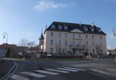
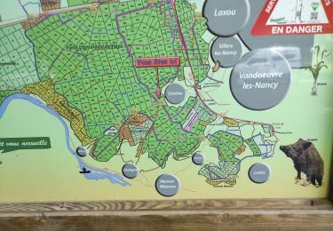
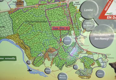
Randonnée Vélo de route Malzéville - Nancy_Lyon - Photo
 plevier
plevier

Utilisateur

© OpenStreetMap contributors
Longueur
Longueur
558 km
Altitude max
Altitude max
386 m
Dénivelé positif
Dénivelé positif
4017 m
Km-Effort
Km-Effort  
612 km
Altitude min
Altitude min
158 m
Dénivelé négatif
Dénivelé négatif
4044 m
Boucle
Boucle
Non
Date de création :
2021-07-20 13:07:02.485
Dernière modification :
2021-07-20 14:40:13.624

(0 Avis)

Vélo de route
Vélo de route
37h04
Difficulté : Très difficile

Scannez ce code QR pour ouvrir la randonnée dans l'application SityTrail

Application GPS de randonnée GRATUITE

Logo SityTrail SityTrail

IGN / Instituts géographiques

Télécharger SityTrail sur l'App Store Télécharger SityTrail sur Google Play

Logo SityTrail SityTrail World

Le monde est à vous

Télécharger SityTrail sur l'App Store Télécharger SityTrail sur Google Play Télécharger SityTrail sur Huawei AppGallery

À propos

Randonnée Vélo de route de 558 km à découvrir à Grand Est, Meurthe-et-Moselle, Malzéville. Cette randonnée est proposée par plevier.

Profil altimétrique

Points d'intérêt

Point d'intérêt Bayon - Bayon - Photo
plevier
BAYON 
Point d'intérêt Charmes - Charmes - Photo
plevier
CHARMES 
Point d'intérêt Sanchey - Bouzey - Photo
plevier
SANCHEY 
Point d'intérêt La Vôge-les-Bains - Voges les bains - Photo
plevier
LA VÔGE-LES-BAINS 
Point d'intérêt Athée - Auxone - Photo
plevier
ATHÉE 
Point d'intérêt Saint-Usage - St Jean de Losne - Photo
plevier
SAINT-USAGE 
Point d'intérêt Pagny-la-Ville - Pagny - Photo
plevier
PAGNY-LA-VILLE 
Point d'intérêt Pouilly-sur-Saône - Seurre - Photo
plevier
POUILLY-SUR-SAÔNE 
Point d'intérêt Verdun-sur-le-Doubs - Verdun - Photo
plevier
VERDUN-SUR-LE-DOUBS 
Point d'intérêt Saint-Marcel - Chalon - Photo
plevier
SAINT-MARCEL 
Point d'intérêt Tournus - Tournus - Photo
plevier
TOURNUS 
Point d'intérêt Uchizy - Uchizy - Photo
plevier
UCHIZY 
Point d'intérêt Sancé - Sance - Photo
plevier
SANCÉ 
Point d'intérêt Cormoranche-sur-Saône - macon2 - Photo
plevier
CORMORANCHE-SUR-SAÔNE 
Point d'intérêt Saint-Symphorien-d'Ancelles - St romain - Photo
plevier
SAINT-SYMPHORIEN-D'ANCELLES 
Point d'intérêt Saint-Didier-sur-Chalaronne - Thoiré - Photo
plevier
SAINT-DIDIER-SUR-CHALARONNE 
Point d'intérêt Montmerle-sur-Saône - Montmerle - Photo
plevier
MONTMERLE-SUR-SAÔNE 
Point d'intérêt Fareins - Villefranche - Photo
plevier
FAREINS 
Point d'intérêt Trévoux - Trévoux - Photo
plevier
TRÉVOUX 
Point d'intérêt Parcieux - Mazieux - Photo
plevier
PARCIEUX 

Localisation

Pays :
France
Région :
Grand Est
Département/Province :
Meurthe-et-Moselle
Commune :
Malzéville
Localité :
Unknown
Départ:(UTM)
292236 ; 5402188 (32U) N.

Randonnées à proximité

Randonnée A pied Champigneulles - Circuit du Val Saint-Barthélémy - Photo
A pied
PRO

A pied

Facile
Champigneulles, Grand Est, Meurthe-et-Moselle, France
7 km | 8,6 km-effort
1h 57min
Oui
Randonnée A pied Agincourt - Circuit M - Photo
A pied
PRO

A pied

Facile
Agincourt, Grand Est, Meurthe-et-Moselle, France
13,3 km | 17,8 km-effort
4h 3min
Non
Randonnée A pied Champigneulles - Circuit du Noirval - Photo
A pied
PRO

A pied

Facile
Champigneulles, Grand Est, Meurthe-et-Moselle, France
11,1 km | 13,5 km-effort
3h 4min
Oui
Randonnée Marche Nancy - Ma dernière avant opération  - Photo
Marche
Toyot 8

Marche

Très difficile
(1)
Nancy, Grand Est, Meurthe-et-Moselle, France
22 km | 25 km-effort
4h 12min
Oui
Randonnée Cyclotourisme Frouard - 4ème rando vélo Frouard - Lagarde 62 km - Photo
Cyclotourisme
GUIDE
jeanmarcMasson

Cyclotourisme

Très difficile
Frouard, Grand Est, Meurthe-et-Moselle, France
62 km | 67 km-effort
4h 32min
Non
Randonnée Marche Nancy - Ma rando du jour - Photo
Marche
Toyot 8

Marche

Difficile
Nancy, Grand Est, Meurthe-et-Moselle, France
35 km | 41 km-effort
5h 55min
Oui
Randonnée Marche Nancy - Nancy Gondreville Nancy - Photo
Marche
Toyot 8

Marche

Difficile
Nancy, Grand Est, Meurthe-et-Moselle, France
64 km | 74 km-effort
10h 57min
Oui
Randonnée Marche Nancy - Nancy Saizeray Jaillon Pierre la Treiche Marion Nancy  - Photo
Marche
Toyot 8

Marche

Difficile
Nancy, Grand Est, Meurthe-et-Moselle, France
73 km | 85 km-effort
12h 13min
Oui
Randonnée A pied Lay-Saint-Christophe - Circuit L - Photo
A pied
PRO

A pied

Facile
Lay-Saint-Christophe, Grand Est, Meurthe-et-Moselle, France
14,7 km | 18,5 km-effort
4h 11min
Oui


Fermer
Mes abonnements