![](/images/other/stat-length.png)
20211118 - Saive 5.6 Km
pierreh01
Utilisateur GUIDE
![Longueur](/images/other/stat-length.png)
Longueur
4,8 km
![Altitude max](https://static1.geolcdn.com/siteimages/upload/files/1508320355ic_sort_altitude_max_24dp.png)
Altitude max
195 m
![Dénivelé positif](https://static1.geolcdn.com/siteimages/upload/files/1508320355ic_sort_den_pos_24dp.png)
Dénivelé positif
33 m
![Km-Effort](/images/other/stat-length.png)
Km-Effort
5,3 km
![Altitude min](https://static1.geolcdn.com/siteimages/upload/files/1508320355ic_sort_altitude_min_24dp.png)
Altitude min
174 m
![Dénivelé négatif](https://static1.geolcdn.com/siteimages/upload/files/1508320355ic_sort_den_neg_24dp.png)
Dénivelé négatif
35 m
![Boucle](https://static1.geolcdn.com/siteimages/upload/files/16400158638029165_repeat_loop_refresh_sync_direction_icon.png)
Boucle
Oui
Date de création :
2021-11-18 08:04:14.0
Dernière modification :
2021-11-18 12:39:35.06
![Marche](https://static1.geolcdn.com/sitytour/trail-icons/101.png)
2h23
Difficulté : Facile
![Scannez ce code QR pour ouvrir la randonnée dans l'application SityTrail](https://capi.geolives.com/qq0zvz2zws4bq2lad0pu/sitytour/trails/3005811/qr.png?size=200)
Application GPS de randonnée GRATUITE
À propos
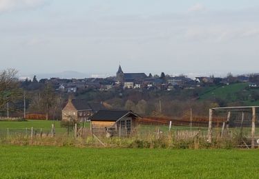
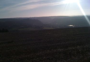
Randonnée Marche de 4,8 km à découvrir à Wallonie, Liège, Blegny. Cette randonnée est proposée par pierreh01.
Description
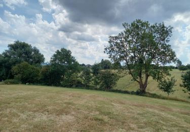
Jeudi 18 novembre 2021 : Balade mensuelle ornithologique
Au départ de l'ancien parking de la caserne de SAIVE, balade commentée par Roger PONSEN dans les environs de l'ancien domaine militaire.
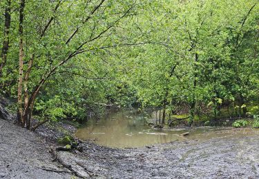
Pas mal de boue et heureusement de la route aussi.
Localisation
Pays :
Belgique
Région :
Wallonie
Département/Province :
Liège
Commune :
Blegny
Localité :
Unknown
Départ:(Dec)
Départ:(UTM)
689072 ; 5614688 (31U) N.
Commentaires
Randonnées à proximité
![Randonnée Marche Fléron - Retinne_1402 - Photo](https://media.geolcdn.com/t/375/260/ext.jpg?maxdim=2&url=https%3A%2F%2Fmedia.geolcdn.com%2Ff%2F65875cd7-f353-4090-b6ef-a8656311fae6.jpg)
![Marche Marche](https://static1.geolcdn.com/sitytour/trail-icons/101.png)
Retinne_1402
Marche
Moyen
(1)
Fléron,
Wallonie,
Liège,
Belgique
![](/images/other/stat-length.png)
9,8 km | 12,3 km-effort
2h 47min
![](https://static1.geolcdn.com/siteimages/upload/files/16400158638029165_repeat_loop_refresh_sync_direction_icon.png)
Oui
![Randonnée Marche Blegny - Barchon _1702 - Photo](https://media.geolcdn.com/t/375/260/ext.jpg?maxdim=2&url=https%3A%2F%2Fmedia.geolcdn.com%2Ff%2F08e717c2-a47c-47f0-9a4e-fb7b564b3f18.jpg)
![Marche Marche](https://static1.geolcdn.com/sitytour/trail-icons/101.png)
Barchon _1702
Marche
Facile
(1)
Blegny,
Wallonie,
Liège,
Belgique
![](/images/other/stat-length.png)
9,9 km | 11,8 km-effort
2h 40min
![](https://static1.geolcdn.com/siteimages/upload/files/16400158638029165_repeat_loop_refresh_sync_direction_icon.png)
Oui
![Randonnée Marche Blegny - 20230703 - Blegny-Mine 6.8 Km - Photo](https://media.geolcdn.com/t/375/260/ext.jpg?maxdim=2&url=https%3A%2F%2Fmedia.geolcdn.com%2Ff%2F840a4c96-62cb-4388-9c6c-d720f9bd1cc9.jpeg)
![Marche Marche](https://static1.geolcdn.com/sitytour/trail-icons/101.png)
20230703 - Blegny-Mine 6.8 Km
Marche
Moyen
(1)
Blegny,
Wallonie,
Liège,
Belgique
![](/images/other/stat-length.png)
6,8 km | 8,6 km-effort
2h 8min
![](https://static1.geolcdn.com/siteimages/upload/files/16400158638029165_repeat_loop_refresh_sync_direction_icon.png)
Oui
![Randonnée Marche Soumagne - Cerexhe-Heuseux _1395 - Photo](https://media.geolcdn.com/t/375/260/ext.jpg?maxdim=2&url=https%3A%2F%2Fmedia.geolcdn.com%2Ff%2Fa90bb153-f7f9-4ccc-abe3-d0c8ad0a64f0.jpg)
![Marche Marche](https://static1.geolcdn.com/sitytour/trail-icons/101.png)
Cerexhe-Heuseux _1395
Marche
Facile
(3)
Soumagne,
Wallonie,
Liège,
Belgique
![](/images/other/stat-length.png)
10,4 km | 13,4 km-effort
3h 2min
![](https://static1.geolcdn.com/siteimages/upload/files/16400158638029165_repeat_loop_refresh_sync_direction_icon.png)
Oui
![Randonnée Marche Blegny - Mortier - Photo](https://media.geolcdn.com/t/375/260/ext.jpg?maxdim=2&url=https%3A%2F%2Fmedia.geolcdn.com%2Ff%2F8ae971b0-94ee-4292-831a-4bed9649b36e.jpg)
![Marche Marche](https://static1.geolcdn.com/sitytour/trail-icons/101.png)
![Randonnée Marche Fléron - F15 Fléron Fond du Pucet - Photo](https://media.geolcdn.com/t/375/260/ext.jpg?maxdim=2&url=https%3A%2F%2Fmedia.geolcdn.com%2Ff%2F52059866-a3d8-42bb-ace6-902ab69a25c9.jpg)
![Marche Marche](https://static1.geolcdn.com/sitytour/trail-icons/101.png)
F15 Fléron Fond du Pucet
Marche
Facile
(2)
Fléron,
Wallonie,
Liège,
Belgique
![](/images/other/stat-length.png)
4,8 km | 6 km-effort
57min
![](https://static1.geolcdn.com/siteimages/upload/files/16400158638029165_repeat_loop_refresh_sync_direction_icon.png)
Oui
![Randonnée Vélo électrique Blegny - Par les Houlpais - Photo](https://media.geolcdn.com/t/375/260/ext.jpg?maxdim=2&url=https%3A%2F%2Fmedia.geolcdn.com%2Ff%2F91501caf-acdf-43bf-a952-638e9aed87aa.jpg)
![Vélo électrique Vélo électrique](https://static1.geolcdn.com/sitytour/trail-icons/205.png)
Par les Houlpais
Vélo électrique
Difficile
(1)
Blegny,
Wallonie,
Liège,
Belgique
![](/images/other/stat-length.png)
37 km | 48 km-effort
2h 30min
![](https://static1.geolcdn.com/siteimages/upload/files/16400158638029165_repeat_loop_refresh_sync_direction_icon.png)
Oui
![Randonnée Marche Beyne-Heusay - Beyne-Heusay - Grivegnée par la Chapelle Sainte-Anne - Photo](https://media.geolcdn.com/t/375/260/ext.jpg?maxdim=2&url=https%3A%2F%2Fservices.sitytrail.com%2FGeolivesWS%2FDownloadMedia.ashx%3FTrailID%3D229568%26Media%3D20120115145851.jpg)
![Marche Marche](https://static1.geolcdn.com/sitytour/trail-icons/101.png)
Beyne-Heusay - Grivegnée par la Chapelle Sainte-Anne
Marche
Très facile
(1)
Beyne-Heusay,
Wallonie,
Liège,
Belgique
![](/images/other/stat-length.png)
5,1 km | 6 km-effort
45min
![](https://static1.geolcdn.com/siteimages/upload/files/16400158638029165_repeat_loop_refresh_sync_direction_icon.png)
Non
![Randonnée Marche Soumagne - RF-Lg-03_Wégimont grande boucle - Photo](https://media.geolcdn.com/t/375/260/ext.jpg?maxdim=2&url=https%3A%2F%2Fstatic1.geolcdn.com%2Fsiteimages%2Fupload%2Ffiles%2F1553511878bg_sport_marche.png)
![Marche Marche](https://static1.geolcdn.com/sitytour/trail-icons/101.png)
RF-Lg-03_Wégimont grande boucle
Marche
Difficile
(1)
Soumagne,
Wallonie,
Liège,
Belgique
![](/images/other/stat-length.png)
12 km | 14,8 km-effort
3h 21min
![](https://static1.geolcdn.com/siteimages/upload/files/16400158638029165_repeat_loop_refresh_sync_direction_icon.png)
Oui