Randonnée Marche Lisle - Rando de lisle - Photo
 Jean LABADIE
Jean LABADIE

Utilisateur

© OpenStreetMap contributors
Longueur
Longueur
18,7 km
Altitude max
Altitude max
149 m
Dénivelé positif
Dénivelé positif
212 m
Km-Effort
Km-Effort  
21 km
Altitude min
Altitude min
86 m
Dénivelé négatif
Dénivelé négatif
216 m
Boucle
Boucle
Oui
Date de création :
2021-11-19 14:47:20.433
Dernière modification :
2022-01-27 13:16:34.348

(1 Avis)

Marche
Marche
4h21
Difficulté : Moyen

Scannez ce code QR pour ouvrir la randonnée dans l'application SityTrail

Application GPS de randonnée GRATUITE

Logo SityTrail SityTrail

IGN / Instituts géographiques

Télécharger SityTrail sur l'App Store Télécharger SityTrail sur Google Play

Logo SityTrail SityTrail World

Le monde est à vous

Télécharger SityTrail sur l'App Store Télécharger SityTrail sur Google Play Télécharger SityTrail sur Huawei AppGallery

À propos

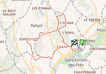
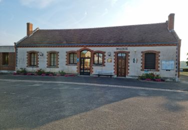
Randonnée Marche de 18,7 km à découvrir à Centre-Val de Loire, Loir-et-Cher, Lisle. Cette randonnée est proposée par Jean LABADIE.

Description

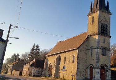
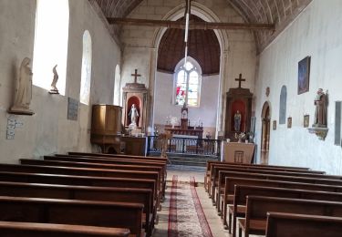
Le départ de la randonnée se fait depuis le parking en face de l'église.
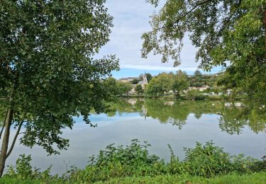
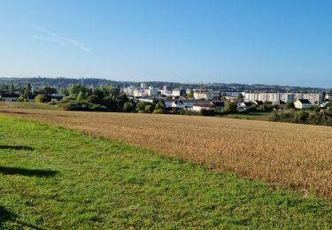
La randonnée traverse les bois de l'Epau qui sont privés. Veillez à bien suivre le tracé qui emprunte des chemins communaux. Attention en période de chasse. Battues fréquentes.

Profil altimétrique

Points d'intérêt

Point d'intérêt Saint-Firmin-des-Prés - 1- Pénétrer dans le bois  - Photo
Jean LABADIE
SAINT-FIRMIN-DES-PRÉS 
Point d'intérêt Lisle - 2-  - Photo
Jean LABADIE
LISLE 
Point d'intérêt Lisle - 3-Clôture - Photo
Jean LABADIE
LISLE 
Point d'intérêt Saint-Firmin-des-Prés - 4- Carrefour 4 chemins - Photo
Jean LABADIE
SAINT-FIRMIN-DES-PRÉS 

Localisation

Pays :
France
Région :
Centre-Val de Loire
Département/Province :
Loir-et-Cher
Commune :
Lisle
Localité :
Unknown
Départ:(UTM)
359064 ; 5301604 (31T) N.

Commentaires

Veuillez vous connecter pour laisser un commentaire ou une note


Randonnées à proximité

Randonnée Marche Lisle - Lisle - Bord du Loir - Photo
Marche
guydu41

Marche

Facile
Lisle, Centre-Val de Loire, Loir-et-Cher, France
8,9 km | 9,5 km-effort
2h 9min
Oui
Randonnée Marche Saint-Firmin-des-Prés - Saint-Firmin-des-Prés - Photo
Marche
guydu41

Marche

Facile
Saint-Firmin-des-Prés, Centre-Val de Loire, Loir-et-Cher, France
8,9 km | 9,9 km-effort
1h 58min
Oui
Randonnée Marche Rahart - Rahart - Photo
Marche
guydu41

Marche

Facile
Rahart, Centre-Val de Loire, Loir-et-Cher, France
8,1 km | 9,3 km-effort
2h 6min
Oui
Randonnée Marche Lisle - Lisle - Bois de l'Epau - Photo
Marche
guydu41

Marche

Facile
Lisle, Centre-Val de Loire, Loir-et-Cher, France
8,9 km | 10,2 km-effort
2h 19min
Oui
Randonnée Marche Renay - Renay - Photo
Marche
guydu41

Marche

Facile
Renay, Centre-Val de Loire, Loir-et-Cher, France
13,8 km | 15,8 km-effort
3h 35min
Oui
Randonnée Marche Saint-Ouen - Parcours nature à Saint-Ouen (41100) - Photo
Marche
guydu41

Marche

Facile
Saint-Ouen, Centre-Val de Loire, Loir-et-Cher, France
16,1 km | 19 km-effort
4h 3min
Oui
Randonnée Marche Saint-Ouen - Saint-Ouen - Circuit découverte 2 - Photo
Marche
guydu41

Marche

Très facile
Saint-Ouen, Centre-Val de Loire, Loir-et-Cher, France
10,5 km | 12,4 km-effort
3h 16min
Oui
Randonnée Marche Saint-Firmin-des-Prés - St Firmin Mjo - Photo
Marche
christ41

Marche

Facile
Saint-Firmin-des-Prés, Centre-Val de Loire, Loir-et-Cher, France
16 km | 17,9 km-effort
3h 9min
Oui
Randonnée Marche Busloup - Busloup  - Photo
Marche
jackalv

Marche

Facile
Busloup, Centre-Val de Loire, Loir-et-Cher, France
21 km | 25 km-effort
3h 8min
Oui


Fermer
Mes abonnements