Randonnée Marche Châtillon-sur-Cher - chatillon sur cher - Photo
 lecmic
lecmic

Utilisateur

© OpenStreetMap contributors
Longueur
Longueur
12,2 km
Altitude max
Altitude max
120 m
Dénivelé positif
Dénivelé positif
126 m
Km-Effort
Km-Effort  
13,9 km
Altitude min
Altitude min
73 m
Dénivelé négatif
Dénivelé négatif
131 m
Boucle
Boucle
Oui
Date de création :
2022-01-12 13:04:00.158
Dernière modification :
2022-01-12 15:53:42.473

(1 Avis)

Marche
Marche
2h47
Difficulté : Très facile

Scannez ce code QR pour ouvrir la randonnée dans l'application SityTrail

Application GPS de randonnée GRATUITE

Logo SityTrail SityTrail

IGN / Instituts géographiques

Télécharger SityTrail sur l'App Store Télécharger SityTrail sur Google Play

Logo SityTrail SityTrail World

Le monde est à vous

Télécharger SityTrail sur l'App Store Télécharger SityTrail sur Google Play Télécharger SityTrail sur Huawei AppGallery

À propos

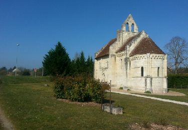
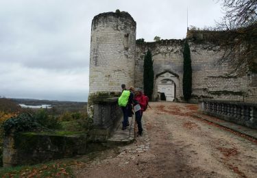
Randonnée Marche de 12,2 km à découvrir à Centre-Val de Loire, Loir-et-Cher, Châtillon-sur-Cher. Cette randonnée est proposée par lecmic.

Description

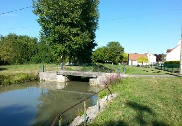
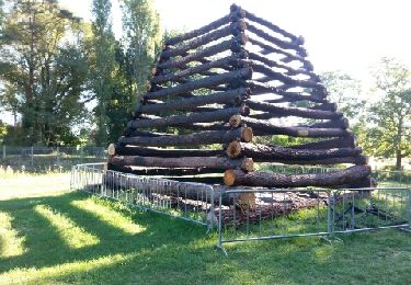
rando du pont canal berry

Profil altimétrique

Localisation

Pays :
France
Région :
Centre-Val de Loire
Département/Province :
Loir-et-Cher
Commune :
Châtillon-sur-Cher
Localité :
Unknown
Départ:(UTM)
387501 ; 5236870 (31T) N.

Commentaires

Veuillez vous connecter pour laisser un commentaire ou une note


Randonnées à proximité

Randonnée Marche Selles-sur-Cher - selles sur cher  à saint aignan par le canal - Photo
Marche
lagardienne

Marche

Facile
Selles-sur-Cher, Centre-Val de Loire, Loir-et-Cher, France
28 km | 31 km-effort
6h 17min
Oui
Randonnée Marche Selles-sur-Cher - chatillon - Photo
Marche
lagardienne

Marche

Très facile
Selles-sur-Cher, Centre-Val de Loire, Loir-et-Cher, France
16 km | 17,8 km-effort
2h 58min
Oui
Randonnée Marche Selles-sur-Cher - De selle sur Cher â gievres - Photo
Marche
lagardienne

Marche

Très facile
Selles-sur-Cher, Centre-Val de Loire, Loir-et-Cher, France
17,9 km | 19,3 km-effort
3h 20min
Oui
Randonnée Marche Lye - le puits de saray - tesnières - Photo
Marche
annehc

Marche

Très difficile
Lye, Centre-Val de Loire, Indre, France
25 km | 30 km-effort
5h 12min
Non
Randonnée Marche Châtillon-sur-Cher - Châtillon sur cher pont canal - Photo
Marche
lecmic

Marche

Facile
Châtillon-sur-Cher, Centre-Val de Loire, Loir-et-Cher, France
11,9 km | 13,5 km-effort
2h 52min
Oui
Randonnée Marche Châtillon-sur-Cher - Châtillon sur cher  - Photo
Marche
lecmic

Marche

Moyen
Châtillon-sur-Cher, Centre-Val de Loire, Loir-et-Cher, France
25 km | 28 km-effort
4h 32min
Oui
Randonnée Marche Billy -  billy - Photo
Marche
lecmic

Marche

Très facile
Billy, Centre-Val de Loire, Loir-et-Cher, France
11,9 km | 12,9 km-effort
2h 51min
Oui
Randonnée Marche Billy - billy - Photo
Marche
lecmic

Marche

Facile
Billy, Centre-Val de Loire, Loir-et-Cher, France
19,5 km | 21 km-effort
3h 25min
Oui
Randonnée Marche Selles-sur-Cher - selles sur cher - Photo
Marche
lecmic

Marche

Très facile
Selles-sur-Cher, Centre-Val de Loire, Loir-et-Cher, France
19,6 km | 21 km-effort
3h 13min
Oui


Fermer
Mes abonnements