![](/images/other/stat-length.png)
![Randonnée A pied Hotton - 15. Croix de Pierre - Photo](https://media.geolcdn.com/t/1900/400/ext.pjpeg?maxdim=2&url=https%3A%2F%2Fmedia.geolcdn.com%2Ff%2F1d835470-208e-4b9d-85cd-450f65ecce2b.jpeg)
15. Croix de Pierre
SityTrail - itinéraires balisés pédestres
Tous les sentiers balisés d’Europe PRO
![Longueur](/images/other/stat-length.png)
Longueur
5,8 km
![Altitude max](https://static1.geolcdn.com/siteimages/upload/files/1508320355ic_sort_altitude_max_24dp.png)
Altitude max
309 m
![Dénivelé positif](https://static1.geolcdn.com/siteimages/upload/files/1508320355ic_sort_den_pos_24dp.png)
Dénivelé positif
152 m
![Km-Effort](/images/other/stat-length.png)
Km-Effort
7,8 km
![Altitude min](https://static1.geolcdn.com/siteimages/upload/files/1508320355ic_sort_altitude_min_24dp.png)
Altitude min
206 m
![Dénivelé négatif](https://static1.geolcdn.com/siteimages/upload/files/1508320355ic_sort_den_neg_24dp.png)
Dénivelé négatif
152 m
![Boucle](https://static1.geolcdn.com/siteimages/upload/files/16400158638029165_repeat_loop_refresh_sync_direction_icon.png)
Boucle
Oui
Balise
Date de création :
2022-02-09 18:53:19.382
Dernière modification :
2022-02-09 18:53:19.382
![A pied](https://static1.geolcdn.com/sitytour/trail-icons/100.png)
1h46
Difficulté : Facile
![Scannez ce code QR pour ouvrir la randonnée dans l'application SityTrail](https://capi.geolives.com/qq0zvz2zws4bq2lad0pu/sitytour/trails/3084828/qr.png?size=200)
Application GPS de randonnée GRATUITE
À propos
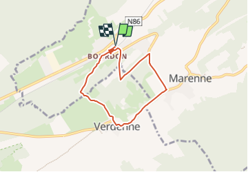
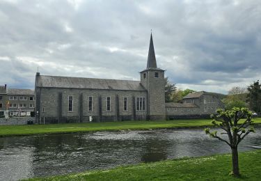
Randonnée A pied de 5,8 km à découvrir à Wallonie, Luxembourg, Hotton. Cette randonnée est proposée par SityTrail - itinéraires balisés pédestres.
Description
Randonnée créée par Royal Syndicat d'Initiative de Hotton.
Localisation
Pays :
Belgique
Région :
Wallonie
Département/Province :
Luxembourg
Commune :
Hotton
Localité :
Unknown
Départ:(Dec)
Départ:(UTM)
670970 ; 5568841 (31U) N.
Commentaires
Randonnées à proximité
![Randonnée Marche Hotton - RB-Lu-04_Marenne - Photo](https://media.geolcdn.com/t/375/260/ext.jpg?maxdim=2&url=https%3A%2F%2Fservices.sitytrail.com%2FGeolivesWS%2FDownloadMedia.ashx%3FTrailID%3D179613%26Media%3Dc1eccb03-838f-4466-b103-ba3011ffaee0.jpg)
![Marche Marche](https://static1.geolcdn.com/sitytour/trail-icons/101.png)
RB-Lu-04_Marenne
Marche
Moyen
(13)
Hotton,
Wallonie,
Luxembourg,
Belgique
![](/images/other/stat-length.png)
18,4 km | 24 km-effort
5h 6min
![](https://static1.geolcdn.com/siteimages/upload/files/16400158638029165_repeat_loop_refresh_sync_direction_icon.png)
Oui
![Randonnée Marche Marche-en-Famenne - RB-Lu-31_Marche-en-Famenne - Photo](https://media.geolcdn.com/t/375/260/ext.jpg?maxdim=2&url=https%3A%2F%2Fmedia.geolcdn.com%2Ff%2Fa3476dbc-c577-4b1e-acc4-82c57d99db25.JPG)
![Marche Marche](https://static1.geolcdn.com/sitytour/trail-icons/101.png)
RB-Lu-31_Marche-en-Famenne
Marche
Très facile
(3)
Marche-en-Famenne,
Wallonie,
Luxembourg,
Belgique
![](/images/other/stat-length.png)
24 km | 29 km-effort
6h 10min
![](https://static1.geolcdn.com/siteimages/upload/files/16400158638029165_repeat_loop_refresh_sync_direction_icon.png)
Oui
![Randonnée Marche Hotton - RF-Lu-03 Sur la Calestienne, entre Ardenne et Famenne : Hotton - Photo](https://media.geolcdn.com/t/375/260/ext.jpg?maxdim=2&url=https%3A%2F%2Fservices.sitytrail.com%2FGeolivesWS%2FDownloadMedia.ashx%3FTrailID%3D407838%26Media%3D5ce28d25-1425-4e98-96ff-2c6c15aabb08.jpg)
![Marche Marche](https://static1.geolcdn.com/sitytour/trail-icons/101.png)
RF-Lu-03 Sur la Calestienne, entre Ardenne et Famenne : Hotton
Marche
Très facile
(3)
Hotton,
Wallonie,
Luxembourg,
Belgique
![](/images/other/stat-length.png)
11,7 km | 15,3 km-effort
3h 16min
![](https://static1.geolcdn.com/siteimages/upload/files/16400158638029165_repeat_loop_refresh_sync_direction_icon.png)
Oui
![Randonnée Marche Marche-en-Famenne - Balade pédestre de la Hédrée - Photo](https://media.geolcdn.com/t/375/260/ext.jpg?maxdim=2&url=https%3A%2F%2Fmedia.geolcdn.com%2Ff%2Fab1d5669-7ecf-451e-a04e-4f6f7bcd2b0a.jpg)
![Marche Marche](https://static1.geolcdn.com/sitytour/trail-icons/101.png)
Balade pédestre de la Hédrée
Marche
Moyen
(2)
Marche-en-Famenne,
Wallonie,
Luxembourg,
Belgique
![](/images/other/stat-length.png)
5,7 km | 8,2 km-effort
1h 51min
![](https://static1.geolcdn.com/siteimages/upload/files/16400158638029165_repeat_loop_refresh_sync_direction_icon.png)
Oui
![Randonnée Marche Marche-en-Famenne - Balade au coeur de Marche - Photo](https://media.geolcdn.com/t/375/260/ext.jpg?maxdim=2&url=https%3A%2F%2Fmedia.geolcdn.com%2Ff%2F15b9b319-2c34-4c39-b3ee-d3f123570689.JPG)
![Marche Marche](https://static1.geolcdn.com/sitytour/trail-icons/101.png)
Balade au coeur de Marche
Marche
Facile
(1)
Marche-en-Famenne,
Wallonie,
Luxembourg,
Belgique
![](/images/other/stat-length.png)
2,8 km | 3,1 km-effort
41min
![](https://static1.geolcdn.com/siteimages/upload/files/16400158638029165_repeat_loop_refresh_sync_direction_icon.png)
Oui
![Randonnée Marche Marche-en-Famenne - Champlon - Boucle qui alterne sous-bois et vues dégagées à 360°. Larges sentiers caillouteux et un peu de macadam. - Photo](https://media.geolcdn.com/t/375/260/ext.jpg?maxdim=2&url=https%3A%2F%2Fmedia.geolcdn.com%2Ff%2Ff9518a34-3708-4717-a5a9-ec6d14ee87bd.jpg)
![Marche Marche](https://static1.geolcdn.com/sitytour/trail-icons/101.png)
Champlon - Boucle qui alterne sous-bois et vues dégagées à 360°. Larges senti...
Marche
Facile
(1)
Marche-en-Famenne,
Wallonie,
Luxembourg,
Belgique
![](/images/other/stat-length.png)
9,6 km | 12,8 km-effort
2h 23min
![](https://static1.geolcdn.com/siteimages/upload/files/16400158638029165_repeat_loop_refresh_sync_direction_icon.png)
Oui
![Randonnée Marche Hotton - Saint-Pierre - Photo](https://media.geolcdn.com/t/375/260/ext.jpg?maxdim=2&url=https%3A%2F%2Fservices.sitytrail.com%2FGeolivesWS%2FDownloadMedia.ashx%3FTrailID%3D204152%26Media%3D4d13859b-e8ea-464e-b6f5-80f7a1b7659d.jpg)
![Marche Marche](https://static1.geolcdn.com/sitytour/trail-icons/101.png)
Saint-Pierre
Marche
Facile
(3)
Hotton,
Wallonie,
Luxembourg,
Belgique
![](/images/other/stat-length.png)
10,9 km | 12,1 km-effort
2h 43min
![](https://static1.geolcdn.com/siteimages/upload/files/16400158638029165_repeat_loop_refresh_sync_direction_icon.png)
Oui
![Randonnée Marche Hotton - Balade à Hotton - Photo](https://media.geolcdn.com/t/375/260/ext.jpg?maxdim=2&url=https%3A%2F%2Fmedia.geolcdn.com%2Ff%2F768efbbe-c567-45b1-bd57-69176b5f50b6.jpeg)
![Marche Marche](https://static1.geolcdn.com/sitytour/trail-icons/101.png)
Balade à Hotton
Marche
Moyen
Hotton,
Wallonie,
Luxembourg,
Belgique
![](/images/other/stat-length.png)
7,1 km | 8,9 km-effort
2h 0min
![](https://static1.geolcdn.com/siteimages/upload/files/16400158638029165_repeat_loop_refresh_sync_direction_icon.png)
Non
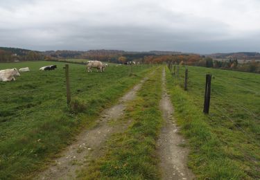
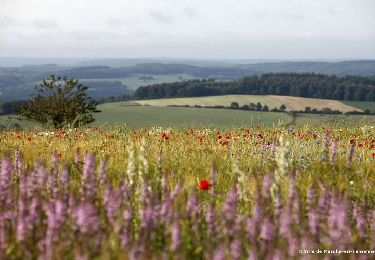
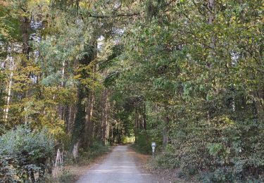
Sans grand intérêt. Une balade de campagne très commune. Une traversée de village qui n'a d'autre intérêt que d'ajouter du kilométrage. À cela s'ajoute un balisage mal réalisé, voire carrément erroné (une flèche vous indique d'aller à gauche au lieu de la droite comme prévu par le parcours). Et pour finir, un parcours presque exclusivement routier...