


13,2 km | 17,3 km-effort
![Randonnée A pied Aix-la-Chapelle - [B6] Rundweg Rollefbachtal/Eich - Photo](https://media.geolcdn.com/t/1900/400/ext.pjpeg?maxdim=2&url=https%3A%2F%2Fmedia.geolcdn.com%2Ff%2Fe7a3f3e2-7018-4a3b-b715-55bd5149ec32.jpeg)

Tous les sentiers balisés d’Europe PRO


Application GPS de randonnée GRATUITE
 SityTrail
IGN / Instituts géographiques
SityTrail World
Le monde est à vous
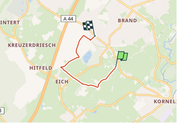
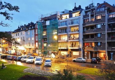
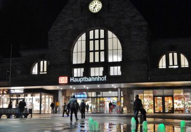
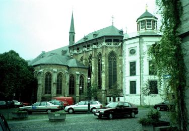
Randonnée A pied de 3,3 km à découvrir à Rhénanie-du-Nord-Westphalie, Région urbaine d'Aix-la-Chapelle, Aix-la-Chapelle. Cette randonnée est proposée par SityTrail - itinéraires balisés pédestres.
![Randonnée A pied Aix-la-Chapelle - [B6] Rundweg Rollefbachtal/Eich - Photo 1](https://media.geolcdn.com/t/2048/auto/ebb24fd4-7aa3-4735-890a-40069f80c5b9.jpeg&format=jpg&maxdim=0 "Randonnée A pied Aix-la-Chapelle - [B6] Rundweg Rollefbachtal/Eich - Photo 1")
![Randonnée A pied Aix-la-Chapelle - [B6] Rundweg Rollefbachtal/Eich - Photo 2](https://media.geolcdn.com/t/2048/auto/53dd4096-5a87-4dd8-8fe2-062e4ffc063d.jpeg&format=jpg&maxdim=0 "Randonnée A pied Aix-la-Chapelle - [B6] Rundweg Rollefbachtal/Eich - Photo 2")
![Randonnée A pied Aix-la-Chapelle - [B6] Rundweg Rollefbachtal/Eich - Photo 3](https://media.geolcdn.com/t/2048/auto/1c5de87d-df1c-44fc-9937-2e0f31b35adf.jpeg&format=jpg&maxdim=0 "Randonnée A pied Aix-la-Chapelle - [B6] Rundweg Rollefbachtal/Eich - Photo 3")
![Randonnée A pied Aix-la-Chapelle - [B6] Rundweg Rollefbachtal/Eich - Photo 4](https://media.geolcdn.com/t/2048/auto/2485a11b-82a9-4555-abae-fe7ea3790075.jpeg&format=jpg&maxdim=0 "Randonnée A pied Aix-la-Chapelle - [B6] Rundweg Rollefbachtal/Eich - Photo 4")
![Randonnée A pied Aix-la-Chapelle - [B6] Rundweg Rollefbachtal/Eich - Photo 5](https://media.geolcdn.com/t/2048/auto/3fc1f39d-de34-4ea5-a6a2-8088f4989972.jpeg&format=jpg&maxdim=0 "Randonnée A pied Aix-la-Chapelle - [B6] Rundweg Rollefbachtal/Eich - Photo 5")
![Randonnée A pied Aix-la-Chapelle - [B6] Rundweg Rollefbachtal/Eich - Photo 6](https://media.geolcdn.com/t/2048/auto/7d9d1d65-246c-4f31-905b-a9475be456df.jpeg&format=jpg&maxdim=0 "Randonnée A pied Aix-la-Chapelle - [B6] Rundweg Rollefbachtal/Eich - Photo 6")
![Randonnée A pied Aix-la-Chapelle - [B6] Rundweg Rollefbachtal/Eich - Photo 7](https://media.geolcdn.com/t/2048/auto/265a109a-34ec-4af9-98cc-9ce53bd60522.jpeg&format=jpg&maxdim=0 "Randonnée A pied Aix-la-Chapelle - [B6] Rundweg Rollefbachtal/Eich - Photo 7")
![Randonnée A pied Aix-la-Chapelle - [B6] Rundweg Rollefbachtal/Eich - Photo 8](https://media.geolcdn.com/t/2048/auto/c3e43013-91c2-4d13-9857-32f59ef34b5d.jpeg&format=jpg&maxdim=0 "Randonnée A pied Aix-la-Chapelle - [B6] Rundweg Rollefbachtal/Eich - Photo 8")
![Randonnée A pied Aix-la-Chapelle - [B6] Rundweg Rollefbachtal/Eich - Photo 9](https://media.geolcdn.com/t/2048/auto/a1c5f67f-9824-4097-8802-b96f68c8eec5.jpeg&format=jpg&maxdim=0 "Randonnée A pied Aix-la-Chapelle - [B6] Rundweg Rollefbachtal/Eich - Photo 9")
![Randonnée A pied Aix-la-Chapelle - [B6] Rundweg Rollefbachtal/Eich - Photo 10](https://media.geolcdn.com/t/2048/auto/e7a3f3e2-7018-4a3b-b715-55bd5149ec32.jpeg&format=jpg&maxdim=0 "Randonnée A pied Aix-la-Chapelle - [B6] Rundweg Rollefbachtal/Eich - Photo 10")

Marche
Marche

Marche
Marche

A pied
A pied
A pied
A pied
A pied