Randonnée Marche Gemeinde Gaschurn - walser_31 - Photo

Optez pour le retour à la nature GUIDE+

© OpenStreetMap contributors
Longueur
Longueur
24 km
Altitude max
Altitude max
2303 m
Dénivelé positif
Dénivelé positif
173 m
Km-Effort
Km-Effort  
31 km
Altitude min
Altitude min
860 m
Dénivelé négatif
Dénivelé négatif
1600 m
Boucle
Boucle
Non
Date de création :
2014-12-10 00:00:00.0
Dernière modification :
2014-12-10 00:00:00.0

(0 Avis)

Marche
Marche
--
Difficulté : Inconnu

Scannez ce code QR pour ouvrir la randonnée dans l'application SityTrail

Application GPS de randonnée GRATUITE

Logo SityTrail SityTrail

IGN / Instituts géographiques

Télécharger SityTrail sur l'App Store Télécharger SityTrail sur Google Play

Logo SityTrail SityTrail World

Le monde est à vous

Télécharger SityTrail sur l'App Store Télécharger SityTrail sur Google Play Télécharger SityTrail sur Huawei AppGallery

À propos

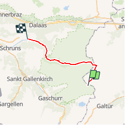
Randonnée Marche de 24 km à découvrir à Vorarlberg, Bezirk Bludenz, Gemeinde Gaschurn. Cette randonnée est proposée par My Switzerland.

Profil altimétrique

Localisation

Pays :
Autriche
Région :
Vorarlberg
Département/Province :
Bezirk Bludenz
Commune :
Gemeinde Gaschurn
Localité :
Unknown
Départ:(Dec)
Départ:(UTM)
586590 ; 5206593 (32T) N.

Randonnées à proximité

Randonnée Marche Gemeinde Galtür - walser_30 - Photo
Marche
GUIDE+

Marche

Très facile
Gemeinde Galtür, Tyrol, Bezirk Landeck, Autriche
11,6 km | 20 km-effort
Inconnu
Non
Randonnée Marche Gemeinde Galtür - w-oostenrijk-5-daagse-hoogalpiene-huttentrektocht - Photo
Marche
gpstracks

Marche

Très facile
Gemeinde Galtür, Tyrol, Bezirk Landeck, Autriche
65 km | 122 km-effort
Inconnu
Oui


Fermer
Mes abonnements