Randonnée A pied Schorbach - Circuit panoramique autour de Bitche - Photo

Circuit panoramique autour de Bitche

Tous les sentiers balisés d’Europe PRO

© OpenStreetMap contributors
Longueur
Longueur
13,1 km
Altitude max
Altitude max
418 m
Dénivelé positif
Dénivelé positif
305 m
Km-Effort
Km-Effort  
17,2 km
Altitude min
Altitude min
278 m
Dénivelé négatif
Dénivelé négatif
304 m
Boucle
Boucle
Oui
Balise
Balise
Date de création :
2022-02-15 01:38:11.344
Dernière modification :
2022-03-02 10:26:27.316

(1 Avis)

A pied
A pied
3h54
Difficulté : Facile

Scannez ce code QR pour ouvrir la randonnée dans l'application SityTrail

Application GPS de randonnée GRATUITE

Logo SityTrail SityTrail

IGN / Instituts géographiques

Télécharger SityTrail sur l'App Store Télécharger SityTrail sur Google Play

Logo SityTrail SityTrail World

Le monde est à vous

Télécharger SityTrail sur l'App Store Télécharger SityTrail sur Google Play Télécharger SityTrail sur Huawei AppGallery

À propos

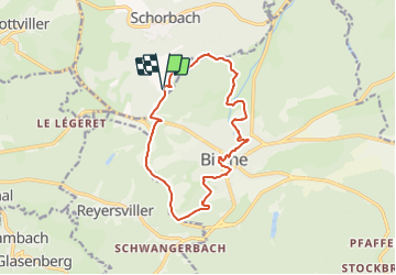
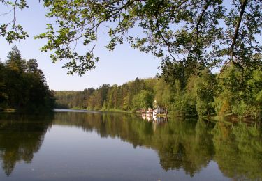
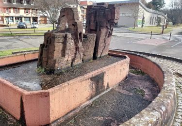
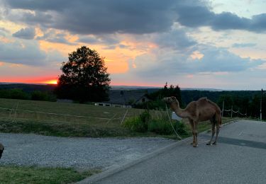
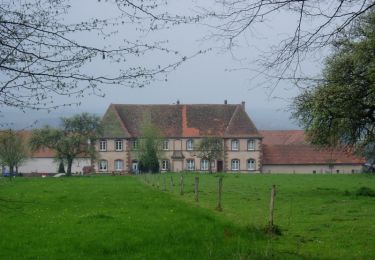
Randonnée A pied de 13,1 km à découvrir à Grand Est, Moselle, Schorbach. Cette randonnée est proposée par SityTrail - itinéraires balisés pédestres.

Description

Randonnée créée par Club vosgien Bitche.

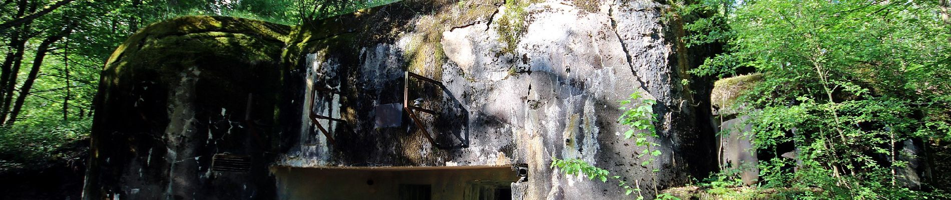
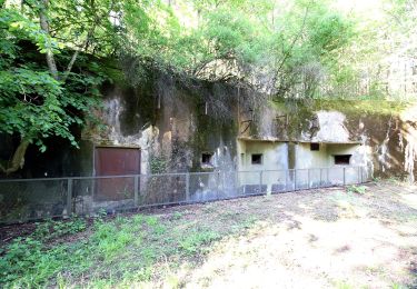
Formerly marked by a vertical yellow rectangle.

Symbole: red circle with white dot in the middle


Site web: https://ignrando.fr/fr/parcours/27495-3713et-bitche-9-anneau-rouge-circulaire-autour-de-bitche

Photos

Localisation

Pays :
France
Région :
Grand Est
Département/Province :
Moselle
Commune :
Schorbach
Localité :
Unknown
Départ:(UTM)
383621 ; 5435905 (32U) N.

Commentaires

Veuillez vous connecter pour laisser un commentaire ou une note


Superbe parcours pour découvrir Bitche.


Randonnées à proximité

Randonnée Marche Bitche - Etang de Hasselfurth et Hochkopf - Bitche - Photo
Marche
tracegps

Marche

Moyen
(1)
Bitche, Grand Est, Moselle, France
7,8 km | 10,1 km-effort
2h 0min
Oui
Randonnée Marche Bitche - Circuit panoramique de Bitche - Photo
Marche
tracegps

Marche

Moyen
(2)
Bitche, Grand Est, Moselle, France
12,7 km | 16,7 km-effort
3h 25min
Oui
Randonnée A pied Hanviller - Chevalet jaune - Photo
A pied
PRO

A pied

Facile
Hanviller, Grand Est, Moselle, France
6,3 km | 7,1 km-effort
1h 37min
Non
Randonnée A pied Schorbach - Anneau bleu - Photo
A pied
PRO

A pied

Facile
Schorbach, Grand Est, Moselle, France
14,6 km | 18,7 km-effort
4h 15min
Oui
Randonnée A pied Bitche - Triangle jaune - Photo
A pied
PRO

A pied

Facile
Bitche, Grand Est, Moselle, France
8,4 km | 10,7 km-effort
2h 26min
Non
Randonnée A pied Bitche - Rectangle jaune-blanc-jaune - Photo
A pied
PRO

A pied

Difficile
Bitche, Grand Est, Moselle, France
26 km | 35 km-effort
7h 58min
Non
Randonnée A pied Bitche - Chevalet jaune - Photo
A pied
PRO

A pied

Facile
Bitche, Grand Est, Moselle, France
12,1 km | 18,2 km-effort
4h 7min
Non
Randonnée Randonnée équestre Lambach - Promenade autour de Bitche - Photo
Randonnée équestre
Silke Roth

Randonnée équestre

Très difficile
Lambach, Grand Est, Moselle, France
9,8 km | 13,7 km-effort
2h 15min
Oui
Randonnée A pied Lengelsheim - Anneau vert - Photo
A pied
PRO

A pied

Facile
Lengelsheim, Grand Est, Moselle, France
10,2 km | 13,8 km-effort
3h 7min
Oui


Fermer
Mes abonnements