Randonnée A pied Bitche - Disque bleu - Photo

Tous les sentiers balisés d’Europe PRO

© OpenStreetMap contributors
Longueur
Longueur
10,7 km
Altitude max
Altitude max
408 m
Dénivelé positif
Dénivelé positif
241 m
Km-Effort
Km-Effort  
13,8 km
Altitude min
Altitude min
234 m
Dénivelé négatif
Dénivelé négatif
214 m
Boucle
Boucle
Non
Balise
Balise
Date de création :
2022-02-15 15:06:55.418
Dernière modification :
2022-03-02 17:32:44.616

(0 Avis)

A pied
A pied
3h08
Difficulté : Facile

Scannez ce code QR pour ouvrir la randonnée dans l'application SityTrail

Application GPS de randonnée GRATUITE

Logo SityTrail SityTrail

IGN / Instituts géographiques

Télécharger SityTrail sur l'App Store Télécharger SityTrail sur Google Play

Logo SityTrail SityTrail World

Le monde est à vous

Télécharger SityTrail sur l'App Store Télécharger SityTrail sur Google Play Télécharger SityTrail sur Huawei AppGallery

À propos

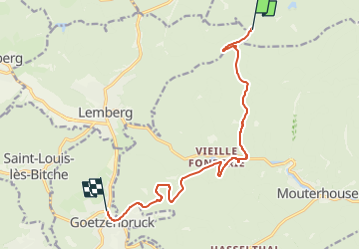
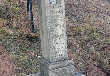
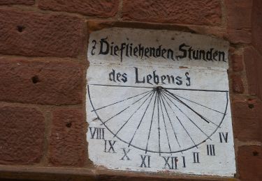
Randonnée A pied de 10,7 km à découvrir à Grand Est, Moselle, Bitche. Cette randonnée est proposée par SityTrail - itinéraires balisés pédestres.

Description

Randonnée créée par Club vosgien Bitche.

Symbole: blue dot


Site web: https://ignrando.fr/fr/parcours/27688-3713et-bitche-23-disque-bleu-etang-hasselfurth-weissbach-goetzenbruck

Photos

Localisation

Pays :
France
Région :
Grand Est
Département/Province :
Moselle
Commune :
Bitche
Localité :
Unknown
Départ:(UTM)
385176 ; 5430783 (32U) N.

Randonnées à proximité

Randonnée Marche Bitche - Etang de Hasselfurth et Hochkopf - Bitche - Photo
Marche
tracegps

Marche

Moyen
(1)
Bitche, Grand Est, Moselle, France
7,8 km | 10,1 km-effort
2h 0min
Oui
Randonnée Marche Bitche - Circuit panoramique de Bitche - Photo
Marche
tracegps

Marche

Moyen
(2)
Bitche, Grand Est, Moselle, France
12,7 km | 16,7 km-effort
3h 25min
Oui
Randonnée A pied Mouterhouse - Croix jaune - Photo
A pied
PRO

A pied

Facile
Mouterhouse, Grand Est, Moselle, France
9,9 km | 14,4 km-effort
3h 16min
Non
Randonnée A pied Lemberg - Triangle bleu - Photo
A pied
PRO

A pied

Facile
Lemberg, Grand Est, Moselle, France
9 km | 10,9 km-effort
2h 29min
Non
Randonnée A pied Lemberg - Anneau bleu - Photo
A pied
PRO

A pied

Facile
Lemberg, Grand Est, Moselle, France
6,1 km | 7,9 km-effort
1h 48min
Oui
Randonnée A pied Lemberg - Sentier des grottes - Photo
A pied
PRO

A pied

Facile
Lemberg, Grand Est, Moselle, France
7,9 km | 11,3 km-effort
2h 33min
Oui
Randonnée A pied Mouterhouse - Grand Tour de la Bildmuehle - Photo
A pied
PRO

A pied

Facile
Mouterhouse, Grand Est, Moselle, France
6,5 km | 8,7 km-effort
1h 58min
Oui
Randonnée A pied Lemberg - Circuit archéologique - Photo
A pied
PRO

A pied

Facile
Lemberg, Grand Est, Moselle, France
8,7 km | 12 km-effort
2h 44min
Oui
Randonnée A pied Mouterhouse - Anneau bleu - Photo
A pied
PRO

A pied

Facile
Mouterhouse, Grand Est, Moselle, France
6,4 km | 7,7 km-effort
1h 45min
Oui


Fermer
Mes abonnements