Randonnée Marche Serdinya - flassa. taratera 850 positif 13km 4h30 - Photo

flassa. taratera 850 positif 13km 4h30

 Erius
Erius

Utilisateur

© OpenStreetMap contributors
Longueur
Longueur
13,8 km
Altitude max
Altitude max
1797 m
Dénivelé positif
Dénivelé positif
850 m
Km-Effort
Km-Effort  
25 km
Altitude min
Altitude min
966 m
Dénivelé négatif
Dénivelé négatif
858 m
Boucle
Boucle
Oui
Date de création :
2022-02-27 08:29:56.48
Dernière modification :
2022-03-01 09:31:04.044

(0 Avis)

Marche
Marche
4h21
Difficulté : Très difficile

Scannez ce code QR pour ouvrir la randonnée dans l'application SityTrail

Application GPS de randonnée GRATUITE

Logo SityTrail SityTrail

IGN / Instituts géographiques

Télécharger SityTrail sur l'App Store Télécharger SityTrail sur Google Play

Logo SityTrail SityTrail World

Le monde est à vous

Télécharger SityTrail sur l'App Store Télécharger SityTrail sur Google Play Télécharger SityTrail sur Huawei AppGallery

À propos

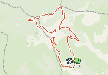
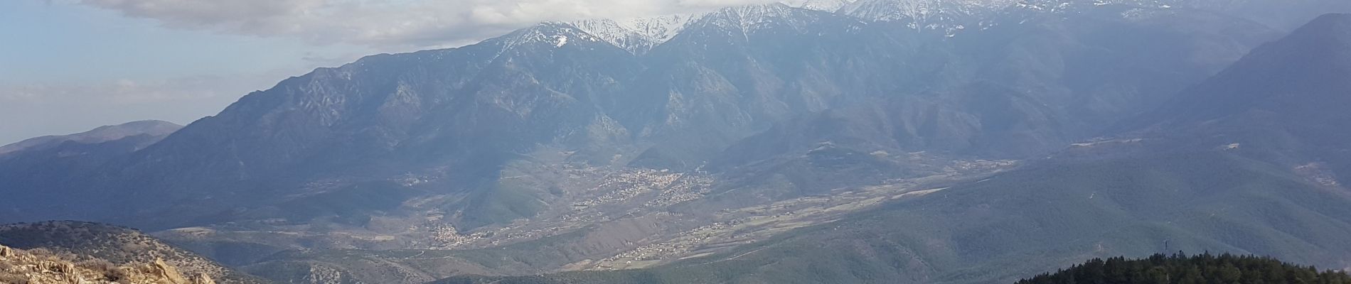
Randonnée Marche de 13,8 km à découvrir à Occitanie, Pyrénées-Orientales, Serdinya. Cette randonnée est proposée par Erius.

Description

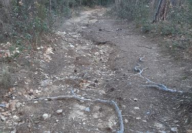
départ eglisette après piste carrossable auto haute

Profil altimétrique

Photos

Localisation

Pays :
France
Région :
Occitanie
Département/Province :
Pyrénées-Orientales
Commune :
Serdinya
Localité :
Unknown
Départ:(UTM)
443645 ; 4713824 (31T) N.

Randonnées à proximité

Randonnée Marche Olette - Evol village et chateau ( Olette) - Photo
Marche
Joël.cof

Marche

Facile
(1)
Olette, Occitanie, Pyrénées-Orientales, France
3,2 km | 5,6 km-effort
1h 16min
Oui
Randonnée Marche Jujols - Jujols 1 - Photo
Marche
jcmartin

Marche

Moyen
(1)
Jujols, Occitanie, Pyrénées-Orientales, France
13,2 km | 22 km-effort
4h 2min
Oui
Randonnée Marche Fuilla - fuilla (66) - Photo
Marche
66Gribouille83

Marche

Difficile
Fuilla, Occitanie, Pyrénées-Orientales, France
11,7 km | 17,8 km-effort
5h 57min
Oui
Randonnée Marche Jujols - jujols marbre rouge  - Photo
Marche
66Gribouille83

Marche

Très difficile
Jujols, Occitanie, Pyrénées-Orientales, France
16,5 km | 28 km-effort
9h 13min
Oui
Randonnée Marche Sahorre - Thorrent - Py et le Rec de Thorrent - Photo
Marche
Jean-marie Compta

Marche

Moyen
Sahorre, Occitanie, Pyrénées-Orientales, France
18,5 km | 30 km-effort
5h 33min
Oui
Randonnée Marche Fuilla - Ville franche / fort Liberia /Chapelle St André de Bell lloc / St esteve de calmeilles - Photo
Marche
robertperello

Marche

Moyen
Fuilla, Occitanie, Pyrénées-Orientales, France
11,5 km | 21 km-effort
3h 39min
Oui
Randonnée Marche Fuilla - 20220112 horts  - Photo
Marche
ThonyM

Marche

Difficile
Fuilla, Occitanie, Pyrénées-Orientales, France
14,6 km | 27 km-effort
4h 31min
Oui
Randonnée Marche Olette - 20211216 Olette - Photo
Marche
ThonyM

Marche

Moyen
Olette, Occitanie, Pyrénées-Orientales, France
16 km | 28 km-effort
5h 8min
Oui
Randonnée Marche Fuilla - 20211202 boucle depuis Villefranche66 - Photo
Marche
ThonyM

Marche

Moyen
Fuilla, Occitanie, Pyrénées-Orientales, France
17,2 km | 30 km-effort
5h 24min
Oui


Fermer
Mes abonnements