Randonnée Marche Pouzilhac - Le Serre du Cabrol - Pouzilhac - Photo

Le Serre du Cabrol - Pouzilhac

 tracegps
tracegps

Utilisateur

© OpenStreetMap contributors
Longueur
Longueur
15,9 km
Altitude max
Altitude max
253 m
Dénivelé positif
Dénivelé positif
242 m
Km-Effort
Km-Effort  
19,1 km
Altitude min
Altitude min
120 m
Dénivelé négatif
Dénivelé négatif
241 m
Boucle
Boucle
Oui
Date de création :
2014-12-10 00:00:00.0
Dernière modification :
2014-12-10 00:00:00.0

(0 Avis)

Marche
Marche
4h00
Difficulté : Difficile

Scannez ce code QR pour ouvrir la randonnée dans l'application SityTrail

Application GPS de randonnée GRATUITE

Logo SityTrail SityTrail

IGN / Instituts géographiques

Télécharger SityTrail sur l'App Store Télécharger SityTrail sur Google Play

Logo SityTrail SityTrail World

Le monde est à vous

Télécharger SityTrail sur l'App Store Télécharger SityTrail sur Google Play Télécharger SityTrail sur Huawei AppGallery

À propos

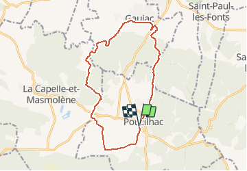
Randonnée Marche de 15,9 km à découvrir à Occitanie, Gard, Pouzilhac. Cette randonnée est proposée par tracegps.

Description

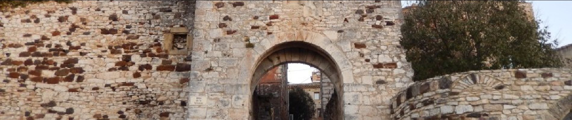
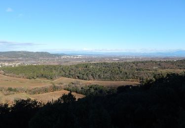
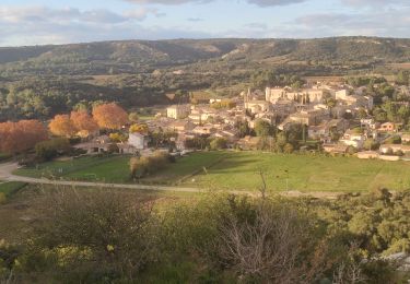
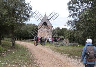
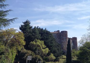
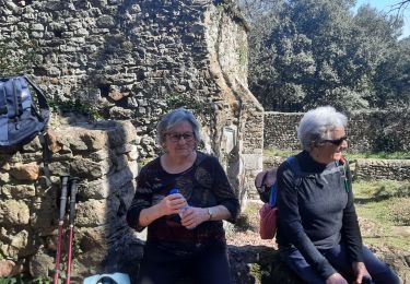
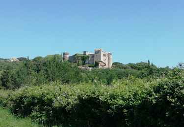
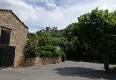
Circuit entre vignes et forêts de garrigues ou de châtaigniers, entre calcaires et gneiss. Parking en bas du village (D101 ou remparts du village). D'abord au sud puis l'ouest vers Panely, quitter les vignes pour monter au Serre de Cabrol et traverser une forêt de châtaigniers. Rejoindre La Veyre puis Gaujac avant de remonter à Pouzilhac. Bonne balade.

Profil altimétrique

Photos

Localisation

Pays :
France
Région :
Occitanie
Département/Province :
Gard
Commune :
Pouzilhac
Localité :
Unknown
Départ:(Dec)
Départ:(UTM)
626441 ; 4877540 (31T) N.

Randonnées à proximité

Randonnée Marche Pouzilhac - Le sentier botanique - Pouzilhac - Photo
Marche
tracegps

Marche

Difficile
(4)
Pouzilhac, Occitanie, Gard, France
11,3 km | 14 km-effort
3h 30min
Oui
Randonnée Marche Valliguières - Valliguières - St Pierre - Solidarité - Photo
Marche
rando30129

Marche

Moyen
(1)
Valliguières, Occitanie, Gard, France
5,6 km | 7 km-effort
1h 35min
Oui
Randonnée Marche Valliguières - Valliguières - Etang - St Pierre - Photo
Marche
rando30129

Marche

Moyen
(1)
Valliguières, Occitanie, Gard, France
7,3 km | 8,8 km-effort
2h 14min
Oui
Randonnée Marche La Capelle-et-Masmolène - Masmolène et l'étang de la Capelle - Photo
Marche
jesusmarieclaire

Marche

Très facile
(1)
La Capelle-et-Masmolène, Occitanie, Gard, France
14,4 km | 16,8 km-effort
3h 37min
Non
Randonnée Marche La Capelle-et-Masmolène - La Capelle-et-Masmolène - Photo
Marche
Gegetop

Marche

Facile
La Capelle-et-Masmolène, Occitanie, Gard, France
7,7 km | 9,1 km-effort
2h 8min
Oui
Randonnée Marche La Capelle-et-Masmolène - la Capelle Masmolène - Photo
Marche
GUIDE
nadinebondoux

Marche

Moyen
La Capelle-et-Masmolène, Occitanie, Gard, France
16,8 km | 21 km-effort
5h 45min
Oui
Randonnée Marche Gaujac - Gaujac 160323 - Photo
Marche
fario

Marche

Difficile
Gaujac, Occitanie, Gard, France
11 km | 14,3 km-effort
3h 15min
Oui
Randonnée V.T.T. La Capelle-et-Masmolène - 30-vtt-lacapelle-St-Siffret-25km-230m-juin21 - Photo
V.T.T.
SyMA

V.T.T.

Moyen
La Capelle-et-Masmolène, Occitanie, Gard, France
25 km | 28 km-effort
2h 41min
Oui
Randonnée Marche La Capelle-et-Masmolène - 30-lacapelle-forets-15km-240m-juin21 - Photo
Marche
SyMA

Marche

Moyen
La Capelle-et-Masmolène, Occitanie, Gard, France
14,9 km | 18,1 km-effort
3h 37min
Oui


Fermer
Mes abonnements