Randonnée Marche Mareuil-sur-Cher - Mareuil-sur-Cher - les Sables GR41 et PR - 15.7km 240m 4h00 - 2022 04 22 - Photo

Mareuil-sur-Cher - les Sables GR41 et PR - 15.7km 240m 4h00 - 2022 04 22

 Orcal37
Orcal37

Utilisateur

© OpenStreetMap contributors
Longueur
Longueur
15,7 km
Altitude max
Altitude max
157 m
Dénivelé positif
Dénivelé positif
242 m
Km-Effort
Km-Effort  
18,9 km
Altitude min
Altitude min
67 m
Dénivelé négatif
Dénivelé négatif
242 m
Boucle
Boucle
Oui
Date de création :
2022-04-22 12:00:25.852
Dernière modification :
2022-04-24 18:04:56.978

(0 Avis)

Marche
Marche
4h00
Difficulté : Facile

Scannez ce code QR pour ouvrir la randonnée dans l'application SityTrail

Application GPS de randonnée GRATUITE

Logo SityTrail SityTrail

IGN / Instituts géographiques

Télécharger SityTrail sur l'App Store Télécharger SityTrail sur Google Play

Logo SityTrail SityTrail World

Le monde est à vous

Télécharger SityTrail sur l'App Store Télécharger SityTrail sur Google Play Télécharger SityTrail sur Huawei AppGallery

À propos

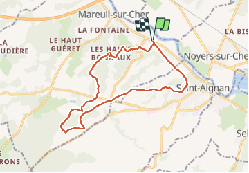
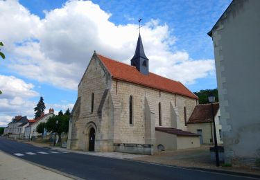
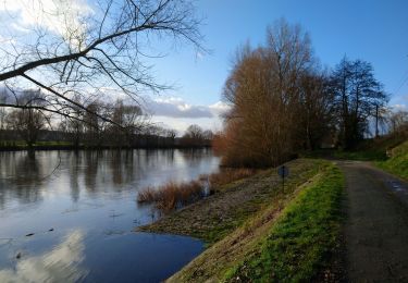
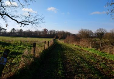
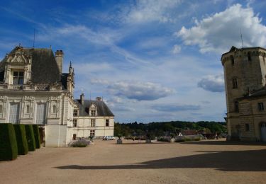
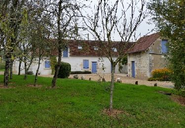
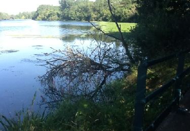
Randonnée Marche de 15,7 km à découvrir à Centre-Val de Loire, Loir-et-Cher, Mareuil-sur-Cher. Cette randonnée est proposée par Orcal37.

Description

Mareuil-sur-Cher - les Sables GR41 et PR - 15.7km 240m 4h00 - 2022 04 22

Profil altimétrique

Photos

Localisation

Pays :
France
Région :
Centre-Val de Loire
Département/Province :
Loir-et-Cher
Commune :
Mareuil-sur-Cher
Localité :
Unknown
Départ:(UTM)
375126 ; 5238165 (31T) N.

Randonnées à proximité

Randonnée V.T.T. Thésée - Thesee - Chateau de Fougères  - Photo
V.T.T.
Alain-luypaert

V.T.T.

Moyen
Thésée, Centre-Val de Loire, Loir-et-Cher, France
37 km | 41 km-effort
3h 36min
Oui
Randonnée V.T.T. Thésée - Thésée - Saint Aignan - Photo
V.T.T.
Alain-luypaert

V.T.T.

Facile
Thésée, Centre-Val de Loire, Loir-et-Cher, France
21 km | 23 km-effort
2h 29min
Oui
Randonnée Marche Seigy - Seigy - GR41 Saint-Aignan - 15.3km 250m 3h50 - 2022 08 27 - Photo
Marche
Orcal37

Marche

Facile
Seigy, Centre-Val de Loire, Loir-et-Cher, France
15,3 km | 18,7 km-effort
3h 50min
Oui
Randonnée Marche Thésée - Thésée - GR41 et GRP - 8km 100m 1h50 - 2021 01 17 - Photo
Marche
Orcal37

Marche

Facile
Thésée, Centre-Val de Loire, Loir-et-Cher, France
8 km | 9,4 km-effort
1h 50min
Oui
Randonnée Marche Pouillé - Pouillé - le Haut Guéret - boucles sur GR41 - 12.4km 200m 2h45 - 2021 01 10 - Photo
Marche
Orcal37

Marche

Facile
Pouillé, Centre-Val de Loire, Loir-et-Cher, France
12,4 km | 15,1 km-effort
2h 45min
Oui
Randonnée Marche Saint-Aignan - Zoo de Beauval - 5.2km 60m 2h20 - 2017 04 01  - Photo
Marche
Orcal37

Marche

Très facile
Saint-Aignan, Centre-Val de Loire, Loir-et-Cher, France
5 km | 5,8 km-effort
2h 20min
Oui
Randonnée Marche Saint-Aignan - Saint-Aignan - Centre-ville Château Zoo - 13km 175m 4h00 - 2015 12 27 - Photo
Marche
Orcal37

Marche

Très facile
Saint-Aignan, Centre-Val de Loire, Loir-et-Cher, France
13 km | 15,4 km-effort
4h 0min
Oui
Randonnée Marche Saint-Aignan - Beauval - Photo
Marche
cyberm

Marche

Moyen
Saint-Aignan, Centre-Val de Loire, Loir-et-Cher, France
12,1 km | 14,2 km-effort
3h 6min
Oui
Randonnée Marche Saint-Aignan - GR41 et bord de Cher quand même possible - Photo
Marche
Arnoldr8491

Marche

Très facile
(1)
Saint-Aignan, Centre-Val de Loire, Loir-et-Cher, France
13,4 km | 15,4 km-effort
5h 38min
Non


Fermer
Mes abonnements