Randonnée Cheval Foix - de Foix à Col de Pierre blanche 57 km - Photo

de Foix à Col de Pierre blanche 57 km

 Lozère Cheval
Lozère Cheval

Utilisateur

© OpenStreetMap contributors
Longueur
Longueur
57 km
Altitude max
Altitude max
1668 m
Dénivelé positif
Dénivelé positif
3180 m
Km-Effort
Km-Effort  
95 km
Altitude min
Altitude min
382 m
Dénivelé négatif
Dénivelé négatif
2015 m
Boucle
Boucle
Non
Date de création :
2022-05-10 05:54:05.065
Dernière modification :
2022-05-13 07:49:45.542

(0 Avis)

Cheval
Cheval
--
Difficulté : Inconnu

Scannez ce code QR pour ouvrir la randonnée dans l'application SityTrail

Application GPS de randonnée GRATUITE

Logo SityTrail SityTrail

IGN / Instituts géographiques

Télécharger SityTrail sur l'App Store Télécharger SityTrail sur Google Play

Logo SityTrail SityTrail World

Le monde est à vous

Télécharger SityTrail sur l'App Store Télécharger SityTrail sur Google Play Télécharger SityTrail sur Huawei AppGallery

À propos

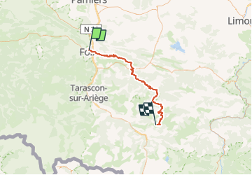
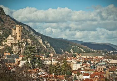
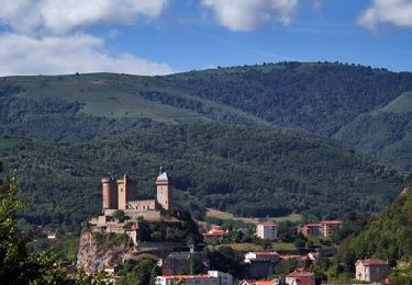
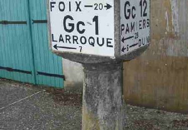
Randonnée Cheval de 57 km à découvrir à Occitanie, Ariège, Foix. Cette randonnée est proposée par Lozère Cheval.

Description

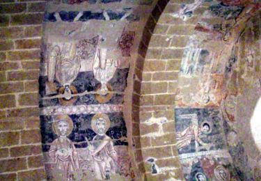
Caval_GR107_2012_SN_caval 002
gpx de magali

Profil altimétrique

Points d'intérêt

Point d'intérêt Soula - Gite Le Pastourel - Photo
Lozère Cheval
Point d'intérêt Soula - Infocus-du-sud  - Photo
Lozère Cheval
Point d'intérêt Leychert - Gite du Pech Cathare - Photo
Lozère Cheval
Point d'intérêt Montségur - La Maison sous le chateau - Photo
Lozère Cheval
Point d'intérêt Montségur - Gites Marcerou - Photo
Lozère Cheval
MONTSÉGUR 
Point d'intérêt Montségur - Gîte Lespeyrots Montségur - Photo
Lozère Cheval
Point d'intérêt Montségur - Montségur- Hotel Couquet - Photo
Lozère Cheval
Point d'intérêt Montségur - Simon Janos - Photo
Lozère Cheval
MONTSÉGUR 
Point d'intérêt Montségur - GITES RURAUX DU SARRAT - Photo
Lozère Cheval
Point d'intérêt Montferrier - La Noria Alain - Photo
Lozère Cheval
MONTFERRIER 
Point d'intérêt Montferrier - Chambres d'Hôtes Labyrinth - Photo
Lozère Cheval
Point d'intérêt Montferrier - gite le Toupinat - Photo
Lozère Cheval
MONTFERRIER 
Point d'intérêt Montferrier - Gite de France à Montferrier - Photo
Lozère Cheval
Point d'intérêt Montferrier - Les Ninounettes - Photo
Lozère Cheval
MONTFERRIER 
Point d'intérêt Roquefixade - Gite Roquefixade - Photo
Lozère Cheval
ROQUEFIXADE 
Point d'intérêt Comus - Gite d'étape le Prébystère - Photo
Lozère Cheval
Point d'intérêt Prades - Le Silence du Midi - Photo
Lozère Cheval
Point d'intérêt Comus - Oustal Dé l'Annetta - Photo
Lozère Cheval
Point d'intérêt Montaillou - La Caminada Vielha - Photo
Lozère Cheval
MONTAILLOU 
Point d'intérêt Camurac - Gite d'étape La Marmite - Photo
Lozère Cheval
Point d'intérêt Camurac - Chateau De Camurac - Photo
Lozère Cheval
Point d'intérêt Camurac - La chaumine aux étoiles - Photo
Lozère Cheval

Localisation

Pays :
France
Région :
Occitanie
Département/Province :
Ariège
Commune :
Foix
Localité :
Unknown
Départ:(UTM)
386426 ; 4758354 (31T) N.

Randonnées à proximité

Randonnée Marche Prayols - Cuminge  - Photo
Marche
David Girabet

Marche

Facile
(1)
Prayols, Occitanie, Ariège, France
3,5 km | 6,1 km-effort
1h 0min
Oui
Randonnée Marche Foix - 01 - FOIX à ROQUEFIXADE - Chemin des Bons-Hommes GR107 GR367 - Photo
Marche
jopost

Marche

Difficile
Foix, Occitanie, Ariège, France
18,6 km | 30 km-effort
6h 36min
Non
Randonnée Marche Foix - pech de foix - Photo
Marche
christian425

Marche

Très facile
(1)
Foix, Occitanie, Ariège, France
7,5 km | 13,6 km-effort
3h 43min
Oui
Randonnée Vélo Foix - A vélo en Basse Ariège - Foix - Photo
Vélo
tracegps

Vélo

Moyen
Foix, Occitanie, Ariège, France
97 km | 111 km-effort
4h 49min
Oui
Randonnée Vélo Foix - Port de Lers - Foix - Photo
Vélo
tracegps

Vélo

Difficile
Foix, Occitanie, Ariège, France
115 km | 152 km-effort
6h 7min
Oui
Randonnée Vélo Foix - De Foix au lac de Montbel - Photo
Vélo
tracegps

Vélo

Difficile
Foix, Occitanie, Ariège, France
104 km | 124 km-effort
5h 0min
Oui
Randonnée Vélo Foix - Sortie cyclo vers Mirepoix - Photo
Vélo
tracegps

Vélo

Moyen
Foix, Occitanie, Ariège, France
81 km | 94 km-effort
3h 4min
Oui
Randonnée Vélo Foix - De Foix à Montségur - Photo
Vélo
tracegps

Vélo

Difficile
Foix, Occitanie, Ariège, France
87 km | 109 km-effort
4h 13min
Oui
Randonnée Vélo Foix - Rhodes le Bas - Foix - Photo
Vélo
tracegps

Vélo

Moyen
Foix, Occitanie, Ariège, France
75 km | 89 km-effort
2h 45min
Oui


Fermer
Mes abonnements