Randonnée V.T.T. Virton - Montmédy  -   Balade_VTT_52kms - Photo

Montmédy - Balade_VTT_52kms

 Pascal L
Pascal L

Utilisateur

© OpenStreetMap contributors
Longueur
Longueur
52 km
Altitude max
Altitude max
378 m
Dénivelé positif
Dénivelé positif
1044 m
Km-Effort
Km-Effort  
66 km
Altitude min
Altitude min
183 m
Dénivelé négatif
Dénivelé négatif
1041 m
Boucle
Boucle
Oui
Date de création :
2022-06-03 07:36:08.761
Dernière modification :
2022-11-05 15:48:20.593

(0 Avis)

V.T.T.
V.T.T.
4h50
Difficulté : Difficile

Scannez ce code QR pour ouvrir la randonnée dans l'application SityTrail

Application GPS de randonnée GRATUITE

Logo SityTrail SityTrail

IGN / Instituts géographiques

Télécharger SityTrail sur l'App Store Télécharger SityTrail sur Google Play

Logo SityTrail SityTrail World

Le monde est à vous

Télécharger SityTrail sur l'App Store Télécharger SityTrail sur Google Play Télécharger SityTrail sur Huawei AppGallery

À propos

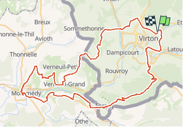
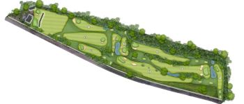
Randonnée V.T.T. de 52 km à découvrir à Wallonie, Luxembourg, Virton. Cette randonnée est proposée par Pascal L.

Description

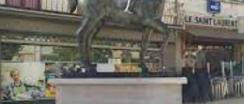
Aller/Retour: Virton (Delhaize)
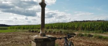
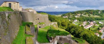
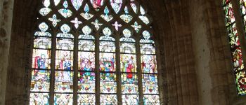
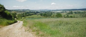
Endroits de passage: Chenois, Saint-Mard, Bois de la Côte et de Guéville, Pont Camus, Ruisseau de Radru, Torgny, le Moulin, Velosnes (FR), Etangs de la Praye, D118, Les XV stations du Rosaire, Villécloye, D643, Montmedy (ville basse et haute, chemin de la Poterne,  citadelle),
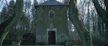
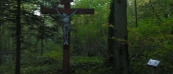
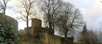
Tivoli et son panorama (Vierge de Tivoli), Fresnois et son château, Verneuil-Grand et son calvaire, point de vue sur la citadelle de Montmédy et la vallée de la Chiers (la Gaillette), Bois des Fosses, Bois Là-Haut (la Guingette, BE), Couvreux, Villers-la-Loue, Houdrigny, Belle Vue

Videos (4) :
1) https://vimeo.com/727702980
2) https://vimeo.com/727704046
3) https://vimeo.com/727704562
4) https://vimeo.com/727705291

Ref.
- https://ernelle.villecloye.com/rosaire.aspx
- https://mapio.net/place/16311411/
- https://www.meix-devant-virton.be/loisirs/tourisme/documentation/guide-montmedy-fr-en.pdf
- https://www.geocaching.com/geocache/GC46M86_k10-le-calvaire-monumental-de-verneuil-grand

(2022.06.03)

Profil altimétrique

Points d'intérêt

Point d'intérêt Rouvroy - Croix des Aisements - Photo
Pascal L
Point d'intérêt Montmédy - La citadelle de Montmedy - Photo
Pascal L
Point d'intérêt Rouvroy - Croix Sainte Reine - Photo
Pascal L
Point d'intérêt Virton - Golf Découverte Virton - Photo
Pascal L
Point d'intérêt Meix-devant-Virton - La Ferme de Rosière à Houdrigny - Photo
Pascal L
Point d'intérêt Virton - Pont Camus - Photo
Pascal L
VIRTON 

Localisation

Pays :
Belgique
Région :
Wallonie
Département/Province :
Luxembourg
Commune :
Virton
Localité :
Virton
Départ:(UTM)
684029 ; 5494246 (31U) N.

Randonnées à proximité

Randonnée Marche Virton - RB-Lu-17_Ethe_via-var-1-et-2-et-3 - Photo
Marche
PRO

Marche

Très facile
(3)
Virton, Wallonie, Luxembourg, Belgique
29 km | 35 km-effort
7h 33min
Oui
Randonnée V.T.T. Virton - Autour de Ethe  -  Balade_VTT_20kms - Photo
V.T.T.
Pascal L

V.T.T.

Facile
(1)
Virton, Wallonie, Luxembourg, Belgique
21 km | 26 km-effort
1h 40min
Oui
Randonnée Marche Virton - GAUME Balade  naturelle et historique - Photo
Marche
julucasi

Marche

Très facile
(1)
Virton, Wallonie, Luxembourg, Belgique
5,2 km | 6,8 km-effort
1h 16min
Oui
Randonnée A pied Virton - La Bajocienne - Photo
A pied
GUIDE+

A pied

Facile
(1)
Virton, Wallonie, Luxembourg, Belgique
11 km | 14,5 km-effort
3h 17min
Oui
Randonnée A pied Virton - Chenois-Latour Boucle agricole et touristique - Entre villages, pommes et petits fruits - Photo
A pied
GUIDE
DUPONT Rita

A pied

Facile
Virton, Wallonie, Luxembourg, Belgique
6,4 km | 7,7 km-effort
1h 45min
Oui
Randonnée Marche Virton - RB-Lu-17_Ethe_via-racc - Photo
Marche
PRO

Marche

Très facile
Virton, Wallonie, Luxembourg, Belgique
15,6 km | 19,3 km-effort
4h 8min
Oui
Randonnée Marche Virton - RB-Lu-17_Ethe - Photo
Marche
PRO

Marche

Très facile
Virton, Wallonie, Luxembourg, Belgique
22 km | 28 km-effort
5h 55min
Oui
Randonnée Cheval Rouvroy - rallye 2014 - Photo
Cheval
christianegabriel

Cheval

Moyen
(1)
Rouvroy, Wallonie, Luxembourg, Belgique
26 km | 32 km-effort
4h 1min
Oui
Randonnée V.T.T. Virton - Autour de Tintigny  -  Balade_VTT_54Kms - Photo
V.T.T.
Pascal L

V.T.T.

Très difficile
Virton, Wallonie, Luxembourg, Belgique
54 km | 64 km-effort
4h 25min
Oui


Fermer
Mes abonnements