Tocht Mountainbike Virton - Montmédy  -   Balade_VTT_52kms - Photo

Montmédy - Balade_VTT_52kms

 Pascal L
Pascal L

Gebruiker

© OpenStreetMap contributors
Lengte
Lengte
52 km
Max. hoogte
Max. hoogte
378 m
Positief hoogteverschil
1044 m
Km-Effort
Km-Effort  
66 km
Min. hoogte
Min. hoogte
183 m
Negatief hoogteverschil
1041 m
Boucle
Boucle
Ja
Datum van aanmaak :
2022-06-03 07:36:08.761
Laatste wijziging :
2022-11-05 15:48:20.593

(0 Bericht)

Mountainbike
Mountainbike
4h50
Moeilijkheid : Moeilijk

Scan deze QR-code om de tocht te openen in de SityTrail-applicatie

Gratisgps-wandelapplicatie

Logo SityTrail SityTrail

IGN / Geografische instituten

SityTrail uit de App Store downloaden SityTrail uit Google Play downloaden

Logo SityTrail SityTrail World

De wereld gaat voor u open

SityTrail uit de App Store downloaden SityTrail uit Google Play downloaden SityTrail op Huawei AppGallery downloaden

Over ons

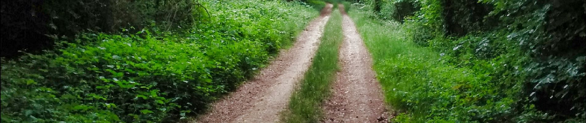
Tocht Mountainbike van 52 km beschikbaar op Wallonië, Luxemburg, Virton. Deze tocht wordt voorgesteld door Pascal L.

Beschrijving

Aller/Retour: Virton (Delhaize)
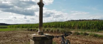
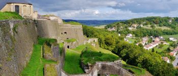
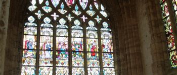
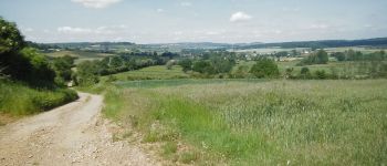
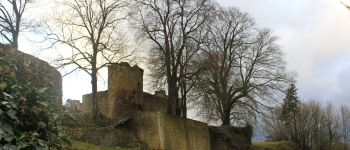
Endroits de passage: Chenois, Saint-Mard, Bois de la Côte et de Guéville, Pont Camus, Ruisseau de Radru, Torgny, le Moulin, Velosnes (FR), Etangs de la Praye, D118, Les XV stations du Rosaire, Villécloye, D643, Montmedy (ville basse et haute, chemin de la Poterne,  citadelle),
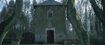
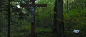
Tivoli et son panorama (Vierge de Tivoli), Fresnois et son château, Verneuil-Grand et son calvaire, point de vue sur la citadelle de Montmédy et la vallée de la Chiers (la Gaillette), Bois des Fosses, Bois Là-Haut (la Guingette, BE), Couvreux, Villers-la-Loue, Houdrigny, Belle Vue

Videos (4) :
1) https://vimeo.com/727702980
2) https://vimeo.com/727704046
3) https://vimeo.com/727704562
4) https://vimeo.com/727705291

Ref.
- https://ernelle.villecloye.com/rosaire.aspx
- https://mapio.net/place/16311411/
- https://www.meix-devant-virton.be/loisirs/tourisme/documentation/guide-montmedy-fr-en.pdf
- https://www.geocaching.com/geocache/GC46M86_k10-le-calvaire-monumental-de-verneuil-grand

(2022.06.03)

Hoogteprofiel

POI's

POI Rouvroy - Croix des Aisements - Photo
Pascal L
POI Montmédy - La citadelle de Montmedy - Photo
Pascal L
POI Rouvroy - Croix Sainte Reine - Photo
Pascal L
POI Virton - Golf Découverte Virton - Photo
Pascal L
POI Meix-devant-Virton - La Ferme de Rosière à Houdrigny - Photo
Pascal L
POI Virton - Pont Camus - Photo
Pascal L
VIRTON 

Plaatsbepaling

Land:
Belgium
Regio :
Wallonië
Departement/Provincie :
Luxemburg
Gemeente :
Virton
Locatie:
Virton
Vertrek:(UTM)
684029 ; 5494246 (31U) N.

Wandeltochten in de omgeving

Tocht Stappen Virton - RB-Lu-17_Ethe_via-var-1-et-2-et-3 - Photo
Stappen
PRO

Stappen

Heel gemakkelijk
(3)
Virton, Wallonië, Luxemburg, Belgium
29 km | 35 km-effort
7h 33min
Ja
Tocht Mountainbike Virton - T2019-06-16-16-47 - Photo
Mountainbike
Pascal L

Mountainbike

Gemakkelijk
(1)
Virton, Wallonië, Luxemburg, Belgium
21 km | 26 km-effort
1h 40min
Ja
Tocht Stappen Virton - GAUME Balade  naturelle et historique - Photo
Stappen
julucasi

Stappen

Heel gemakkelijk
(1)
Virton, Wallonië, Luxemburg, Belgium
5,2 km | 6,8 km-effort
1h 16min
Ja
Tocht Te voet Virton - La Bajocienne - Photo
Te voet
GUIDE+

Te voet

Gemakkelijk
(1)
Virton, Wallonië, Luxemburg, Belgium
11 km | 14,5 km-effort
3h 17min
Ja
Tocht Te voet Virton - Chenois-Latour - Agrarische wandeling -  dorpen, appels en klein fruit - Photo
Te voet
GUIDE
DUPONT Rita

Te voet

Gemakkelijk
Virton, Wallonië, Luxemburg, Belgium
6,4 km | 7,7 km-effort
1h 45min
Ja
Tocht Stappen Virton - RB-Lu-17_Ethe_via-racc - Photo
Stappen
PRO

Stappen

Heel gemakkelijk
Virton, Wallonië, Luxemburg, Belgium
15,6 km | 19,3 km-effort
4h 8min
Ja
Tocht Stappen Virton - RB-Lu-17_Ethe - Photo
Stappen
PRO

Stappen

Heel gemakkelijk
Virton, Wallonië, Luxemburg, Belgium
22 km | 28 km-effort
5h 55min
Ja
Tocht Paard Rouvroy - rallye 2014 - Photo
Paard
christianegabriel

Paard

Medium
(1)
Rouvroy, Wallonië, Luxemburg, Belgium
26 km | 32 km-effort
4h 1min
Ja
Tocht Mountainbike Virton - Autour de Tintigny  -  Balade_VTT_54Kms - Photo
Mountainbike
Pascal L

Mountainbike

Zeer moeilijk
Virton, Wallonië, Luxemburg, Belgium
54 km | 64 km-effort
4h 25min
Ja


Sluiten
Mijn abonnementen