![](/images/other/stat-length.png)
![Randonnée Marche Le Luc - Tour hexagonale - L'oppidum de la Fouirette - La Mascaronne - Peyrassol - Plan Jaubert - L'amaurigue - Photo](https://media.geolcdn.com/t/1900/400/ext.pjpeg?maxdim=2&url=https%3A%2F%2Fmedia.geolcdn.com%2Ff%2Ff80c5f9b-41dd-4e6b-ab88-57c5d990921e.jpg)
Tour hexagonale - L'oppidum de la Fouirette - La Mascaronne - Peyrassol - Plan Jaubert - L'amaurigue
affinetataille
Utilisateur GUIDE
![Longueur](/images/other/stat-length.png)
Longueur
17,4 km
![Altitude max](https://static1.geolcdn.com/siteimages/upload/files/1508320355ic_sort_altitude_max_24dp.png)
Altitude max
305 m
![Dénivelé positif](https://static1.geolcdn.com/siteimages/upload/files/1508320355ic_sort_den_pos_24dp.png)
Dénivelé positif
362 m
![Km-Effort](/images/other/stat-length.png)
Km-Effort
22 km
![Altitude min](https://static1.geolcdn.com/siteimages/upload/files/1508320355ic_sort_altitude_min_24dp.png)
Altitude min
162 m
![Dénivelé négatif](https://static1.geolcdn.com/siteimages/upload/files/1508320355ic_sort_den_neg_24dp.png)
Dénivelé négatif
361 m
![Boucle](https://static1.geolcdn.com/siteimages/upload/files/16400158638029165_repeat_loop_refresh_sync_direction_icon.png)
Boucle
Oui
Date de création :
2022-07-20 14:04:58.136
Dernière modification :
2023-05-14 13:58:02.868
![Marche](https://static1.geolcdn.com/sitytour/trail-icons/101.png)
5h30
Difficulté : Facile
![Scannez ce code QR pour ouvrir la randonnée dans l'application SityTrail](https://capi.geolives.com/qq0zvz2zws4bq2lad0pu/sitytour/trails/3323189/qr.png?size=200)
Application GPS de randonnée GRATUITE
À propos
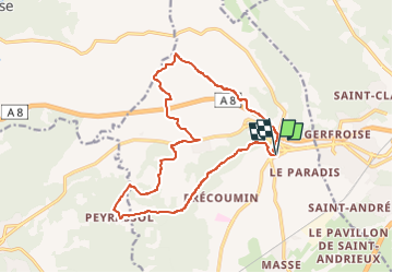
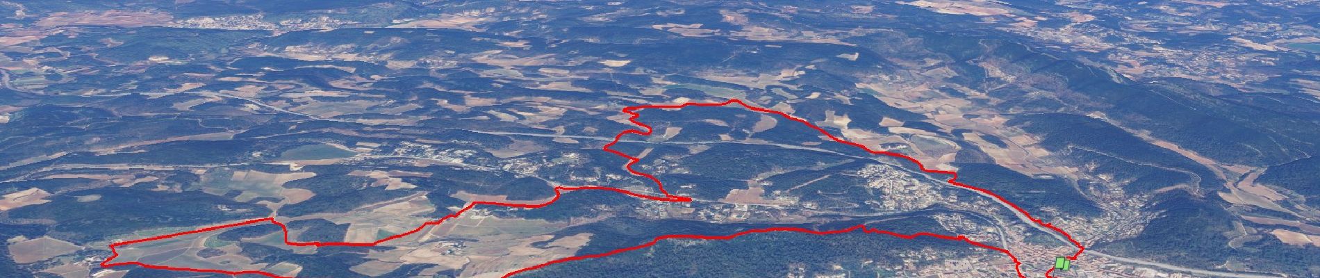
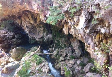
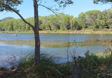
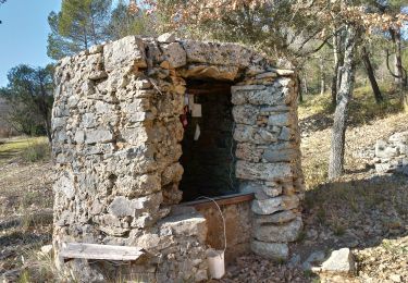
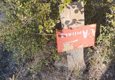
Randonnée Marche de 17,4 km à découvrir à Provence-Alpes-Côte d'Azur, Var, Le Luc. Cette randonnée est proposée par affinetataille.
Description
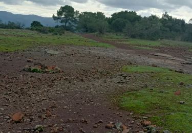
Jolie randonnée au milieu des vignes de 3 domaines du secteur. Sans grandes difficultés, quelques portails à passer pour traverser le domaine de la Mascaronne qu'il faut bien refermer.
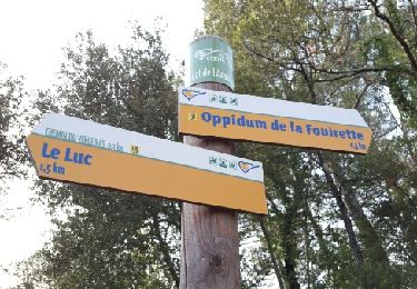
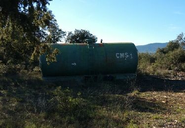
Localisation
Pays :
France
Région :
Provence-Alpes-Côte d'Azur
Département/Province :
Var
Commune :
Le Luc
Localité :
Unknown
Départ:(Dec)
Départ:(UTM)
282429 ; 4807872 (32T) N.
Commentaires
Randonnées à proximité
![Randonnée Marche Le Cannet-des-Maures - la brigue - Photo](https://media.geolcdn.com/t/375/260/ext.jpg?maxdim=2&url=https%3A%2F%2Fstatic1.geolcdn.com%2Fsiteimages%2Fupload%2Ffiles%2F1553511878bg_sport_marche.png)
![Marche Marche](https://static1.geolcdn.com/sitytour/trail-icons/101.png)
la brigue
Marche
Moyen
(1)
Le Cannet-des-Maures,
Provence-Alpes-Côte d'Azur,
Var,
France
![](/images/other/stat-length.png)
14,3 km | 19,2 km-effort
3h 59min
![](https://static1.geolcdn.com/siteimages/upload/files/16400158638029165_repeat_loop_refresh_sync_direction_icon.png)
Oui
![Randonnée Marche Le Luc - Le Luc Mascaronne rando - Photo](https://media.geolcdn.com/t/375/260/ext.jpg?maxdim=2&url=https%3A%2F%2Fservices.sitytrail.com%2FGeolivesWS%2FDownloadMedia.ashx%3FTrailID%3D707114%26Media%3Dfix__20170301100746.jpg)
![Marche Marche](https://static1.geolcdn.com/sitytour/trail-icons/101.png)
Le Luc Mascaronne rando
Marche
Facile
Le Luc,
Provence-Alpes-Côte d'Azur,
Var,
France
![](/images/other/stat-length.png)
18,3 km | 23 km-effort
4h 59min
![](https://static1.geolcdn.com/siteimages/upload/files/16400158638029165_repeat_loop_refresh_sync_direction_icon.png)
Oui
![Randonnée Marche Le Cannet-des-Maures - Le Vieux Cannet-Entraygues - Photo](https://media.geolcdn.com/t/375/260/ext.jpg?maxdim=2&url=https%3A%2F%2Fservices.sitytrail.com%2FGeolivesWS%2FDownloadMedia.ashx%3FTrailID%3D706253%26Media%3Dfix__20161207132105.jpg)
![Marche Marche](https://static1.geolcdn.com/sitytour/trail-icons/101.png)
Le Vieux Cannet-Entraygues
Marche
Facile
Le Cannet-des-Maures,
Provence-Alpes-Côte d'Azur,
Var,
France
![](/images/other/stat-length.png)
17,3 km | 23 km-effort
6h 14min
![](https://static1.geolcdn.com/siteimages/upload/files/16400158638029165_repeat_loop_refresh_sync_direction_icon.png)
Oui
![Randonnée Marche Le Luc - Le Luc - La Mascaronne reco - Photo](https://media.geolcdn.com/t/375/260/ext.jpg?maxdim=2&url=https%3A%2F%2Fservices.sitytrail.com%2FGeolivesWS%2FDownloadMedia.ashx%3FTrailID%3D706234%26Media%3Dfix__20170224115803.jpg)
![Marche Marche](https://static1.geolcdn.com/sitytour/trail-icons/101.png)
Le Luc - La Mascaronne reco
Marche
Facile
Le Luc,
Provence-Alpes-Côte d'Azur,
Var,
France
![](/images/other/stat-length.png)
19,1 km | 25 km-effort
5h 21min
![](https://static1.geolcdn.com/siteimages/upload/files/16400158638029165_repeat_loop_refresh_sync_direction_icon.png)
Oui
![Randonnée V.T.T. Le Cannet-des-Maures - Entraygues - Photo](https://media.geolcdn.com/t/375/260/ext.jpg?maxdim=2&url=https%3A%2F%2Fservices.sitytrail.com%2FGeolivesWS%2FDownloadMedia.ashx%3FTrailID%3D150777%26Media%3D20120901105824.jpg)
![V.T.T. V.T.T.](https://static1.geolcdn.com/sitytour/trail-icons/202.png)
Entraygues
V.T.T.
Très facile
Le Cannet-des-Maures,
Provence-Alpes-Côte d'Azur,
Var,
France
![](/images/other/stat-length.png)
22 km | 28 km-effort
2h 20min
![](https://static1.geolcdn.com/siteimages/upload/files/16400158638029165_repeat_loop_refresh_sync_direction_icon.png)
Oui
![Randonnée Marche nordique Le Cannet-des-Maures - voie verte la bourdrague - Photo](https://media.geolcdn.com/t/375/260/ext.jpg?maxdim=2&url=https%3A%2F%2Fmedia.geolcdn.com%2Ff%2Fbfbbca16-3b3c-4339-9c1a-50184c53d2c1.jpg)
![Marche nordique Marche nordique](https://static1.geolcdn.com/sitytour/trail-icons/102.png)
voie verte la bourdrague
Marche nordique
Très facile
Le Cannet-des-Maures,
Provence-Alpes-Côte d'Azur,
Var,
France
![](/images/other/stat-length.png)
3,6 km | 4 km-effort
1h 12min
![](https://static1.geolcdn.com/siteimages/upload/files/16400158638029165_repeat_loop_refresh_sync_direction_icon.png)
Oui
![Randonnée Marche Le Cannet-des-Maures - chapeiie st michel le vieux cannet - Photo](https://media.geolcdn.com/t/375/260/ext.jpg?maxdim=2&url=https%3A%2F%2Fmedia.geolcdn.com%2Ff%2Fb78c16ec-d165-45e7-a9e4-a60b75dd047e.jpg)
![Marche Marche](https://static1.geolcdn.com/sitytour/trail-icons/101.png)
chapeiie st michel le vieux cannet
Marche
Moyen
Le Cannet-des-Maures,
Provence-Alpes-Côte d'Azur,
Var,
France
![](/images/other/stat-length.png)
15,4 km | 21 km-effort
4h 22min
![](https://static1.geolcdn.com/siteimages/upload/files/16400158638029165_repeat_loop_refresh_sync_direction_icon.png)
Oui
![Randonnée Marche Le Cannet-des-Maures - Le vieux cannet 14 février 2023 - Photo](https://media.geolcdn.com/t/375/260/ext.jpg?maxdim=2&url=https%3A%2F%2Fmedia.geolcdn.com%2Ff%2Fe72052d7-c9e8-41c8-bf91-0813292edbe4.jpg)
![Marche Marche](https://static1.geolcdn.com/sitytour/trail-icons/101.png)
Le vieux cannet 14 février 2023
Marche
Moyen
Le Cannet-des-Maures,
Provence-Alpes-Côte d'Azur,
Var,
France
![](/images/other/stat-length.png)
15,3 km | 20 km-effort
4h 10min
![](https://static1.geolcdn.com/siteimages/upload/files/16400158638029165_repeat_loop_refresh_sync_direction_icon.png)
Oui
![Randonnée V.T.T. Le Luc - real martin - Photo](https://media.geolcdn.com/t/375/260/ext.jpg?maxdim=2&url=https%3A%2F%2Fmedia.geolcdn.com%2Ff%2Fa600f8e3-8c52-453e-b24b-f278c801b41b.jpg)
![V.T.T. V.T.T.](https://static1.geolcdn.com/sitytour/trail-icons/202.png)
real martin
V.T.T.
Moyen
Le Luc,
Provence-Alpes-Côte d'Azur,
Var,
France
![](/images/other/stat-length.png)
19,2 km | 22 km-effort
2h 30min
![](https://static1.geolcdn.com/siteimages/upload/files/16400158638029165_repeat_loop_refresh_sync_direction_icon.png)
Oui