Randonnée Marche Ladirat - vallée heureuse  - Photo

vallée heureuse

 sebcar
sebcar

Utilisateur

© OpenStreetMap contributors
Longueur
Longueur
12,8 km
Altitude max
Altitude max
483 m
Dénivelé positif
Dénivelé positif
372 m
Km-Effort
Km-Effort  
17,8 km
Altitude min
Altitude min
243 m
Dénivelé négatif
Dénivelé négatif
373 m
Boucle
Boucle
Oui
Date de création :
2022-07-30 05:43:45.814
Dernière modification :
2022-07-30 16:15:59.955

(0 Avis)

Marche
Marche
3h21
Difficulté : Difficile

Scannez ce code QR pour ouvrir la randonnée dans l'application SityTrail

Application GPS de randonnée GRATUITE

Logo SityTrail SityTrail

IGN / Instituts géographiques

Télécharger SityTrail sur l'App Store Télécharger SityTrail sur Google Play

Logo SityTrail SityTrail World

Le monde est à vous

Télécharger SityTrail sur l'App Store Télécharger SityTrail sur Google Play Télécharger SityTrail sur Huawei AppGallery

À propos

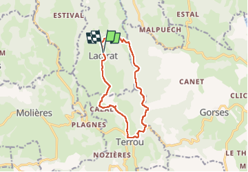
Randonnée Marche de 12,8 km à découvrir à Occitanie, Lot, Ladirat. Cette randonnée est proposée par sebcar.

Description

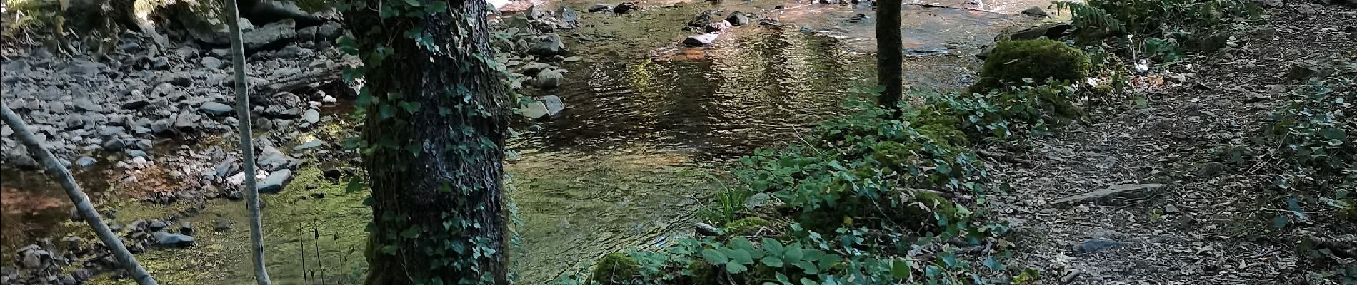
Remontée de la vallée de la Baves dans le Ségala

Profil altimétrique

Photos

Localisation

Pays :
France
Région :
Occitanie
Département/Province :
Lot
Commune :
Ladirat
Localité :
Unknown
Départ:(UTM)
418502 ; 4962937 (31T) N.

Randonnées à proximité

Randonnée Marche Terrou - Terrou2 - Photo
Marche
thomas.o.vert

Marche

Moyen
Terrou, Occitanie, Lot, France
14,5 km | 20 km-effort
3h 46min
Oui
Randonnée Marche Latouille-Lentillac - Arts nature 🏞 Latouille Lentillac - Photo
Marche
Gegetop

Marche

Très facile
Latouille-Lentillac, Occitanie, Lot, France
1,9 km | 3 km-effort
1h 30min
Oui
Randonnée Marche Latouille-Lentillac - Circuit des trois églises, Latouille lentillac - Photo
Marche
houbart

Marche

Très difficile
Latouille-Lentillac, Occitanie, Lot, France
13,5 km | 20 km-effort
4h 32min
Oui
Randonnée Marche Molières - Molieres - Photo
Marche
thomas.o.vert

Marche

Facile
Molières, Occitanie, Lot, France
25 km | 32 km-effort
2h 12min
Non
Randonnée Marche Terrou - TERROU  - Photo
Marche
Claude Quirion

Marche

Terrou, Occitanie, Lot, France
7,1 km | 9,6 km-effort
1h 45min
Non
Randonnée Marche Latouille-Lentillac - Les trois églises - Photo
Marche
phlassus

Marche

Facile
Latouille-Lentillac, Occitanie, Lot, France
13,5 km | 21 km-effort
3h 55min
Oui
Randonnée Marche Terrou - Terrou_6kms - Photo
Marche
ZAMBAUX

Marche

Moyen
Terrou, Occitanie, Lot, France
6,5 km | 8,8 km-effort
1h 52min
Oui
Randonnée Marche Terrou - TERROU_TOLERME   14.4 km - Photo
Marche
ZAMBAUX

Marche

Très difficile
Terrou, Occitanie, Lot, France
14,4 km | 20 km-effort
4h 23min
Non
Randonnée Marche Terrou - TERROU   9.1 km - Photo
Marche
ZAMBAUX

Marche

Difficile
Terrou, Occitanie, Lot, France
9,1 km | 13,8 km-effort
2h 52min
Oui


Fermer
Mes abonnements