![](/images/other/stat-length.png)
![Randonnée Marche Peyzac-le-Moustier - la Roque-St-Christophe St léon/Vézère - Photo](https://media.geolcdn.com/t/1900/400/ext.pjpeg?maxdim=2&url=https%3A%2F%2Fstatic1.geolcdn.com%2Fsiteimages%2Fupload%2Ffiles%2F1553511878bg_sport_marche.png)
la Roque-St-Christophe St léon/Vézère
natacha.brion69
Utilisateur
![Longueur](/images/other/stat-length.png)
Longueur
14 km
![Altitude max](https://static1.geolcdn.com/siteimages/upload/files/1508320355ic_sort_altitude_max_24dp.png)
Altitude max
230 m
![Dénivelé positif](https://static1.geolcdn.com/siteimages/upload/files/1508320355ic_sort_den_pos_24dp.png)
Dénivelé positif
405 m
![Km-Effort](/images/other/stat-length.png)
Km-Effort
19,4 km
![Altitude min](https://static1.geolcdn.com/siteimages/upload/files/1508320355ic_sort_altitude_min_24dp.png)
Altitude min
63 m
![Dénivelé négatif](https://static1.geolcdn.com/siteimages/upload/files/1508320355ic_sort_den_neg_24dp.png)
Dénivelé négatif
404 m
![Boucle](https://static1.geolcdn.com/siteimages/upload/files/16400158638029165_repeat_loop_refresh_sync_direction_icon.png)
Boucle
Oui
Date de création :
2022-08-23 09:36:28.215
Dernière modification :
2022-08-23 09:37:35.389
![Marche](https://static1.geolcdn.com/sitytour/trail-icons/101.png)
4h23
Difficulté : Très difficile
![Scannez ce code QR pour ouvrir la randonnée dans l'application SityTrail](https://capi.geolives.com/qq0zvz2zws4bq2lad0pu/sitytour/trails/3364876/qr.png?size=200)
Application GPS de randonnée GRATUITE
À propos
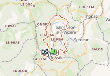
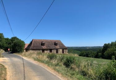
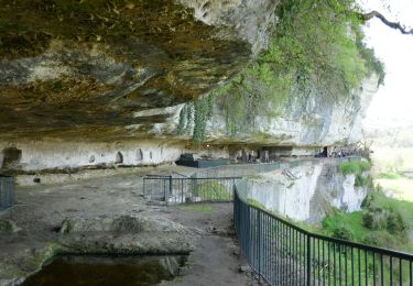
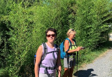
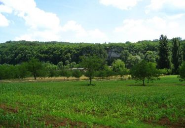
Randonnée Marche de 14 km à découvrir à Nouvelle-Aquitaine, Dordogne, Peyzac-le-Moustier. Cette randonnée est proposée par natacha.brion69.
Description
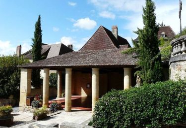
Boucle au départ de La Roque St Christophe, par Peyzac le Moustier et St Léon sur Vézère
Localisation
Pays :
France
Région :
Nouvelle-Aquitaine
Département/Province :
Dordogne
Commune :
Peyzac-le-Moustier
Localité :
Unknown
Départ:(Dec)
Départ:(UTM)
347919 ; 4983417 (31T) N.
Commentaires
Randonnées à proximité
![Randonnée Vélo électrique Plazac - Sensei Lissac - Photo](https://media.geolcdn.com/t/375/260/ext.jpg?maxdim=2&url=https%3A%2F%2Fmedia.geolcdn.com%2Ff%2Fccd27d5e-9d83-44d7-a1a6-a717ab1146ce.jpg)
![Vélo électrique Vélo électrique](https://static1.geolcdn.com/sitytour/trail-icons/205.png)
Sensei Lissac
Vélo électrique
Moyen
Plazac,
Nouvelle-Aquitaine,
Dordogne,
France
![](/images/other/stat-length.png)
18,7 km | 26 km-effort
2h 26min
![](https://static1.geolcdn.com/siteimages/upload/files/16400158638029165_repeat_loop_refresh_sync_direction_icon.png)
Oui
![Randonnée Marche Saint-Léon-sur-Vézère - Boucle de Haute-Claire St Léon sur Vézère - Photo](https://media.geolcdn.com/t/375/260/ext.jpg?maxdim=2&url=https%3A%2F%2Fmedia.geolcdn.com%2Ff%2F6b8d4051-3369-48b4-85b3-aee55415b67f.jpg)
![Marche Marche](https://static1.geolcdn.com/sitytour/trail-icons/101.png)
Boucle de Haute-Claire St Léon sur Vézère
Marche
Moyen
Saint-Léon-sur-Vézère,
Nouvelle-Aquitaine,
Dordogne,
France
![](/images/other/stat-length.png)
12,3 km | 17 km-effort
3h 8min
![](https://static1.geolcdn.com/siteimages/upload/files/16400158638029165_repeat_loop_refresh_sync_direction_icon.png)
Oui
![Randonnée Vélo électrique Tursac - Boucle Tursac la Vézère - Photo](https://media.geolcdn.com/t/375/260/ext.jpg?maxdim=2&url=https%3A%2F%2Fmedia.geolcdn.com%2Ff%2F5651ddcf-540e-4ccc-97b7-460cd96b3ffa.JPG)
![Vélo électrique Vélo électrique](https://static1.geolcdn.com/sitytour/trail-icons/205.png)
Boucle Tursac la Vézère
Vélo électrique
Facile
Tursac,
Nouvelle-Aquitaine,
Dordogne,
France
![](/images/other/stat-length.png)
22 km | 29 km-effort
2h 54min
![](https://static1.geolcdn.com/siteimages/upload/files/16400158638029165_repeat_loop_refresh_sync_direction_icon.png)
Oui
![Randonnée Marche Peyzac-le-Moustier - Sensei24. Roque saint christophe - Photo](https://media.geolcdn.com/t/375/260/ext.jpg?maxdim=2&url=https%3A%2F%2Fmedia.geolcdn.com%2Ff%2F91b857a2-44a5-482e-ba5b-0816305726ff.jpg)
![Marche Marche](https://static1.geolcdn.com/sitytour/trail-icons/101.png)
Sensei24. Roque saint christophe
Marche
Difficile
Peyzac-le-Moustier,
Nouvelle-Aquitaine,
Dordogne,
France
![](/images/other/stat-length.png)
16,2 km | 0 m-effort
4h 21min
![](https://static1.geolcdn.com/siteimages/upload/files/16400158638029165_repeat_loop_refresh_sync_direction_icon.png)
Oui
![Randonnée Marche Tursac - La Borie - Photo](https://media.geolcdn.com/t/375/260/ext.jpg?maxdim=2&url=https%3A%2F%2Fservices.sitytrail.com%2FGeolivesWS%2FDownloadMedia.ashx%3FTrailID%3D799194%26Media%3Dfix__20170730174739.jpg)
![Marche Marche](https://static1.geolcdn.com/sitytour/trail-icons/101.png)
La Borie
Marche
Facile
Tursac,
Nouvelle-Aquitaine,
Dordogne,
France
![](/images/other/stat-length.png)
11 km | 14,3 km-effort
2h 55min
![](https://static1.geolcdn.com/siteimages/upload/files/16400158638029165_repeat_loop_refresh_sync_direction_icon.png)
Oui
![Randonnée Marche Tursac - la Borie - Photo](https://media.geolcdn.com/t/375/260/ext.jpg?maxdim=2&url=https%3A%2F%2Fservices.sitytrail.com%2FGeolivesWS%2FDownloadMedia.ashx%3FTrailID%3D799191%26Media%3Dfix__20170730174739.jpg)
![Marche Marche](https://static1.geolcdn.com/sitytour/trail-icons/101.png)
la Borie
Marche
Facile
Tursac,
Nouvelle-Aquitaine,
Dordogne,
France
![](/images/other/stat-length.png)
11 km | 14,3 km-effort
2h 55min
![](https://static1.geolcdn.com/siteimages/upload/files/16400158638029165_repeat_loop_refresh_sync_direction_icon.png)
Oui
![Randonnée Marche Peyzac-le-Moustier - vezere_11 - Photo](https://media.geolcdn.com/t/375/260/ext.jpg?maxdim=2&url=https%3A%2F%2Fstatic1.geolcdn.com%2Fsiteimages%2Fupload%2Ffiles%2F1553511878bg_sport_marche.png)
![Marche Marche](https://static1.geolcdn.com/sitytour/trail-icons/101.png)
vezere_11
Marche
Moyen
(1)
Peyzac-le-Moustier,
Nouvelle-Aquitaine,
Dordogne,
France
![](/images/other/stat-length.png)
8 km | 11,7 km-effort
2h 26min
![](https://static1.geolcdn.com/siteimages/upload/files/16400158638029165_repeat_loop_refresh_sync_direction_icon.png)
Oui
![Randonnée V.T.T. Saint-Léon-sur-Vézère - Rando VTT Silex 2013 - Saint Léon sur Vézère - Photo](https://media.geolcdn.com/t/375/260/ext.jpg?maxdim=2&url=https%3A%2F%2Fservices.sitytrail.com%2FGeolivesWS%2FDownloadMedia.ashx%3FTrailID%3D317058%26Media%3D16206_6.jpg)
![V.T.T. V.T.T.](https://static1.geolcdn.com/sitytour/trail-icons/202.png)
Rando VTT Silex 2013 - Saint Léon sur Vézère
V.T.T.
Difficile
Saint-Léon-sur-Vézère,
Nouvelle-Aquitaine,
Dordogne,
France
![](/images/other/stat-length.png)
41 km | 54 km-effort
4h 15min
![](https://static1.geolcdn.com/siteimages/upload/files/16400158638029165_repeat_loop_refresh_sync_direction_icon.png)
Oui
![Randonnée V.T.T. Saint-Léon-sur-Vézère - De Saint Léon-sur-Vézère au Verdoyant - Photo](https://media.geolcdn.com/t/375/260/ext.jpg?maxdim=2&url=https%3A%2F%2Fservices.sitytrail.com%2FGeolivesWS%2FDownloadMedia.ashx%3FTrailID%3D215098%26Media%3D15680_4.jpg)
![V.T.T. V.T.T.](https://static1.geolcdn.com/sitytour/trail-icons/202.png)
De Saint Léon-sur-Vézère au Verdoyant
V.T.T.
Difficile
Saint-Léon-sur-Vézère,
Nouvelle-Aquitaine,
Dordogne,
France
![](/images/other/stat-length.png)
25 km | 34 km-effort
3h 0min
![](https://static1.geolcdn.com/siteimages/upload/files/16400158638029165_repeat_loop_refresh_sync_direction_icon.png)
Non