![](/images/other/stat-length.png)
![Randonnée Marche Wavre-Sainte-Catherine - waversebossen/Natuurpunt/St.Katelijne Waver - Photo](https://media.geolcdn.com/t/1900/400/ext.pjpeg?maxdim=2&url=https%3A%2F%2Fmedia.geolcdn.com%2Ff%2F43d9684e-c64f-4184-b53f-7aac08166f6a.jpg)
waversebossen/Natuurpunt/St.Katelijne Waver
gogo1965
Utilisateur
![Longueur](/images/other/stat-length.png)
Longueur
8,6 km
![Altitude max](https://static1.geolcdn.com/siteimages/upload/files/1508320355ic_sort_altitude_max_24dp.png)
Altitude max
19 m
![Dénivelé positif](https://static1.geolcdn.com/siteimages/upload/files/1508320355ic_sort_den_pos_24dp.png)
Dénivelé positif
49 m
![Km-Effort](/images/other/stat-length.png)
Km-Effort
9,3 km
![Altitude min](https://static1.geolcdn.com/siteimages/upload/files/1508320355ic_sort_altitude_min_24dp.png)
Altitude min
4 m
![Dénivelé négatif](https://static1.geolcdn.com/siteimages/upload/files/1508320355ic_sort_den_neg_24dp.png)
Dénivelé négatif
49 m
![Boucle](https://static1.geolcdn.com/siteimages/upload/files/16400158638029165_repeat_loop_refresh_sync_direction_icon.png)
Boucle
Oui
Date de création :
2022-08-28 09:45:06.957
Dernière modification :
2022-08-28 12:20:30.797
![Marche](https://static1.geolcdn.com/sitytour/trail-icons/101.png)
1h30
Difficulté : Très facile
![Scannez ce code QR pour ouvrir la randonnée dans l'application SityTrail](https://capi.geolives.com/qq0zvz2zws4bq2lad0pu/sitytour/trails/3370806/qr.png?size=200)
Application GPS de randonnée GRATUITE
À propos
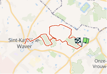
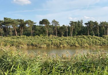
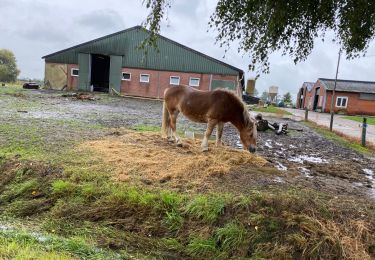
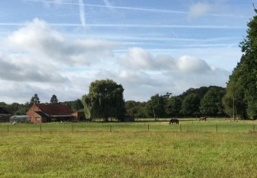
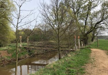
Randonnée Marche de 8,6 km à découvrir à Flandre, Anvers, Wavre-Sainte-Catherine. Cette randonnée est proposée par gogo1965.
Description
De staptijd komt niet overeen met werkelijkheid, heel veel onduidelijke routes. Het rechte stuk heen/weer niet doen was fout in route
Localisation
Pays :
Belgique
Région :
Flandre
Département/Province :
Anvers
Commune :
Wavre-Sainte-Catherine
Localité :
Wavre-Sainte-Catherine
Départ:(Dec)
Départ:(UTM)
609679 ; 5658610 (31U) N.
Commentaires
Randonnées à proximité
![Randonnée Marche Malines - Mechels Broek - Photo](https://media.geolcdn.com/t/375/260/ext.jpg?maxdim=2&url=https%3A%2F%2Fmedia.geolcdn.com%2Ff%2F9bcb37dd-3951-4aca-95ae-228b9c6b487f.jpg)
![Marche Marche](https://static1.geolcdn.com/sitytour/trail-icons/101.png)
![Randonnée A pied Lierre - Brede Zeyppad - Photo](https://media.geolcdn.com/t/375/260/ext.jpg?maxdim=2&url=https%3A%2F%2Fmedia.geolcdn.com%2Ff%2F454c2cd9-2c0d-453a-b483-d5e4fc5b160c.jpeg)
![A pied A pied](https://static1.geolcdn.com/sitytour/trail-icons/100.png)
![Randonnée Marche Duffel - Duffel 22 km - Photo](https://media.geolcdn.com/t/375/260/ext.jpg?maxdim=2&url=https%3A%2F%2Fmedia.geolcdn.com%2Ff%2F5de96220-824b-4235-bf30-d8d21f522f10.jpg)
![Marche Marche](https://static1.geolcdn.com/sitytour/trail-icons/101.png)
![Randonnée Marche Lierre - Lammeke Lier 19 km - Photo](https://media.geolcdn.com/t/375/260/ext.jpg?maxdim=2&url=https%3A%2F%2Fmedia.geolcdn.com%2Ff%2F984d65d7-90f5-4b2f-b7ee-aa064772520b.jpg)
![Marche Marche](https://static1.geolcdn.com/sitytour/trail-icons/101.png)
Lammeke Lier 19 km
Marche
Facile
Lierre,
Flandre,
Anvers,
Belgique
![](/images/other/stat-length.png)
19,3 km | 20 km-effort
4h 52min
![](https://static1.geolcdn.com/siteimages/upload/files/16400158638029165_repeat_loop_refresh_sync_direction_icon.png)
Oui
![Randonnée Marche Bonheiden - Malines les marais moeras 21 km - Photo](https://media.geolcdn.com/t/375/260/ext.jpg?maxdim=2&url=https%3A%2F%2Fmedia.geolcdn.com%2Ff%2Fcdb70a8a-04c8-4736-88ef-c7450fb13e45.jpg)
![Marche Marche](https://static1.geolcdn.com/sitytour/trail-icons/101.png)
Malines les marais moeras 21 km
Marche
Bonheiden,
Flandre,
Anvers,
Belgique
![](/images/other/stat-length.png)
22 km | 24 km-effort
5h 16min
![](https://static1.geolcdn.com/siteimages/upload/files/16400158638029165_repeat_loop_refresh_sync_direction_icon.png)
Oui
![Randonnée Marche Bonheiden - malines depuis les marais 14 km - Photo](https://media.geolcdn.com/t/375/260/ext.jpg?maxdim=2&url=https%3A%2F%2Fservices.sitytrail.com%2FGeolivesWS%2FDownloadMedia.ashx%3FTrailID%3D942921%26Media%3D20180414144233.jpg)
![Marche Marche](https://static1.geolcdn.com/sitytour/trail-icons/101.png)
malines depuis les marais 14 km
Marche
Très facile
Bonheiden,
Flandre,
Anvers,
Belgique
![](/images/other/stat-length.png)
14,3 km | 15,2 km-effort
5h 4min
![](https://static1.geolcdn.com/siteimages/upload/files/16400158638029165_repeat_loop_refresh_sync_direction_icon.png)
Oui
![Randonnée Marche Lierre - Fort Koningshooikt Zeypwandeling - Photo](https://media.geolcdn.com/t/375/260/ext.jpg?maxdim=2&url=https%3A%2F%2Fstatic1.geolcdn.com%2Fsiteimages%2Fupload%2Ffiles%2F1553511878bg_sport_marche.png)
![Marche Marche](https://static1.geolcdn.com/sitytour/trail-icons/101.png)
Fort Koningshooikt Zeypwandeling
Marche
Très facile
Lierre,
Flandre,
Anvers,
Belgique
![](/images/other/stat-length.png)
26 km | 28 km-effort
1h 58min
![](https://static1.geolcdn.com/siteimages/upload/files/16400158638029165_repeat_loop_refresh_sync_direction_icon.png)
Non
![Randonnée V.T.T. Bonheiden - Rijmenam - Photo](https://media.geolcdn.com/t/375/260/ext.jpg?maxdim=2&url=https%3A%2F%2Fstatic1.geolcdn.com%2Fsiteimages%2Fupload%2Ffiles%2F1524743154velo.jpg)
![V.T.T. V.T.T.](https://static1.geolcdn.com/sitytour/trail-icons/202.png)
![Randonnée Vélo Wavre-Sainte-Catherine - Belgie - tuindersroute - Photo](https://media.geolcdn.com/t/375/260/ext.jpg?maxdim=2&url=https%3A%2F%2Fstatic1.geolcdn.com%2Fsiteimages%2Fupload%2Ffiles%2F1524743154velo.jpg)
![Vélo Vélo](https://static1.geolcdn.com/sitytour/trail-icons/200.png)
Belgie - tuindersroute
Vélo
Très facile
Wavre-Sainte-Catherine,
Flandre,
Anvers,
Belgique
![](/images/other/stat-length.png)
45 km | 48 km-effort
Inconnu
![](https://static1.geolcdn.com/siteimages/upload/files/16400158638029165_repeat_loop_refresh_sync_direction_icon.png)
Oui