Randonnée Marche Maasmechelen - Mechelse Heide  - Photo
 mumu.larandonneuse
mumu.larandonneuse

Utilisateur GUIDE

© OpenStreetMap contributors
Longueur
Longueur
14,2 km
Altitude max
Altitude max
101 m
Dénivelé positif
Dénivelé positif
156 m
Km-Effort
Km-Effort  
16,2 km
Altitude min
Altitude min
46 m
Dénivelé négatif
Dénivelé négatif
156 m
Boucle
Boucle
Oui
Date de création :
2022-09-01 12:02:37.993
Dernière modification :
2022-09-14 14:40:49.063

(2 Avis)

Marche
Marche
3h41
Difficulté : Facile

Scannez ce code QR pour ouvrir la randonnée dans l'application SityTrail

Application GPS de randonnée GRATUITE

Logo SityTrail SityTrail

IGN / Instituts géographiques

Télécharger SityTrail sur l'App Store Télécharger SityTrail sur Google Play

Logo SityTrail SityTrail World

Le monde est à vous

Télécharger SityTrail sur l'App Store Télécharger SityTrail sur Google Play Télécharger SityTrail sur Huawei AppGallery

À propos

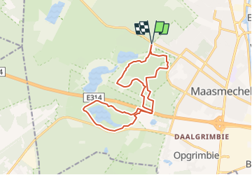
Randonnée Marche de 14,2 km à découvrir à Flandre, Limbourg, Maasmechelen. Cette randonnée est proposée par mumu.larandonneuse.

Description

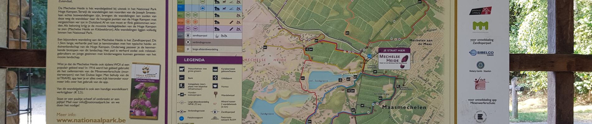
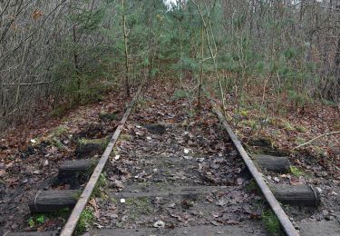
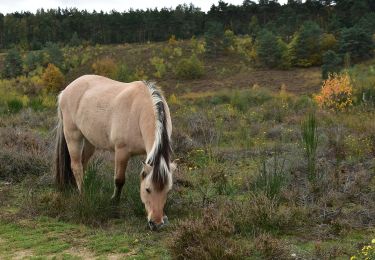
L'itinéraire traverse le Parc National de la Haute Campine (Hoge Kempen). Nous marchons dans le Mechelse Heide et dans la vallée du Kikbeekbron.  

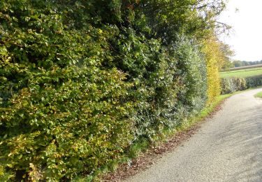
➕ La bruyère pourpre fleurit en août-septembre. 
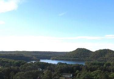
➕ De magnifiques vues.
📍& 🅿️ Porte d'entrée du parc : à Maasmechelen, Joseph Smeetslaan 280.
www.wandelgidszuidlimburg.com n°250 (modifié)

Profil altimétrique

Photos

Localisation

Pays :
Belgique
Région :
Flandre
Département/Province :
Limbourg
Commune :
Maasmechelen
Localité :
Mechelen-aan-de-Maas
Départ:(UTM)
686678 ; 5650748 (31U) N.

Commentaires

Veuillez vous connecter pour laisser un commentaire ou une note


Superbe parcours 100 % nature.


Randonnées à proximité

Randonnée A pied As - Mechelse Heide Noord - Photo
A pied
PRO

A pied

Facile
As, Flandre, Limbourg, Belgique
4,3 km | 4,8 km-effort
1h 5min
Non
Randonnée A pied Maasmechelen - Erfgoedwandeling Eisden Tuinwijk - Photo
A pied
PRO

A pied

Facile
Maasmechelen, Flandre, Limbourg, Belgique
3,1 km | 3,3 km-effort
44min
Oui
Randonnée A pied Dilsen-Stokkem - Connecterra Rode driehoek - Photo
A pied
PRO

A pied

Facile
Dilsen-Stokkem, Flandre, Limbourg, Belgique
6,2 km | 7 km-effort
1h 35min
Non
Randonnée A pied Maasmechelen - Station As Groene rechthoek - Photo
A pied
PRO

A pied

Facile
Maasmechelen, Flandre, Limbourg, Belgique
3,3 km | 3,8 km-effort
51min
Oui
Randonnée A pied Maasmechelen - Leut & Meeswijk Gele zeshoek - Photo
A pied
PRO

A pied

Facile
Maasmechelen, Flandre, Limbourg, Belgique
7 km | 7,4 km-effort
1h 40min
Oui
Randonnée A pied Maasmechelen - Station As Blauwe ruit - Photo
A pied
PRO

A pied

Facile
Maasmechelen, Flandre, Limbourg, Belgique
6,5 km | 7,1 km-effort
1h 36min
Oui
Randonnée A pied Maasmechelen - Station As Rode driehoek - Photo
A pied
PRO

A pied

Facile
Maasmechelen, Flandre, Limbourg, Belgique
12 km | 13,4 km-effort
3h 3min
Oui
Randonnée A pied Dilsen-Stokkem - Litzberg groene rechthoek - Photo
A pied
PRO

A pied

Facile
Dilsen-Stokkem, Flandre, Limbourg, Belgique
3 km | 3,7 km-effort
49min
Oui
Randonnée A pied Maasmechelen - Kikbeekbron Blauwe ruit - Photo
A pied
PRO

A pied

Facile
Maasmechelen, Flandre, Limbourg, Belgique
4,6 km | 5,2 km-effort
1h 11min
Oui


Fermer
Mes abonnements