Randonnée Vélo de route Cernay - Le Grand ballon de Cernay  - Photo

Le Grand ballon de Cernay

 nadd73
nadd73

Utilisateur

© OpenStreetMap contributors
Longueur
Longueur
23 km
Altitude max
Altitude max
1351 m
Dénivelé positif
Dénivelé positif
1238 m
Km-Effort
Km-Effort  
36 km
Altitude min
Altitude min
294 m
Dénivelé négatif
Dénivelé négatif
199 m
Boucle
Boucle
Non
Date de création :
2022-09-22 09:53:40.024
Dernière modification :
2022-09-22 19:03:28.995

(0 Avis)

Vélo de route
Vélo de route
2h15
Difficulté : Difficile

Scannez ce code QR pour ouvrir la randonnée dans l'application SityTrail

Application GPS de randonnée GRATUITE

Logo SityTrail SityTrail

IGN / Instituts géographiques

Télécharger SityTrail sur l'App Store Télécharger SityTrail sur Google Play

Logo SityTrail SityTrail World

Le monde est à vous

Télécharger SityTrail sur l'App Store Télécharger SityTrail sur Google Play Télécharger SityTrail sur Huawei AppGallery

À propos

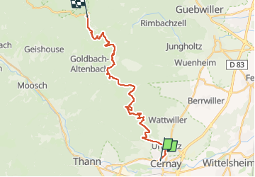
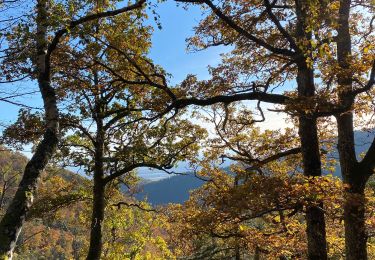
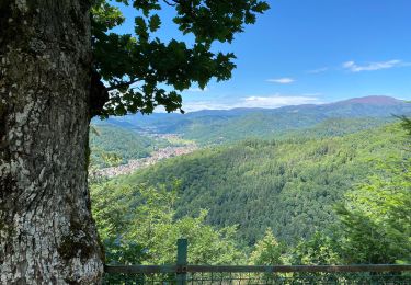
Randonnée Vélo de route de 23 km à découvrir à Grand Est, Haut-Rhin, Cernay. Cette randonnée est proposée par nadd73.

Description

Départ de Uffholtz.
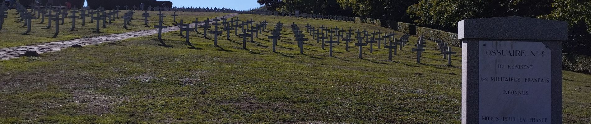
Visite du mémorial de Hatmannswiller
J'ai fait un aller retour.
Donc compter 50km et 1400 de dénivelé.

Profil altimétrique

Photos

Localisation

Pays :
France
Région :
Grand Est
Département/Province :
Haut-Rhin
Commune :
Cernay
Localité :
Unknown
Départ:(UTM)
363220 ; 5296852 (32T) N.

Randonnées à proximité

Randonnée Autre activité Steinbach - lac du ballon - Photo
Autre activité
rodabruna

Autre activité

Très facile
(1)
Steinbach, Grand Est, Haut-Rhin, France
33 km | 64 km-effort
5h 1min
Non
Randonnée Marche Uffholtz - Molkenrain 1 - Photo
Marche
regisbodilis

Marche

Difficile
(1)
Uffholtz, Grand Est, Haut-Rhin, France
15,4 km | 26 km-effort
4h 0min
Oui
Randonnée Marche Steinbach - Rando CLAS du 02/11/2023 - Photo
Marche
boubou68

Marche

Très difficile
Steinbach, Grand Est, Haut-Rhin, France
17,7 km | 27 km-effort
4h 35min
Oui
Randonnée Marche Steinbach - Rando Marcheurs du 03/07/2023 par ALAIN - Photo
Marche
boubou68

Marche

Très difficile
Steinbach, Grand Est, Haut-Rhin, France
20 km | 34 km-effort
5h 1min
Oui
Randonnée Marche Wattwiller - Wattwiller - Domaine du Hirtz (30/03/2023) - Photo
Marche
Richard68500

Marche

Facile
Wattwiller, Grand Est, Haut-Rhin, France
6,1 km | 9,9 km-effort
2h 7min
Oui
Randonnée Marche Uffholtz - Uffholtz - Wattwiller (23/12/2021) - Photo
Marche
Richard68500

Marche

Moyen
Uffholtz, Grand Est, Haut-Rhin, France
11,4 km | 17,2 km-effort
3h 27min
Oui
Randonnée V.T.T. Steinbach - Terrasse de Steinbach  - Photo
V.T.T.
Derrendinger

V.T.T.

Moyen
Steinbach, Grand Est, Haut-Rhin, France
21 km | 30 km-effort
1h 53min
Oui
Randonnée Marche Steinbach - steinbach, waldkapelle, vieux thann - Photo
Marche
baratta

Marche

Facile
(1)
Steinbach, Grand Est, Haut-Rhin, France
9 km | 13,4 km-effort
2h 36min
Oui
Randonnée V.T.T. Steinbach - Rocher Albert + Molkenrain  - Photo
V.T.T.
Derrendinger

V.T.T.

Steinbach, Grand Est, Haut-Rhin, France
28 km | 40 km-effort
2h 26min
Oui


Fermer
Mes abonnements