Randonnée Marche Commarin - Départ panthier - Photo
 eric.guyard21
eric.guyard21

Utilisateur

© OpenStreetMap contributors
Longueur
Longueur
17,3 km
Altitude max
Altitude max
558 m
Dénivelé positif
Dénivelé positif
330 m
Km-Effort
Km-Effort  
22 km
Altitude min
Altitude min
370 m
Dénivelé négatif
Dénivelé négatif
330 m
Boucle
Boucle
Oui
Date de création :
2022-09-26 12:22:21.0
Dernière modification :
2022-09-26 16:09:37.226

(0 Avis)

Marche
Marche
3h43
Difficulté : Très difficile

Scannez ce code QR pour ouvrir la randonnée dans l'application SityTrail

Application GPS de randonnée GRATUITE

Logo SityTrail SityTrail

IGN / Instituts géographiques

Télécharger SityTrail sur l'App Store Télécharger SityTrail sur Google Play

Logo SityTrail SityTrail World

Le monde est à vous

Télécharger SityTrail sur l'App Store Télécharger SityTrail sur Google Play Télécharger SityTrail sur Huawei AppGallery

À propos

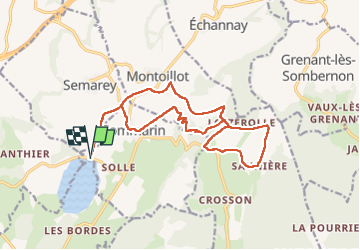
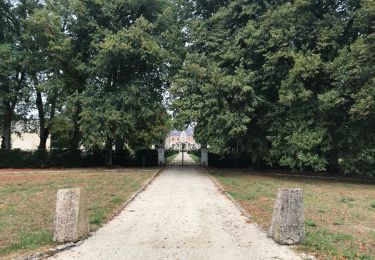
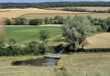
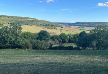
Randonnée Marche de 17,3 km à découvrir à Bourgogne-Franche-Comté, Côte-d'Or, Commarin. Cette randonnée est proposée par eric.guyard21.

Profil altimétrique

Photos

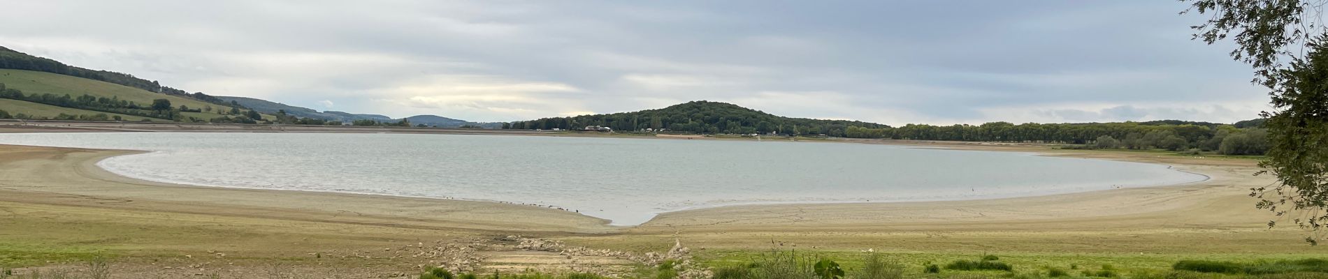
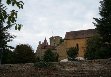
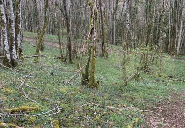
28 photos au total. Cliquez sur une photo pour les afficher toutes dans la galerie.

Localisation

Pays :
France
Région :
Bourgogne-Franche-Comté
Département/Province :
Côte-d'Or
Commune :
Commarin
Localité :
Unknown
Départ:(Dec)
Départ:(UTM)
623647 ; 5234264 (31T) N.

Randonnées à proximité

Randonnée A pied Montoillot - Boucle des Trois Châteaux - Photo
A pied
PRO

A pied

Facile
Montoillot, Bourgogne-Franche-Comté, Côte-d'Or, France
8,6 km | 11,1 km-effort
2h 31min
Non
Randonnée Autre activité Châteauneuf - vandenesse - Photo
Autre activité
gilles1955

Autre activité

Très facile
(1)
Châteauneuf, Bourgogne-Franche-Comté, Côte-d'Or, France
8,1 km | 10,4 km-effort
1h 5min
Oui
Randonnée Marche Civry-en-Montagne - Civet en montagne - Photo
Marche
eric.guyard21

Marche

Civry-en-Montagne, Bourgogne-Franche-Comté, Côte-d'Or, France
10,9 km | 13,9 km-effort
2h 56min
Oui
Randonnée V.T.T. Montoillot - Les trois châteaux 2018.08.27 - Photo
V.T.T.
eric.guyard21

V.T.T.

Moyen
Montoillot, Bourgogne-Franche-Comté, Côte-d'Or, France
21 km | 25 km-effort
1h 47min
Oui
Randonnée V.T.T. Montoillot - Les trois châteaux 2018.08.27 - Photo
V.T.T.
eric.guyard21

V.T.T.

Moyen
Montoillot, Bourgogne-Franche-Comté, Côte-d'Or, France
21 km | 25 km-effort
1h 47min
Oui
Randonnée Marche Vandenesse-en-Auxois - panthiers  - Photo
Marche
belleney

Marche

Très facile
Vandenesse-en-Auxois, Bourgogne-Franche-Comté, Côte-d'Or, France
3,9 km | 4,2 km-effort
1h 25min
Non
Randonnée Marche Châteauneuf - Châteauneuf - Photo
Marche
eric.guyard21

Marche

Difficile
Châteauneuf, Bourgogne-Franche-Comté, Côte-d'Or, France
22 km | 29 km-effort
4h 55min
Oui
Randonnée V.T.T. Montoillot - Les trois cha^teaux 2018.08.27 - Photo
V.T.T.
eric.guyard21

V.T.T.

Facile
Montoillot, Bourgogne-Franche-Comté, Côte-d'Or, France
22 km | 27 km-effort
1h 47min
Oui
Randonnée Marche Montoillot - la boucle des 3 châteaux en auxois (Dijon) - Photo
Marche
eaea7charles

Marche

Très difficile
Montoillot, Bourgogne-Franche-Comté, Côte-d'Or, France
17,9 km | 22 km-effort
5h 1min
Oui


Fermer
Mes abonnements