Randonnée Marche Civry-en-Montagne - Civet en montagne - Photo
 eric.guyard21
eric.guyard21

Utilisateur

© OpenStreetMap contributors
Longueur
Longueur
10,9 km
Altitude max
Altitude max
534 m
Dénivelé positif
Dénivelé positif
229 m
Km-Effort
Km-Effort  
13,9 km
Altitude min
Altitude min
378 m
Dénivelé négatif
Dénivelé négatif
225 m
Boucle
Boucle
Oui
Date de création :
2024-03-25 13:33:30.0
Dernière modification :
2024-03-29 19:32:19.963

(0 Avis)

Marche
Marche
2h56
Difficulté : Inconnu

Scannez ce code QR pour ouvrir la randonnée dans l'application SityTrail

Application GPS de randonnée GRATUITE

Logo SityTrail SityTrail

IGN / Instituts géographiques

Télécharger SityTrail sur l'App Store Télécharger SityTrail sur Google Play

Logo SityTrail SityTrail World

Le monde est à vous

Télécharger SityTrail sur l'App Store Télécharger SityTrail sur Google Play Télécharger SityTrail sur Huawei AppGallery

À propos

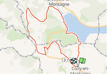
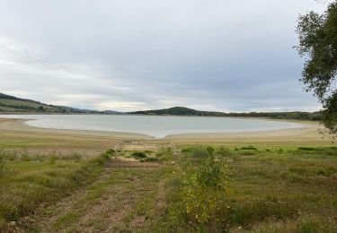
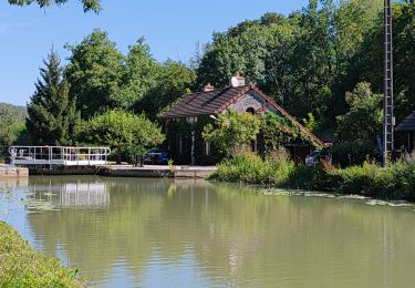
Randonnée Marche de 10,9 km à découvrir à Bourgogne-Franche-Comté, Côte-d'Or, Civry-en-Montagne. Cette randonnée est proposée par eric.guyard21.

Description

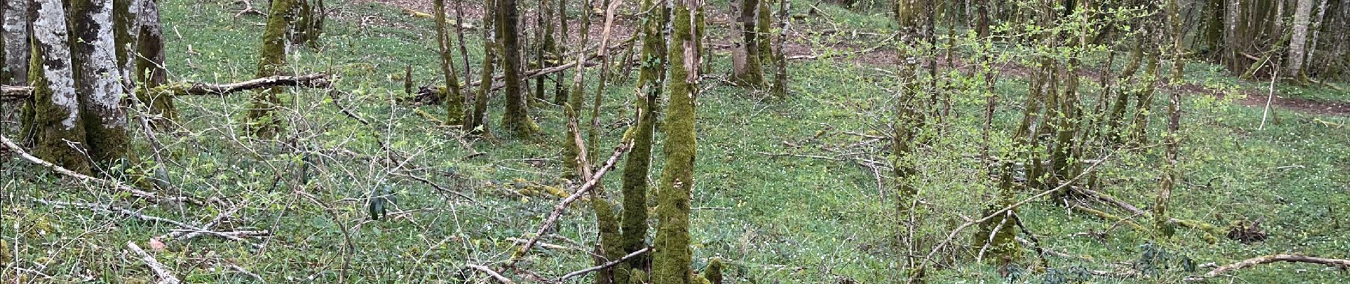
Randonnée tranquille, mais à part faire après la pluie car très boueux

Profil altimétrique

Photos

Localisation

Pays :
France
Région :
Bourgogne-Franche-Comté
Département/Province :
Côte-d'Or
Commune :
Civry-en-Montagne
Localité :
Unknown
Départ:(Dec)
Départ:(UTM)
621735 ; 5238946 (31T) N.

Randonnées à proximité

Randonnée A pied Montoillot - Boucle des Trois Châteaux - Photo
A pied
PRO

A pied

Facile
Montoillot, Bourgogne-Franche-Comté, Côte-d'Or, France
8,6 km | 11,1 km-effort
2h 31min
Non
Randonnée V.T.T. Montoillot - Les trois châteaux 2018.08.27 - Photo
V.T.T.
eric.guyard21

V.T.T.

Moyen
Montoillot, Bourgogne-Franche-Comté, Côte-d'Or, France
21 km | 25 km-effort
1h 47min
Oui
Randonnée V.T.T. Montoillot - Les trois châteaux 2018.08.27 - Photo
V.T.T.
eric.guyard21

V.T.T.

Moyen
Montoillot, Bourgogne-Franche-Comté, Côte-d'Or, France
21 km | 25 km-effort
1h 47min
Oui
Randonnée Marche Pouilly-en-Auxois - Bourgogne 4L mercredi_backup - Photo
Marche
abalcerek

Marche

Très facile
(1)
Pouilly-en-Auxois, Bourgogne-Franche-Comté, Côte-d'Or, France
191 km | 240 km-effort
6h 40min
Oui
Randonnée Marche Commarin - Départ panthier - Photo
Marche
eric.guyard21

Marche

Très difficile
Commarin, Bourgogne-Franche-Comté, Côte-d'Or, France
17,3 km | 22 km-effort
3h 43min
Oui
Randonnée Cyclotourisme Pouilly-en-Auxois - Pouilly en Auxois à Fleurey sur Ouche - Photo
Cyclotourisme
valetg

Cyclotourisme

Très difficile
Pouilly-en-Auxois, Bourgogne-Franche-Comté, Côte-d'Or, France
44 km | 47 km-effort
5h 7min
Non
Randonnée V.T.T. Montoillot - Les trois cha^teaux 2018.08.27 - Photo
V.T.T.
eric.guyard21

V.T.T.

Facile
Montoillot, Bourgogne-Franche-Comté, Côte-d'Or, France
22 km | 27 km-effort
1h 47min
Oui
Randonnée Marche Montoillot - la boucle des 3 châteaux en auxois (Dijon) - Photo
Marche
eaea7charles

Marche

Très difficile
Montoillot, Bourgogne-Franche-Comté, Côte-d'Or, France
17,9 km | 22 km-effort
5h 1min
Oui
Randonnée A pied Commarin - Les Trois Châteaux - Photo
A pied
mricard

A pied

Facile
Commarin, Bourgogne-Franche-Comté, Côte-d'Or, France
20 km | 26 km-effort
4h 50min
Oui


Fermer
Mes abonnements