Randonnée A pied Saint-Sulpice-de-Favières - Randonnée Saint-Sulpice-de-Favieres n°2 - Photo

Randonnée Saint-Sulpice-de-Favieres n°2

 Jean Pierre Parent
Jean Pierre Parent

Utilisateur

© OpenStreetMap contributors
Longueur
Longueur
20 km
Altitude max
Altitude max
162 m
Dénivelé positif
Dénivelé positif
370 m
Km-Effort
Km-Effort  
25 km
Altitude min
Altitude min
56 m
Dénivelé négatif
Dénivelé négatif
373 m
Boucle
Boucle
Oui
Date de création :
2022-10-02 14:57:12.445
Dernière modification :
2022-11-13 09:18:32.577

(0 Avis)

A pied
A pied
4h51
Difficulté : Moyen

Scannez ce code QR pour ouvrir la randonnée dans l'application SityTrail

Application GPS de randonnée GRATUITE

Logo SityTrail SityTrail

IGN / Instituts géographiques

Télécharger SityTrail sur l'App Store Télécharger SityTrail sur Google Play

Logo SityTrail SityTrail World

Le monde est à vous

Télécharger SityTrail sur l'App Store Télécharger SityTrail sur Google Play Télécharger SityTrail sur Huawei AppGallery

À propos

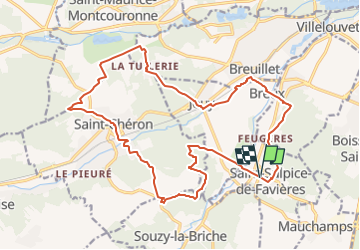
Randonnée A pied de 20 km à découvrir à Île-de-France, Essonne, Saint-Sulpice-de-Favières. Cette randonnée est proposée par Jean Pierre Parent.

Description

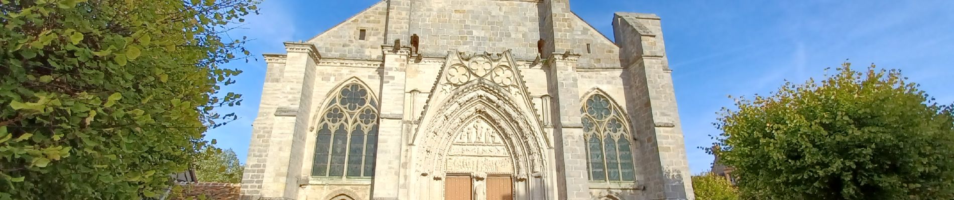
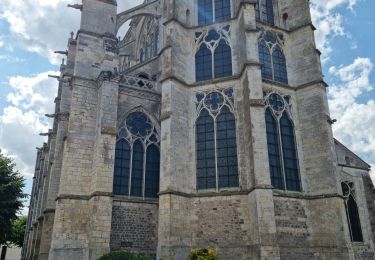
direction de l'église de Saint-Sulpice-de-Favières
longe le domaine de Segrez
direction Breuillet
longe l'Orge jusu'à Jouy
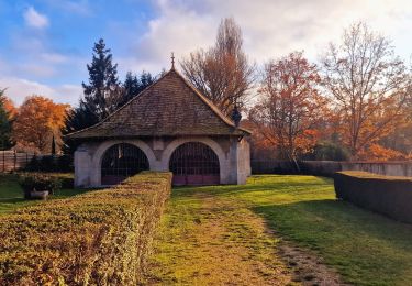
direction Chateau de Baville
retour vers Saint-Cheron
passage entre le camping Parc des Roches et Heliomonde
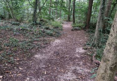
prendre tout droit vers les Carrières de Madagascar

Profil altimétrique

Photos

Localisation

Pays :
France
Région :
Île-de-France
Département/Province :
Essonne
Commune :
Saint-Sulpice-de-Favières
Localité :
Unknown
Départ:(UTM)
439099 ; 5376863 (31U) N.

Randonnées à proximité

Randonnée Marche Saint-Sulpice-de-Favières - Les Pétales de Souzy - Photo
Marche
tracegps

Marche

Difficile
(1)
Saint-Sulpice-de-Favières, Île-de-France, Essonne, France
23 km | 29 km-effort
4h 49min
Oui
Randonnée A pied Saint-Yon - Sur les traces de la Renarde - Photo
A pied
PRO

A pied

Très difficile
Saint-Yon, Île-de-France, Essonne, France
38 km | 44 km-effort
10h 4min
Non
Randonnée Marche Saint-Sulpice-de-Favières - St Sulpice - Photo
Marche
Auger91

Marche

Moyen
(1)
Saint-Sulpice-de-Favières, Île-de-France, Essonne, France
8 km | 10,1 km-effort
2h 18min
Oui
Randonnée Marche Boissy-sous-Saint-Yon - Carrière de Madagascar  - Photo
Marche
danbott

Marche

Très facile
(1)
Boissy-sous-Saint-Yon, Île-de-France, Essonne, France
13,2 km | 16,5 km-effort
2h 59min
Oui
Randonnée Marche Villeconin - Villeconin - Photo
Marche
guydu41

Marche

Moyen
Villeconin, Île-de-France, Essonne, France
8,5 km | 10,9 km-effort
2h 11min
Oui
Randonnée Marche Saint-Sulpice-de-Favières - Saint-Sulpice-de-Favières - Photo
Marche
guydu41

Marche

Moyen
Saint-Sulpice-de-Favières, Île-de-France, Essonne, France
7,5 km | 9,4 km-effort
1h 55min
Oui
Randonnée Marche Chamarande - Lardy - Le Lièvre d'Or - Photo
Marche
guydu41

Marche

Difficile
Chamarande, Île-de-France, Essonne, France
9 km | 12,4 km-effort
2h 48min
Oui
Randonnée Marche Souzy-la-Briche - Carrières de Madagascar à Souzy-la-Briche  - Photo
Marche
guydu41

Marche

Moyen
Souzy-la-Briche, Île-de-France, Essonne, France
6,8 km | 8,3 km-effort
1h 52min
Oui
Randonnée Marche Saint-Maurice-Montcouronne - Boucle St Maurice Montcouronne - Brigitte - Photo
Marche
chessyca

Marche

Très facile
Saint-Maurice-Montcouronne, Île-de-France, Essonne, France
21 km | 24 km-effort
4h 19min
Oui


Fermer
Mes abonnements