![](/images/other/stat-length.png)
![Randonnée Marche Unknown - l'île aux oiseaux par temps de lagune très basse - Photo](https://media.geolcdn.com/t/1900/400/ext.pjpeg?maxdim=2&url=https%3A%2F%2Fmedia.geolcdn.com%2Ff%2F9d8b373a-508a-4615-b09b-565207cafe86.jpg)
l'île aux oiseaux par temps de lagune très basse
papiou
Utilisateur
![Longueur](/images/other/stat-length.png)
Longueur
9,2 km
![Altitude max](https://static1.geolcdn.com/siteimages/upload/files/1508320355ic_sort_altitude_max_24dp.png)
Altitude max
6 m
![Dénivelé positif](https://static1.geolcdn.com/siteimages/upload/files/1508320355ic_sort_den_pos_24dp.png)
Dénivelé positif
48 m
![Km-Effort](/images/other/stat-length.png)
Km-Effort
9,8 km
![Altitude min](https://static1.geolcdn.com/siteimages/upload/files/1508320355ic_sort_altitude_min_24dp.png)
Altitude min
-8 m
![Dénivelé négatif](https://static1.geolcdn.com/siteimages/upload/files/1508320355ic_sort_den_neg_24dp.png)
Dénivelé négatif
48 m
![Boucle](https://static1.geolcdn.com/siteimages/upload/files/16400158638029165_repeat_loop_refresh_sync_direction_icon.png)
Boucle
Oui
Date de création :
2023-04-01 07:10:36.986
Dernière modification :
2023-04-01 15:10:47.102
![Marche](https://static1.geolcdn.com/sitytour/trail-icons/101.png)
2h10
Difficulté : Facile
![Scannez ce code QR pour ouvrir la randonnée dans l'application SityTrail](https://capi.geolives.com/qq0zvz2zws4bq2lad0pu/sitytour/trails/3605358/qr.png?size=200)
Application GPS de randonnée GRATUITE
À propos
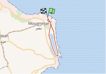
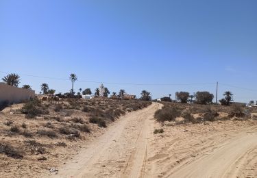
Randonnée Marche de 9,2 km à découvrir à Gouvernorat Médenine, Midoun. Cette randonnée est proposée par papiou.
Description
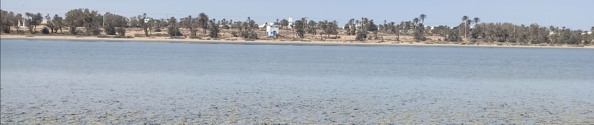
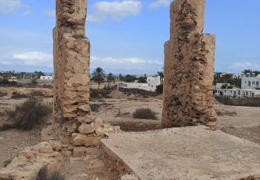
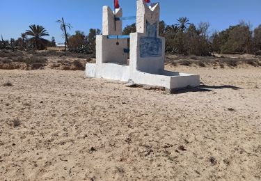
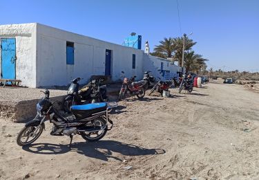
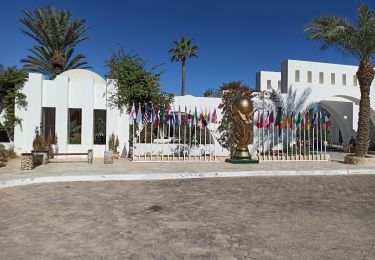
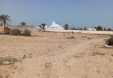
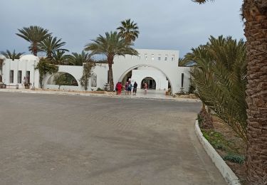
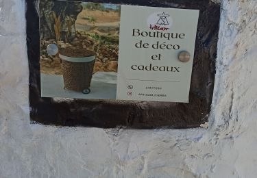
départ du bar, à la sortie de l'hôtel prendre devant dans le ranch rym et rejoindre la lagune et sur la partie gauche aller jusqu'à la pointe de terre en passant par le Coralie puis revenir par la gauche en longeant l'eau de la lagune
Localisation
Pays :
Tunisie
Région :
Gouvernorat Médenine
Département/Province :
Midoun
Commune :
Unknown
Localité :
Unknown
Départ:(Dec)
Départ:(UTM)
689349 ; 3744916 (32S) N.
Commentaires
Randonnées à proximité
![Randonnée Marche - circuit des puits. 10 km - Photo](https://media.geolcdn.com/t/375/260/ext.jpg?maxdim=2&url=https%3A%2F%2Fmedia.geolcdn.com%2Ff%2F1386a994-b987-41e0-ab44-d9ee3f26f5ce.jpg)
![Marche Marche](https://static1.geolcdn.com/sitytour/trail-icons/101.png)
circuit des puits. 10 km
Marche
Très facile
,
Gouvernorat Médenine,
Midoun,
Tunisie
![](/images/other/stat-length.png)
10 km | 10,7 km-effort
2h 20min
![](https://static1.geolcdn.com/siteimages/upload/files/16400158638029165_repeat_loop_refresh_sync_direction_icon.png)
Oui
![Randonnée Marche - circuit des puits 10 km - Photo](https://media.geolcdn.com/t/375/260/ext.jpg?maxdim=2&url=https%3A%2F%2Fmedia.geolcdn.com%2Ff%2Fead715c0-f375-42db-9cad-88abaa66a947.jpg)
![Marche Marche](https://static1.geolcdn.com/sitytour/trail-icons/101.png)
circuit des puits 10 km
Marche
Facile
,
Gouvernorat Médenine,
Midoun,
Tunisie
![](/images/other/stat-length.png)
10 km | 10,7 km-effort
2h 30min
![](https://static1.geolcdn.com/siteimages/upload/files/16400158638029165_repeat_loop_refresh_sync_direction_icon.png)
Oui
![Randonnée Marche - Du Rym à l'île aux oiseaux par la lagune - Photo](https://media.geolcdn.com/t/375/260/ext.jpg?maxdim=2&url=https%3A%2F%2Fmedia.geolcdn.com%2Ff%2F08222ee4-c161-4138-a99e-e0b463f818fc.jpg)
![Marche Marche](https://static1.geolcdn.com/sitytour/trail-icons/101.png)
Du Rym à l'île aux oiseaux par la lagune
Marche
Très facile
,
Gouvernorat Médenine,
Midoun,
Tunisie
![](/images/other/stat-length.png)
10,8 km | 11,5 km-effort
2h 33min
![](https://static1.geolcdn.com/siteimages/upload/files/16400158638029165_repeat_loop_refresh_sync_direction_icon.png)
Oui
![Randonnée Marche - variante du Rym à la petite artisane puis retour par boulangerie - Photo](https://media.geolcdn.com/t/375/260/ext.jpg?maxdim=2&url=https%3A%2F%2Fmedia.geolcdn.com%2Ff%2F12b65f7d-a451-4659-be7a-4d60f1d227aa.jpg)
![Marche Marche](https://static1.geolcdn.com/sitytour/trail-icons/101.png)
variante du Rym à la petite artisane puis retour par boulangerie
Marche
Facile
,
Gouvernorat Médenine,
Midoun,
Tunisie
![](/images/other/stat-length.png)
9,4 km | 10 km-effort
2h 16min
![](https://static1.geolcdn.com/siteimages/upload/files/16400158638029165_repeat_loop_refresh_sync_direction_icon.png)
Oui
![Randonnée Marche - Midoum Rym beach. circuit découverte Giuseppe - Photo](https://media.geolcdn.com/t/375/260/ext.jpg?maxdim=2&url=https%3A%2F%2Fmedia.geolcdn.com%2Ff%2Ff798a8fc-bd57-46ee-af75-8e55d4caa9b4.jpg)
![Marche Marche](https://static1.geolcdn.com/sitytour/trail-icons/101.png)
Midoum Rym beach. circuit découverte Giuseppe
Marche
Facile
(1)
,
Gouvernorat Médenine,
Midoun,
Tunisie
![](/images/other/stat-length.png)
8,3 km | 8,7 km-effort
1h 43min
![](https://static1.geolcdn.com/siteimages/upload/files/16400158638029165_repeat_loop_refresh_sync_direction_icon.png)
Oui
![Randonnée Marche - midoum seabel rym beach Hotel - Photo](https://media.geolcdn.com/t/375/260/ext.jpg?maxdim=2&url=https%3A%2F%2Fmedia.geolcdn.com%2Ff%2Fbbb4acf2-0c82-490c-a91f-e2a9a8ec312b.jpg)
![Marche Marche](https://static1.geolcdn.com/sitytour/trail-icons/101.png)
midoum seabel rym beach Hotel
Marche
Facile
,
Gouvernorat Médenine,
Midoun,
Tunisie
![](/images/other/stat-length.png)
10,5 km | 11,2 km-effort
2h 48min
![](https://static1.geolcdn.com/siteimages/upload/files/16400158638029165_repeat_loop_refresh_sync_direction_icon.png)
Oui
![Randonnée Marche - variante artisane facile - Photo](https://media.geolcdn.com/t/375/260/ext.jpg?maxdim=2&url=https%3A%2F%2Fmedia.geolcdn.com%2Ff%2F12d82cb7-21f9-440e-8a87-770f16f66d8f.jpg)
![Marche Marche](https://static1.geolcdn.com/sitytour/trail-icons/101.png)
variante artisane facile
Marche
Très facile
,
Gouvernorat Médenine,
Midoun,
Tunisie
![](/images/other/stat-length.png)
8,2 km | 8,7 km-effort
2h 1min
![](https://static1.geolcdn.com/siteimages/upload/files/16400158638029165_repeat_loop_refresh_sync_direction_icon.png)
Oui
![Randonnée Marche - circuit découverte de nouveaux sentiers autour du rym - Photo](https://media.geolcdn.com/t/375/260/ext.jpg?maxdim=2&url=https%3A%2F%2Fmedia.geolcdn.com%2Ff%2F6dd79abe-44e1-4594-a211-4dd3f3dae92c.jpg)
![Marche Marche](https://static1.geolcdn.com/sitytour/trail-icons/101.png)
circuit découverte de nouveaux sentiers autour du rym
Marche
Moyen
,
Gouvernorat Médenine,
Midoun,
Tunisie
![](/images/other/stat-length.png)
11,8 km | 12,5 km-effort
2h 29min
![](https://static1.geolcdn.com/siteimages/upload/files/16400158638029165_repeat_loop_refresh_sync_direction_icon.png)
Oui
![Randonnée Marche - variante du circuit de l'âne - Photo](https://media.geolcdn.com/t/375/260/ext.jpg?maxdim=2&url=https%3A%2F%2Fmedia.geolcdn.com%2Ff%2F3b63beed-8faf-4536-b581-6431aef36006.jpg)
![Marche Marche](https://static1.geolcdn.com/sitytour/trail-icons/101.png)
variante du circuit de l'âne
Marche
Facile
,
Gouvernorat Médenine,
Midoun,
Tunisie
![](/images/other/stat-length.png)
8,7 km | 9,5 km-effort
2h 7min
![](https://static1.geolcdn.com/siteimages/upload/files/16400158638029165_repeat_loop_refresh_sync_direction_icon.png)
Oui