Randonnée Cyclotourisme La Charité-sur-Loire - La Charité sur Loire à Châtillon sur Loire  - Photo

La Charité sur Loire à Châtillon sur Loire

 nadd73
nadd73

Utilisateur

© OpenStreetMap contributors
Longueur
Longueur
84 km
Altitude max
Altitude max
310 m
Dénivelé positif
Dénivelé positif
635 m
Km-Effort
Km-Effort  
92 km
Altitude min
Altitude min
125 m
Dénivelé négatif
Dénivelé négatif
660 m
Boucle
Boucle
Non
Date de création :
2023-05-26 08:36:58.24
Dernière modification :
2023-05-26 18:43:09.651

(0 Avis)

Cyclotourisme
Cyclotourisme
6h06
Difficulté : Difficile

Scannez ce code QR pour ouvrir la randonnée dans l'application SityTrail

Application GPS de randonnée GRATUITE

Logo SityTrail SityTrail

IGN / Instituts géographiques

Télécharger SityTrail sur l'App Store Télécharger SityTrail sur Google Play

Logo SityTrail SityTrail World

Le monde est à vous

Télécharger SityTrail sur l'App Store Télécharger SityTrail sur Google Play Télécharger SityTrail sur Huawei AppGallery

À propos

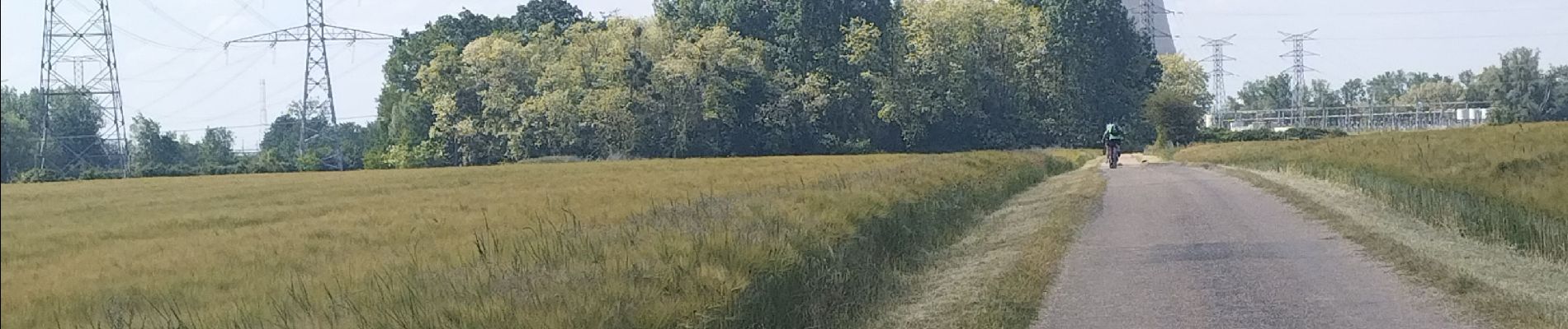
Randonnée Cyclotourisme de 84 km à découvrir à Bourgogne-Franche-Comté, Nièvre, La Charité-sur-Loire. Cette randonnée est proposée par nadd73.

Description

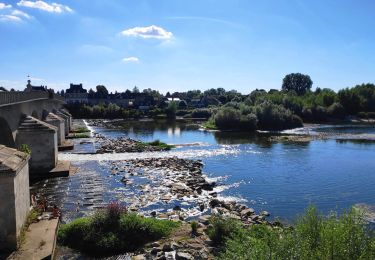
a Sancerre ça grimpe mais ça descend bien 😊.. Beau village.
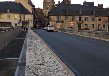
Le Camping de Châtillon est bien équipé en cuisine et c'est Au bord de la Loire.

Profil altimétrique

Photos

Localisation

Pays :
France
Région :
Bourgogne-Franche-Comté
Département/Province :
Nièvre
Commune :
La Charité-sur-Loire
Localité :
Unknown
Départ:(UTM)
500767 ; 5224822 (31T) N.

Randonnées à proximité

Randonnée Marche La Charité-sur-Loire - la charite-sur-loire - Photo
Marche
gdela

Marche

Facile
La Charité-sur-Loire, Bourgogne-Franche-Comté, Nièvre, France
3,1 km | 3,6 km-effort
1h 9min
Oui
Randonnée Marche La Charité-sur-Loire - découverte de la Charité  - Photo
Marche
levequejef

Marche

Moyen
La Charité-sur-Loire, Bourgogne-Franche-Comté, Nièvre, France
10,3 km | 11,8 km-effort
2h 31min
Oui
Randonnée Marche La Chapelle-Montlinard - du canal au Vieux Chêne - Photo
Marche
christian4

Marche

Très facile
La Chapelle-Montlinard, Centre-Val de Loire, Cher, France
11,7 km | 12,8 km-effort
2h 46min
Oui
Randonnée Marche La Chapelle-Montlinard - Chameleux.  - Photo
Marche
Apal67

Marche

Facile
La Chapelle-Montlinard, Centre-Val de Loire, Cher, France
49 m | 49 m-effort
2h 36min
Non
Randonnée V.T.T. La Charité-sur-Loire - 2 La Charité sur Loire-Saint Amand Montrond-St Jacques de Compostelle - Photo
V.T.T.
nicolas54230

V.T.T.

Difficile
La Charité-sur-Loire, Bourgogne-Franche-Comté, Nièvre, France
114 km | 130 km-effort
8h 24min
Non
Randonnée V.T.T. La Charité-sur-Loire - 1 bis Charité-sur-Loire-Bourges et retour-St Jacques de Compostelle - Photo
V.T.T.
nicolas54230

V.T.T.

Moyen
La Charité-sur-Loire, Bourgogne-Franche-Comté, Nièvre, France
60 km | 66 km-effort
8h 35min
Non
Randonnée Vélo La Charité-sur-Loire - Loire à Vélo n° 16 - Photo
Vélo
mimi53

Vélo

Facile
La Charité-sur-Loire, Bourgogne-Franche-Comté, Nièvre, France
21 km | 23 km-effort
1h 21min
Non
Randonnée Autre activité La Charité-sur-Loire - 16 août - Photo
Autre activité
ebeno51

Autre activité

Très facile
La Charité-sur-Loire, Bourgogne-Franche-Comté, Nièvre, France
13,1 km | 14,1 km-effort
22min
Non
Randonnée Autre activité La Chapelle-Montlinard - Canoe_La Charite-St Satur - Photo
Autre activité
kudours

Autre activité

Moyen
La Chapelle-Montlinard, Centre-Val de Loire, Cher, France
25 km | 25 km-effort
Inconnu
Non


Fermer
Mes abonnements