Randonnée Marche Saint-Michel-de-Chaillol - Col de l'Escalier - Photo
 Marco05
Marco05

Utilisateur

© OpenStreetMap contributors
Longueur
Longueur
16 km
Altitude max
Altitude max
2163 m
Dénivelé positif
Dénivelé positif
857 m
Km-Effort
Km-Effort  
27 km
Altitude min
Altitude min
1594 m
Dénivelé négatif
Dénivelé négatif
855 m
Boucle
Boucle
Oui
Date de création :
2023-06-26 16:35:24.731
Dernière modification :
2023-06-27 12:58:27.026

(0 Avis)

Marche
Marche
6h13
Difficulté : Difficile

Scannez ce code QR pour ouvrir la randonnée dans l'application SityTrail

Application GPS de randonnée GRATUITE

Logo SityTrail SityTrail

IGN / Instituts géographiques

Télécharger SityTrail sur l'App Store Télécharger SityTrail sur Google Play

Logo SityTrail SityTrail World

Le monde est à vous

Télécharger SityTrail sur l'App Store Télécharger SityTrail sur Google Play Télécharger SityTrail sur Huawei AppGallery

À propos

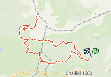
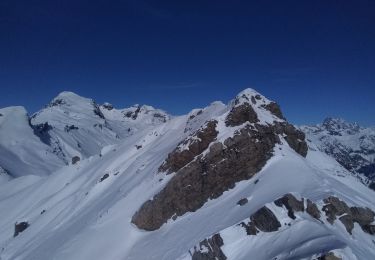
Randonnée Marche de 16 km à découvrir à Provence-Alpes-Côte d'Azur, Hautes-Alpes, Saint-Michel-de-Chaillol. Cette randonnée est proposée par Marco05.

Description

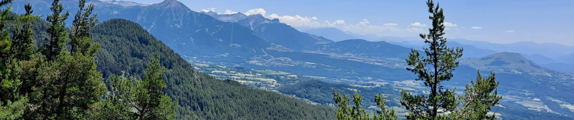
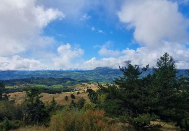
Belle randonnée au départ de Chaillol Station.
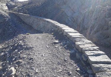
On peut monter la voiture par la piste, un peu caillouteuse, à l'altitude 1723.
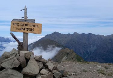
Prendre la direction du col du Viallet et du pic Queyrel.
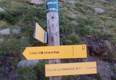
A l'altitude 2000 prendre le sentier à gauche vers col de l'Escalier.
Le suivre jusqu'au col.
La redescente peut se faire par le même itinéraire, ou bien par celui que j'ai tracé mais qui comporte deux kilomètres supplémentaires.
Pas de difficulté technique.

Profil altimétrique

Photos

Localisation

Pays :
France
Région :
Provence-Alpes-Côte d'Azur
Département/Province :
Hautes-Alpes
Commune :
Saint-Michel-de-Chaillol
Localité :
Unknown
Départ:(UTM)
275788 ; 4952893 (32T) N.

Randonnées à proximité

Randonnée Marche Saint-Jean-Saint-Nicolas - Circuit de Costebelle - Photo
Marche
Dervalmarc

Marche

Très facile
(2)
Saint-Jean-Saint-Nicolas, Provence-Alpes-Côte d'Azur, Hautes-Alpes, France
7,4 km | 12,1 km-effort
2h 16min
Oui
Randonnée Marche Saint-Bonnet-en-Champsaur - Infournas haut - Lac des Barbeyroux - Les infournas - Photo
Marche
GUIDE
R@ph

Marche

Difficile
Saint-Bonnet-en-Champsaur, Provence-Alpes-Côte d'Azur, Hautes-Alpes, France
10,1 km | 16 km-effort
3h 38min
Oui
Randonnée Marche Saint-Michel-de-Chaillol - Tête ouest de Mal Cros - Photo
Marche
GUIDE
R@ph

Marche

Très difficile
Saint-Michel-de-Chaillol, Provence-Alpes-Côte d'Azur, Hautes-Alpes, France
21 km | 40 km-effort
8h 2min
Oui
Randonnée Marche Saint-Jean-Saint-Nicolas - Pont Ricous Pelissier Coste Belle Pont du Fossé - Photo
Marche
Orage

Marche

Facile
(2)
Saint-Jean-Saint-Nicolas, Provence-Alpes-Côte d'Azur, Hautes-Alpes, France
11,3 km | 21 km-effort
1h 57min
Oui
Randonnée Marche Saint-Michel-de-Chaillol - Pic Queyrel - Photo
Marche
Marco05

Marche

Difficile
Saint-Michel-de-Chaillol, Provence-Alpes-Côte d'Azur, Hautes-Alpes, France
10,4 km | 19,8 km-effort
4h 29min
Oui
Randonnée Marche Saint-Michel-de-Chaillol - Pic du Tourond - Photo
Marche
Marco05

Marche

Très difficile
Saint-Michel-de-Chaillol, Provence-Alpes-Côte d'Azur, Hautes-Alpes, France
13,7 km | 27 km-effort
6h 14min
Oui
Randonnée Marche Saint-Michel-de-Chaillol - Lac de Malcros - Photo
Marche
Marco05

Marche

Très difficile
Saint-Michel-de-Chaillol, Provence-Alpes-Côte d'Azur, Hautes-Alpes, France
18,7 km | 34 km-effort
7h 43min
Oui
Randonnée Marche Saint-Bonnet-en-Champsaur - Col de l'Escalier - Photo
Marche
flip38

Marche

Moyen
Saint-Bonnet-en-Champsaur, Provence-Alpes-Côte d'Azur, Hautes-Alpes, France
19,6 km | 33 km-effort
6h 3min
Oui
Randonnée Ski de randonnée Saint-Jean-Saint-Nicolas - Soleil boeuf et petite remontée à Prouveyrat - Photo
Ski de randonnée
nadd73

Ski de randonnée

Moyen
Saint-Jean-Saint-Nicolas, Provence-Alpes-Côte d'Azur, Hautes-Alpes, France
12,2 km | 26 km-effort
5h 1min
Oui


Fermer
Mes abonnements