Randonnée Marche Saint-Bonnet-en-Champsaur - Infournas haut - Lac des Barbeyroux - Les infournas - Photo

Infournas haut - Lac des Barbeyroux - Les infournas

 R@ph
R@ph

Utilisateur GUIDE

© OpenStreetMap contributors
Longueur
Longueur
10,1 km
Altitude max
Altitude max
1713 m
Dénivelé positif
Dénivelé positif
446 m
Km-Effort
Km-Effort  
16 km
Altitude min
Altitude min
1307 m
Dénivelé négatif
Dénivelé négatif
454 m
Boucle
Boucle
Oui
Date de création :
2023-09-22 12:55:27.893
Dernière modification :
2023-09-22 13:24:59.169

(0 Avis)

Marche
Marche
3h38
Difficulté : Difficile

Scannez ce code QR pour ouvrir la randonnée dans l'application SityTrail

Application GPS de randonnée GRATUITE

Logo SityTrail SityTrail

IGN / Instituts géographiques

Télécharger SityTrail sur l'App Store Télécharger SityTrail sur Google Play

Logo SityTrail SityTrail World

Le monde est à vous

Télécharger SityTrail sur l'App Store Télécharger SityTrail sur Google Play Télécharger SityTrail sur Huawei AppGallery

À propos

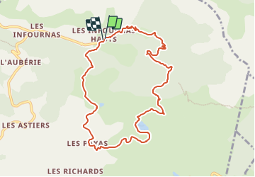
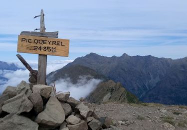
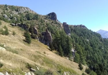
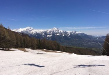
Randonnée Marche de 10,1 km à découvrir à Provence-Alpes-Côte d'Azur, Hautes-Alpes, Saint-Bonnet-en-Champsaur. Cette randonnée est proposée par R@ph.

Description

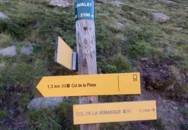
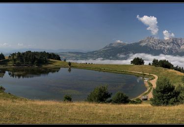
Un parking est disponible au départ des Infournas Hauts dirigez vous vers la maison forestière de Subeyrannes, suivez ensuite le chemin pour arriver au Serre du Moulin. Une barrière est présente sur le chemin de droite prenez à gauche, après une légère montée, vous redescendez ensuite vers le lac des Barbeyroux.

Profil altimétrique

Photos

Localisation

Pays :
France
Région :
Provence-Alpes-Côte d'Azur
Département/Province :
Hautes-Alpes
Commune :
Saint-Bonnet-en-Champsaur
Localité :
Les Infournas
Départ:(UTM)
271125 ; 4955145 (32T) N.

Randonnées à proximité

Randonnée Marche Saint-Michel-de-Chaillol - Tête ouest de Mal Cros - Photo
Marche
GUIDE
R@ph

Marche

Très difficile
Saint-Michel-de-Chaillol, Provence-Alpes-Côte d'Azur, Hautes-Alpes, France
21 km | 40 km-effort
8h 2min
Oui
Randonnée Marche La Motte-en-Champsaur - Jas de Jartier - Photo
Marche
Marco05

Marche

Difficile
La Motte-en-Champsaur, Provence-Alpes-Côte d'Azur, Hautes-Alpes, France
13,7 km | 24 km-effort
5h 22min
Oui
Randonnée Marche Saint-Michel-de-Chaillol - Col de l'Escalier - Photo
Marche
Marco05

Marche

Difficile
Saint-Michel-de-Chaillol, Provence-Alpes-Côte d'Azur, Hautes-Alpes, France
16 km | 27 km-effort
6h 13min
Oui
Randonnée Marche Saint-Michel-de-Chaillol - Pic Queyrel - Photo
Marche
Marco05

Marche

Difficile
Saint-Michel-de-Chaillol, Provence-Alpes-Côte d'Azur, Hautes-Alpes, France
10,4 km | 19,8 km-effort
4h 29min
Oui
Randonnée Marche Saint-Michel-de-Chaillol - Pic du Tourond - Photo
Marche
Marco05

Marche

Très difficile
Saint-Michel-de-Chaillol, Provence-Alpes-Côte d'Azur, Hautes-Alpes, France
13,7 km | 27 km-effort
6h 14min
Oui
Randonnée Marche Saint-Michel-de-Chaillol - Lac de Malcros - Photo
Marche
Marco05

Marche

Très difficile
Saint-Michel-de-Chaillol, Provence-Alpes-Côte d'Azur, Hautes-Alpes, France
18,7 km | 34 km-effort
7h 43min
Oui
Randonnée Marche Saint-Bonnet-en-Champsaur - Col de l'Escalier - Photo
Marche
flip38

Marche

Moyen
Saint-Bonnet-en-Champsaur, Provence-Alpes-Côte d'Azur, Hautes-Alpes, France
19,6 km | 33 km-effort
6h 3min
Oui
Randonnée Marche Saint-Michel-de-Chaillol - pic de queyrel - Photo
Marche
nadd73

Marche

Très difficile
Saint-Michel-de-Chaillol, Provence-Alpes-Côte d'Azur, Hautes-Alpes, France
10,8 km | 21 km-effort
5h 40min
Oui
Randonnée Marche Saint-Michel-de-Chaillol - Chaillol - Photo
Marche
rarnaud

Marche

Facile
Saint-Michel-de-Chaillol, Provence-Alpes-Côte d'Azur, Hautes-Alpes, France
13,1 km | 19,2 km-effort
4h 19min
Oui


Fermer
Mes abonnements