![](/images/other/stat-length.png)
#230714 - Dilbeek, Kattenberg, Rés. Nat. Wolfsputten**
Randos Ouvertes
Utilisateur
![Longueur](/images/other/stat-length.png)
Longueur
5,1 km
![Altitude max](https://static1.geolcdn.com/siteimages/upload/files/1508320355ic_sort_altitude_max_24dp.png)
Altitude max
86 m
![Dénivelé positif](https://static1.geolcdn.com/siteimages/upload/files/1508320355ic_sort_den_pos_24dp.png)
Dénivelé positif
83 m
![Km-Effort](/images/other/stat-length.png)
Km-Effort
6,2 km
![Altitude min](https://static1.geolcdn.com/siteimages/upload/files/1508320355ic_sort_altitude_min_24dp.png)
Altitude min
46 m
![Dénivelé négatif](https://static1.geolcdn.com/siteimages/upload/files/1508320355ic_sort_den_neg_24dp.png)
Dénivelé négatif
86 m
![Boucle](https://static1.geolcdn.com/siteimages/upload/files/16400158638029165_repeat_loop_refresh_sync_direction_icon.png)
Boucle
Oui
Date de création :
2023-07-13 20:26:36.062
Dernière modification :
2023-08-05 09:29:01.52
![Marche](https://static1.geolcdn.com/sitytour/trail-icons/101.png)
1h24
Difficulté : Moyen
![Scannez ce code QR pour ouvrir la randonnée dans l'application SityTrail](https://capi.geolives.com/qq0zvz2zws4bq2lad0pu/sitytour/trails/3732983/qr.png?size=200)
Application GPS de randonnée GRATUITE
À propos
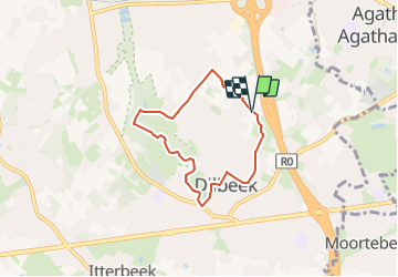
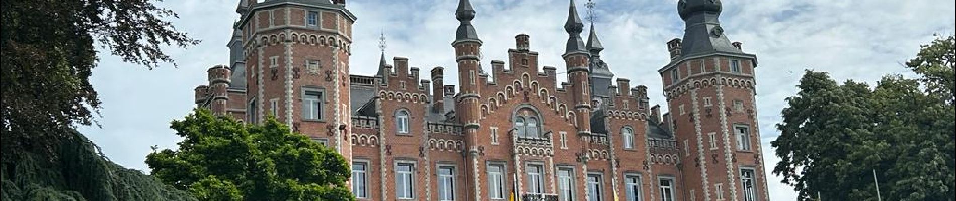
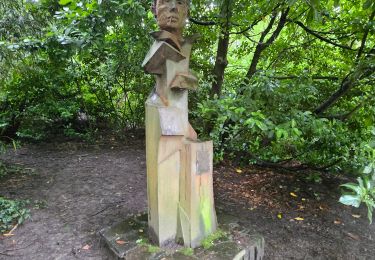
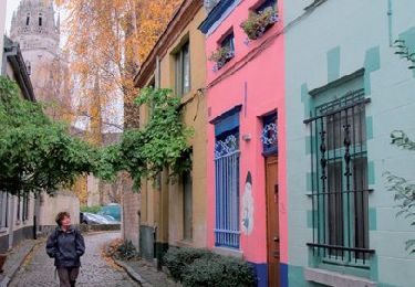
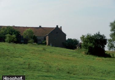
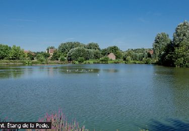
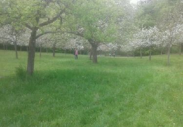
Randonnée Marche de 5,1 km à découvrir à Flandre, Brabant flamand, Dilbeek. Cette randonnée est proposée par Randos Ouvertes.
Description
Crédit photos : Sophie Vermote & Corinne van Aubel
Localisation
Pays :
Belgique
Région :
Flandre
Département/Province :
Brabant flamand
Commune :
Dilbeek
Localité :
Dilbeek
Départ:(Dec)
Départ:(UTM)
589415 ; 5634503 (31U) N.
Commentaires
Randonnées à proximité
![Randonnée Marche Forest - Forest National - Uccle - Photo](https://media.geolcdn.com/t/375/260/ext.jpg?maxdim=2&url=https%3A%2F%2Fmedia.geolcdn.com%2Ff%2F3deb4e32-c7c7-4612-9f7e-c6f2572a529a.jpg)
![Marche Marche](https://static1.geolcdn.com/sitytour/trail-icons/101.png)
Forest National - Uccle
Marche
Facile
(1)
Forest,
Bruxelles-Capitale,
Inconnu,
Belgique
![](/images/other/stat-length.png)
9,6 km | 11,6 km-effort
2h 38min
![](https://static1.geolcdn.com/siteimages/upload/files/16400158638029165_repeat_loop_refresh_sync_direction_icon.png)
Oui
![Randonnée Marche Anderlecht - RB-Br-05-Rac02 - Photo](https://media.geolcdn.com/t/375/260/ext.jpg?maxdim=2&url=https%3A%2F%2Fservices.sitytrail.com%2FGeolivesWS%2FDownloadMedia.ashx%3FTrailID%3D247888%26Media%3Defa9a3b4-e0b1-4a00-9376-0ef985b02cd6.jpg)
![Marche Marche](https://static1.geolcdn.com/sitytour/trail-icons/101.png)
RB-Br-05-Rac02
Marche
Facile
(3)
Anderlecht,
Bruxelles-Capitale,
Inconnu,
Belgique
![](/images/other/stat-length.png)
14,3 km | 16,6 km-effort
3h 46min
![](https://static1.geolcdn.com/siteimages/upload/files/16400158638029165_repeat_loop_refresh_sync_direction_icon.png)
Oui
![Randonnée Marche Anderlecht - RB-Br-05 - Photo](https://media.geolcdn.com/t/375/260/ext.jpg?maxdim=2&url=https%3A%2F%2Fservices.sitytrail.com%2FGeolivesWS%2FDownloadMedia.ashx%3FTrailID%3D247884%26Media%3Defa9a3b4-e0b1-4a00-9376-0ef985b02cd6.jpg)
![Marche Marche](https://static1.geolcdn.com/sitytour/trail-icons/101.png)
RB-Br-05
Marche
Difficile
(3)
Anderlecht,
Bruxelles-Capitale,
Inconnu,
Belgique
![](/images/other/stat-length.png)
23 km | 27 km-effort
6h 8min
![](https://static1.geolcdn.com/siteimages/upload/files/16400158638029165_repeat_loop_refresh_sync_direction_icon.png)
Oui
![Randonnée Marche Molenbeek-Saint-Jean - RB-Br-04_Autour de la basilique - Photo](https://media.geolcdn.com/t/375/260/ext.jpg?maxdim=2&url=https%3A%2F%2Fservices.sitytrail.com%2FGeolivesWS%2FDownloadMedia.ashx%3FTrailID%3D247883%26Media%3De6a7a7ca-c658-4857-8e1b-9ec70ca63e16.jpg)
![Marche Marche](https://static1.geolcdn.com/sitytour/trail-icons/101.png)
RB-Br-04_Autour de la basilique
Marche
Facile
(1)
Molenbeek-Saint-Jean,
Bruxelles-Capitale,
Inconnu,
Belgique
![](/images/other/stat-length.png)
15 km | 17,4 km-effort
3h 56min
![](https://static1.geolcdn.com/siteimages/upload/files/16400158638029165_repeat_loop_refresh_sync_direction_icon.png)
Non
![Randonnée Marche Jette - RB-Br-03 - Photo](https://media.geolcdn.com/t/375/260/ext.jpg?maxdim=2&url=https%3A%2F%2Fservices.sitytrail.com%2FGeolivesWS%2FDownloadMedia.ashx%3FTrailID%3D247875%26Media%3Da6927d94-8231-444f-b471-9c7fccf44207.jpg)
![Marche Marche](https://static1.geolcdn.com/sitytour/trail-icons/101.png)
RB-Br-03
Marche
Difficile
(2)
Jette,
Bruxelles-Capitale,
Inconnu,
Belgique
![](/images/other/stat-length.png)
25 km | 29 km-effort
6h 36min
![](https://static1.geolcdn.com/siteimages/upload/files/16400158638029165_repeat_loop_refresh_sync_direction_icon.png)
Oui
![Randonnée Marche Ville de Bruxelles - RB-Br-02 - Photo](https://media.geolcdn.com/t/375/260/ext.jpg?maxdim=2&url=https%3A%2F%2Fservices.sitytrail.com%2FGeolivesWS%2FDownloadMedia.ashx%3FTrailID%3D247873%26Media%3Ddfaf2d4a-e0b3-4c36-97b5-3b14c6762b25.jpg)
![Marche Marche](https://static1.geolcdn.com/sitytour/trail-icons/101.png)
RB-Br-02
Marche
Moyen
(1)
Ville de Bruxelles,
Bruxelles-Capitale,
Inconnu,
Belgique
![](/images/other/stat-length.png)
21 km | 24 km-effort
5h 32min
![](https://static1.geolcdn.com/siteimages/upload/files/16400158638029165_repeat_loop_refresh_sync_direction_icon.png)
Oui
![Randonnée Marche Anderlecht - RB-Br-06-Rac02 - Photo](https://media.geolcdn.com/t/375/260/ext.jpg?maxdim=2&url=https%3A%2F%2Fservices.sitytrail.com%2FGeolivesWS%2FDownloadMedia.ashx%3FTrailID%3D247893%26Media%3D30c83acb-9f39-44f9-b0f1-68c580ded77c.jpg)
![Marche Marche](https://static1.geolcdn.com/sitytour/trail-icons/101.png)
RB-Br-06-Rac02
Marche
Très facile
(2)
Anderlecht,
Bruxelles-Capitale,
Inconnu,
Belgique
![](/images/other/stat-length.png)
8,4 km | 9,2 km-effort
2h 5min
![](https://static1.geolcdn.com/siteimages/upload/files/16400158638029165_repeat_loop_refresh_sync_direction_icon.png)
Non
![Randonnée Vélo Ville de Bruxelles - Atomium à Atlas - Photo](https://media.geolcdn.com/t/375/260/ext.jpg?maxdim=2&url=https%3A%2F%2Fservices.sitytrail.com%2FGeolivesWS%2FDownloadMedia.ashx%3FTrailID%3D190938%26Media%3D20130510152551.jpeg)
![Vélo Vélo](https://static1.geolcdn.com/sitytour/trail-icons/200.png)
Atomium à Atlas
Vélo
Moyen
(1)
Ville de Bruxelles,
Bruxelles-Capitale,
Inconnu,
Belgique
![](/images/other/stat-length.png)
45 km | 52 km-effort
2h 58min
![](https://static1.geolcdn.com/siteimages/upload/files/16400158638029165_repeat_loop_refresh_sync_direction_icon.png)
Non
![Randonnée Marche Forest - Forest National - Photo](https://media.geolcdn.com/t/375/260/ext.jpg?maxdim=2&url=https%3A%2F%2Fstatic1.geolcdn.com%2Fsiteimages%2Fupload%2Ffiles%2F1553511878bg_sport_marche.png)
![Marche Marche](https://static1.geolcdn.com/sitytour/trail-icons/101.png)
Forest National
Marche
Moyen
(1)
Forest,
Bruxelles-Capitale,
Inconnu,
Belgique
![](/images/other/stat-length.png)
10,2 km | 12,8 km-effort
2h 55min
![](https://static1.geolcdn.com/siteimages/upload/files/16400158638029165_repeat_loop_refresh_sync_direction_icon.png)
Oui