Randonnée Marche Montpezat-sous-Bauzon - Fontaulière-croix de Molière-Le Pal - Photo

Fontaulière-croix de Molière-Le Pal

 coureursdecretes
coureursdecretes

Utilisateur

© OpenStreetMap contributors
Longueur
Longueur
13,7 km
Altitude max
Altitude max
1319 m
Dénivelé positif
Dénivelé positif
291 m
Km-Effort
Km-Effort  
17,6 km
Altitude min
Altitude min
1192 m
Dénivelé négatif
Dénivelé négatif
295 m
Boucle
Boucle
Oui
Date de création :
2023-08-05 16:54:25.879
Dernière modification :
2023-08-16 05:24:53.297

(0 Avis)

Marche
Marche
3h59
Difficulté : Moyen

Scannez ce code QR pour ouvrir la randonnée dans l'application SityTrail

Application GPS de randonnée GRATUITE

Logo SityTrail SityTrail

IGN / Instituts géographiques

Télécharger SityTrail sur l'App Store Télécharger SityTrail sur Google Play

Logo SityTrail SityTrail World

Le monde est à vous

Télécharger SityTrail sur l'App Store Télécharger SityTrail sur Google Play Télécharger SityTrail sur Huawei AppGallery

À propos

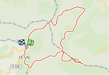
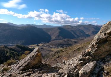
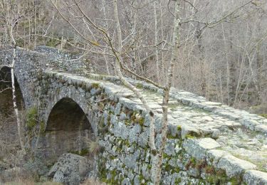
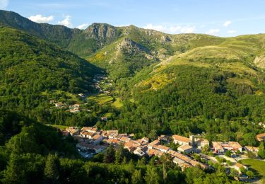
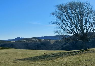
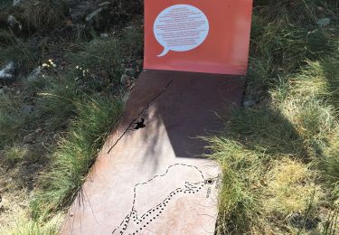
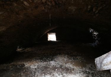
Randonnée Marche de 13,7 km à découvrir à Auvergne-Rhône-Alpes, Ardèche, Montpezat-sous-Bauzon. Cette randonnée est proposée par coureursdecretes.

Description

Rando du 13/09/2021

Profil altimétrique

Localisation

Pays :
France
Région :
Auvergne-Rhône-Alpes
Département/Province :
Ardèche
Commune :
Montpezat-sous-Bauzon
Localité :
Unknown
Départ:(Dec)
Départ:(UTM)
592559 ; 4954659 (31T) N.

Randonnées à proximité

Randonnée Marche Montpezat-sous-Bauzon - 07-Montpezat-sous-Bauzon - Plantades-Clastre-St-Roch-Clastre - Photo
Marche
Maryma

Marche

Moyen
Montpezat-sous-Bauzon, Auvergne-Rhône-Alpes, Ardèche, France
7,3 km | 11,6 km-effort
2h 0min
Oui
Randonnée Marche Le Roux - 2012-06-24 14h24m52 le roux - Photo
Marche
Michel07

Marche

Moyen
(2)
Le Roux, Auvergne-Rhône-Alpes, Ardèche, France
12,9 km | 19,9 km-effort
3h 31min
Oui
Randonnée Marche Montpezat-sous-Bauzon - Balade-Le Villaret-La Forêt- Les Malfaugères - Photo
Marche
coureursdecretes

Marche

Moyen
Montpezat-sous-Bauzon, Auvergne-Rhône-Alpes, Ardèche, France
5,8 km | 7,7 km-effort
1h 50min
Oui
Randonnée Marche Saint-Cirgues-en-Montagne - Rieutord Bauzon Vestide 13km - Photo
Marche
chancha

Marche

Difficile
Saint-Cirgues-en-Montagne, Auvergne-Rhône-Alpes, Ardèche, France
12,6 km | 17,6 km-effort
3h 59min
Oui
Randonnée Marche Montpezat-sous-Bauzon - Montpezat - Le Fau - Chalias - Les plantades - Photo
Marche
coureursdecretes

Marche

Difficile
Montpezat-sous-Bauzon, Auvergne-Rhône-Alpes, Ardèche, France
11,1 km | 18,6 km-effort
4h 14min
Oui
Randonnée Marche Le Roux - Le petit narçon - Haute Grace - Lalligier - Photo
Marche
coureursdecretes

Marche

Très difficile
Le Roux, Auvergne-Rhône-Alpes, Ardèche, France
14 km | 19,1 km-effort
4h 19min
Oui
Randonnée Marche Montpezat-sous-Bauzon - Fontaulière-Montpezat sous Bauzon  - Photo
Marche
zoe.vienne

Marche

Facile
Montpezat-sous-Bauzon, Auvergne-Rhône-Alpes, Ardèche, France
7,6 km | 10,2 km-effort
1h 49min
Non
Randonnée Marche Usclades-et-Rieutord - Bas de rieutore  - Photo
Marche
Henri Quesada

Marche

Très facile
Usclades-et-Rieutord, Auvergne-Rhône-Alpes, Ardèche, France
18,6 km | 28 km-effort
9h 14min
Non
Randonnée Marche Montpezat-sous-Bauzon - Montpezat les Plantades chalias - Photo
Marche
raab

Marche

Moyen
Montpezat-sous-Bauzon, Auvergne-Rhône-Alpes, Ardèche, France
7,8 km | 11,9 km-effort
2h 47min
Oui


Fermer
Mes abonnements