Randonnée Marche Saint-Joseph - 42-st-joseph-10km-320m - Photo
 SyMA
SyMA

Utilisateur

© OpenStreetMap contributors
Longueur
Longueur
10,5 km
Altitude max
Altitude max
590 m
Dénivelé positif
Dénivelé positif
327 m
Km-Effort
Km-Effort  
14,8 km
Altitude min
Altitude min
349 m
Dénivelé négatif
Dénivelé négatif
324 m
Boucle
Boucle
Oui
Date de création :
2023-10-19 07:18:11.613
Dernière modification :
2023-10-21 04:24:45.962

(0 Avis)

Marche
Marche
2h50
Difficulté : Facile

Scannez ce code QR pour ouvrir la randonnée dans l'application SityTrail

Application GPS de randonnée GRATUITE

Logo SityTrail SityTrail

IGN / Instituts géographiques

Télécharger SityTrail sur l'App Store Télécharger SityTrail sur Google Play

Logo SityTrail SityTrail World

Le monde est à vous

Télécharger SityTrail sur l'App Store Télécharger SityTrail sur Google Play Télécharger SityTrail sur Huawei AppGallery

À propos

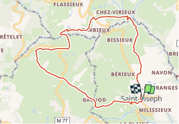
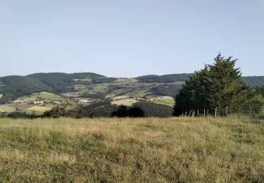
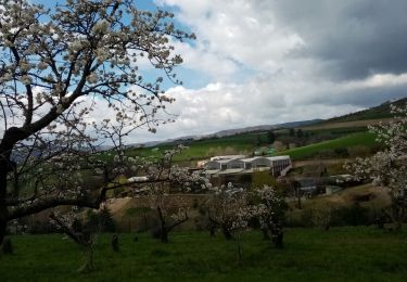
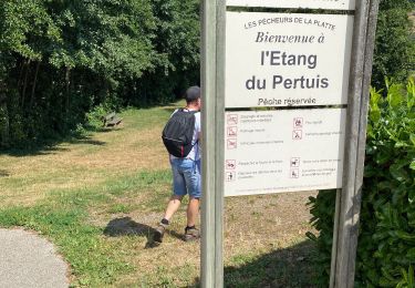
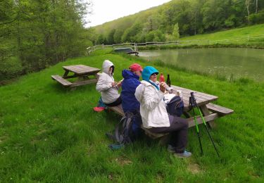
Randonnée Marche de 10,5 km à découvrir à Auvergne-Rhône-Alpes, Loire, Saint-Joseph. Cette randonnée est proposée par SyMA.

Description

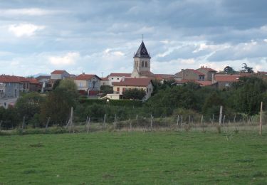
départ St Joseph parking du centre prés de mairie

Profil altimétrique

Photos

Localisation

Pays :
France
Région :
Auvergne-Rhône-Alpes
Département/Province :
Loire
Commune :
Saint-Joseph
Localité :
Unknown
Départ:(UTM)
626314 ; 5045927 (31T) N.

Randonnées à proximité

Randonnée Marche Trèves - Chemin de Fer à Trèves - Photo
Marche
tracegps

Marche

Moyen
(1)
Trèves, Auvergne-Rhône-Alpes, Rhône, France
4,5 km | 6,8 km-effort
1h 30min
Oui
Randonnée Marche Chagnon - 42_Chagnon_13km470m - Photo
Marche
SyMA

Marche

Moyen
Chagnon, Auvergne-Rhône-Alpes, Loire, France
13,1 km | 19,3 km-effort
2h 58min
Oui
Randonnée Marche Chabanière - 69-st-maurice-dargoire2-19km-580m - Photo
Marche
SyMA

Marche

Difficile
Chabanière, Auvergne-Rhône-Alpes, Rhône, France
19,2 km | 27 km-effort
5h 47min
Oui
Randonnée Marche Chabanière - 69_st_maurice_dargeoire_12km_300m - Photo
Marche
SyMA

Marche

Moyen
Chabanière, Auvergne-Rhône-Alpes, Rhône, France
11,6 km | 15,5 km-effort
3h 31min
Oui
Randonnée Marche Saint-Martin-la-Plaine - 42-martinlaplaine-12km450m - Photo
Marche
SyMA

Marche

Difficile
Saint-Martin-la-Plaine, Auvergne-Rhône-Alpes, Loire, France
12,9 km | 18,9 km-effort
4h 17min
Oui
Randonnée Marche Saint-Martin-la-Plaine - rando autour de St Martin la plaine,  - Photo
Marche
mimi69670

Marche

Facile
Saint-Martin-la-Plaine, Auvergne-Rhône-Alpes, Loire, France
10,4 km | 13,6 km-effort
3h 6min
Oui
Randonnée Marche Saint-Martin-la-Plaine - 20200723...De St-Martin-la-Plaine à Ste Catherine - Photo
Marche
galain

Marche

Moyen
Saint-Martin-la-Plaine, Auvergne-Rhône-Alpes, Loire, France
26 km | 36 km-effort
6h 11min
Oui
Randonnée Marche Trèves - Randonnée de Trèves à Dizimieux - Photo
Marche
tracegps

Marche

Moyen
Trèves, Auvergne-Rhône-Alpes, Rhône, France
7,2 km | 10,3 km-effort
2h 0min
Oui
Randonnée Marche Sainte-Catherine - sainte catherine - Photo
Marche
Jean-Luc Villermaux

Marche

Moyen
Sainte-Catherine, Auvergne-Rhône-Alpes, Rhône, France
10,5 km | 14,3 km-effort
4h 42min
Oui


Fermer
Mes abonnements