


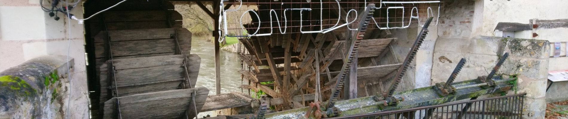
Pont-de-Ruan - PR Sentier Balzacien - 21.6km 195m 4h35 (40mn) - 2023 11 29

Orcal37
Utilisateur GUIDE
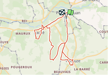

Longueur
22 km

Altitude max
114 m

Dénivelé positif
194 m
Km-Effort
24 km

Altitude min
44 m

Dénivelé négatif
196 m
Boucle
Oui
Date de création :
2023-11-29 09:35:40.709
Dernière modification :
2023-12-02 09:47:04.484
4h35
Difficulté : Facile

Application GPS de randonnée GRATUITE
 SityTrail
IGN / Instituts géographiques
SityTrail Plus
Le monde est à vous
À propos
Randonnée Marche de 22 km à découvrir à Centre-Val de Loire, Indre-et-Loire, Pont-de-Ruan. Cette randonnée est proposée par Orcal37.
Description
Pont-de-Ruan - PR Sentier Balzacien - Thilouze - Saché - 21.6km 195m 4h35 (40mn) - 2023 11 29
Photos
 - 2023 11 29 - Photo 1")
 - 2023 11 29 - Photo 2")
 - 2023 11 29 - Photo 3")
 - 2023 11 29 - Photo 4")
 - 2023 11 29 - Photo 5")
 - 2023 11 29 - Photo 6")
 - 2023 11 29 - Photo 7")
 - 2023 11 29 - Photo 8")
 - 2023 11 29 - Photo 9")
 - 2023 11 29 - Photo 10")
Localisation
Pays :
France
Région :
Centre-Val de Loire
Département/Province :
Indre-et-Loire
Commune :
Pont-de-Ruan
Localité :
Unknown
Départ:(Dec)
Départ:(UTM)
316356 ; 5236464 (31T) N.
Commentaires