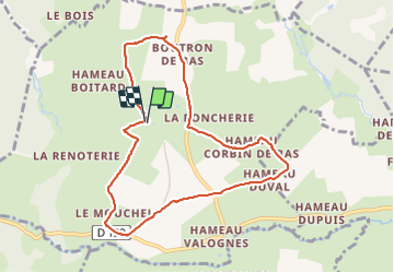
9,7 km | 12,4 km-effort
Brillevast
clrunavot
Utilisateur
Longueur
8,1 km
Altitude max
119 m
Dénivelé positif
142 m
Km-Effort
10 km
Altitude min
49 m
Dénivelé négatif
139 m
Boucle
Oui
Date de création :
2024-01-14 12:46:10.401
Dernière modification :
2024-01-14 15:31:55.094
2h45
Difficulté : Moyen
Application GPS de randonnée GRATUITE
À propos
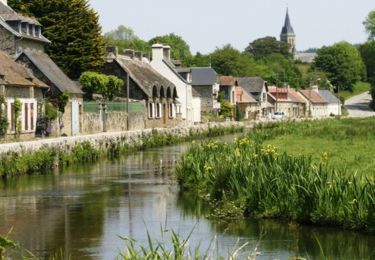
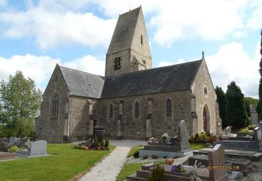
Randonnée Marche de 8,1 km à découvrir à Normandie, Manche, Brillevast. Cette randonnée est proposée par clrunavot.
Description
pkg mairie
Localisation
Pays :
France
Région :
Normandie
Département/Province :
Manche
Commune :
Brillevast
Localité :
Unknown
Départ:(Dec)
Départ:(UTM)
614347 ; 5498245 (30U) N.
Commentaires
Randonnées à proximité
Rando des châtaignes - Teurtheville-Bocage
V.T.T.
Difficile
Teurthéville-Bocage,
Normandie,
Manche,
France
30 km | 37 km-effort
2h 30min
Oui
Rando des châtaignes 2013 - Teurthéville Bocage
V.T.T.
Moyen
Teurthéville-Bocage,
Normandie,
Manche,
France
38 km | 47 km-effort
2h 30min
Oui
Petite balade dans le val de Saire - Théville
V.T.T.
Moyen
Théville,
Normandie,
Manche,
France
31 km | 37 km-effort
4h 49min
Oui
Le long de la vallée de la Sairre
Marche
Moyen
Le Vast,
Normandie,
Manche,
France
10 km | 12,6 km-effort
2h 40min
Oui
Maupertus
Marche
Moyen
Maupertus-sur-Mer,
Normandie,
Manche,
France
6,5 km | 8,6 km-effort
2h 8min
Oui
Rando des Sorciers 2013 - Le Theil
V.T.T.
Difficile
Gonneville-le-Theil,
Normandie,
Manche,
France
42 km | 51 km-effort
2h 45min
Oui
Circuit de la pointe du Brick
Marche
Moyen
Fermanville,
Normandie,
Manche,
France
6,2 km | 8,3 km-effort
1h 52min
Oui