Randonnée Marche Saint-Étienne-de-Chigny - Saint-Étienne-de-Chigny - le Vieux Bourg - Luynes - 15.8km 285m 3h30 - 2024 02 28 - Photo

Saint-Étienne-de-Chigny - le Vieux Bourg - Luynes - 15.8km 285m 3h30 - 2024 02 28

 Orcal37
Orcal37

Utilisateur

© OpenStreetMap contributors
Longueur
Longueur
15,8 km
Altitude max
Altitude max
97 m
Dénivelé positif
Dénivelé positif
284 m
Km-Effort
Km-Effort  
19,6 km
Altitude min
Altitude min
43 m
Dénivelé négatif
Dénivelé négatif
285 m
Boucle
Boucle
Oui
Date de création :
2024-02-28 13:24:15.382
Dernière modification :
2024-02-29 15:00:09.124

(0 Avis)

Marche
Marche
3h30
Difficulté : Moyen

Scannez ce code QR pour ouvrir la randonnée dans l'application SityTrail

Application GPS de randonnée GRATUITE

Logo SityTrail SityTrail

IGN / Instituts géographiques

Télécharger SityTrail sur l'App Store Télécharger SityTrail sur Google Play

Logo SityTrail SityTrail World

Le monde est à vous

Télécharger SityTrail sur l'App Store Télécharger SityTrail sur Google Play Télécharger SityTrail sur Huawei AppGallery

À propos

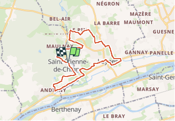
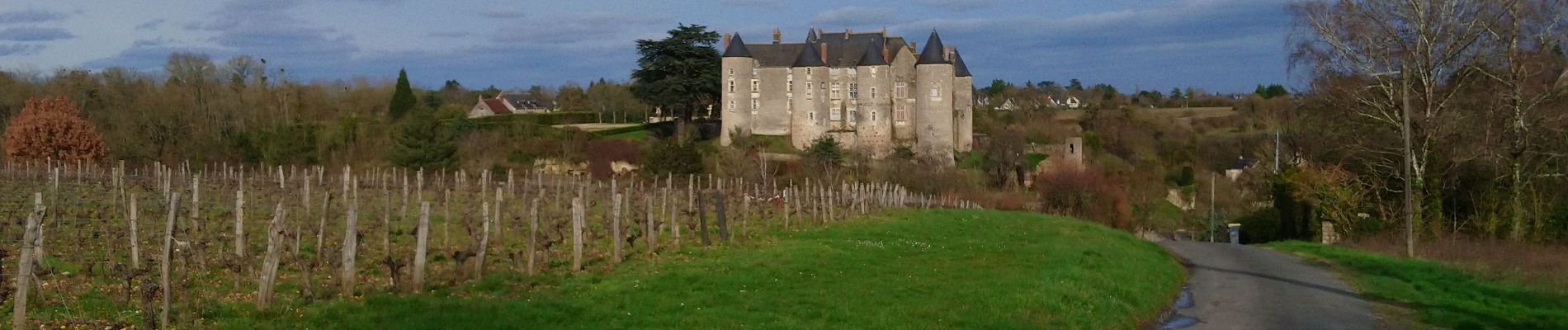
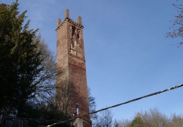
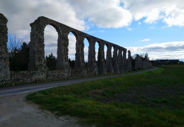
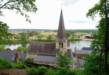
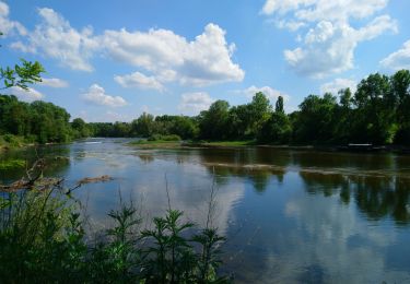
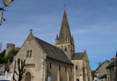
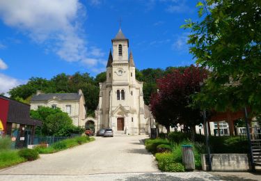
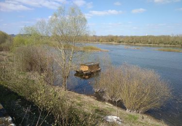
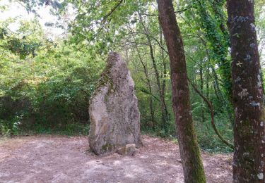
Randonnée Marche de 15,8 km à découvrir à Centre-Val de Loire, Indre-et-Loire, Saint-Étienne-de-Chigny. Cette randonnée est proposée par Orcal37.

Description

Saint-Étienne-de-Chigny - le Vieux Bourg - Luynes - 15.8km 285m 3h30 - 2024 02 28

Profil altimétrique

Photos

Localisation

Pays :
France
Région :
Centre-Val de Loire
Département/Province :
Indre-et-Loire
Commune :
Saint-Étienne-de-Chigny
Localité :
Unknown
Départ:(Dec)
Départ:(UTM)
313320 ; 5250853 (31T) N.

Randonnées à proximité

Randonnée Marche Luynes - Luynes Buissonnière - Photo
Marche
Patakk

Marche

Moyen
(2)
Luynes, Centre-Val de Loire, Indre-et-Loire, France
18,7 km | 22 km-effort
4h 0min
Oui
Randonnée Marche Saint-Étienne-de-Chigny - Saint-Étienne-de-Chigny - la Pile de Cinq-Mars-la-Pile - 14.2km 215m 3h15 - 2024 02 17 - Photo
Marche
Orcal37

Marche

Moyen
Saint-Étienne-de-Chigny, Centre-Val de Loire, Indre-et-Loire, France
14,5 km | 17,2 km-effort
3h 15min
Oui
Randonnée Marche Luynes - Luynes - Aqueduc gallo-romain - 12.6km 115m 2h50 - 2023 02 19 - Photo
Marche
Orcal37

Marche

Facile
Luynes, Centre-Val de Loire, Indre-et-Loire, France
12,6 km | 14,2 km-effort
2h 50min
Oui
Randonnée Marche Savonnières - Savonnières - les Fontaines GR3 et PRs - 20.1km 190m 4h40 - 2022 05 12 - Photo
Marche
Orcal37

Marche

Facile
Savonnières, Centre-Val de Loire, Indre-et-Loire, France
20 km | 23 km-effort
4h 40min
Oui
Randonnée Marche Berthenay - Berthenay - Sentier des deux Eaux - 16.3km 65m 4h00 - 2022 05 08 - Photo
Marche
Orcal37

Marche

Facile
Berthenay, Centre-Val de Loire, Indre-et-Loire, France
16,3 km | 17,2 km-effort
4h 0min
Oui
Randonnée Marche Cinq-Mars-la-Pile - Cinq-Mars-la-Pile - le Mortier Rougeau - 19.5km 265m 4h30 - 2022 04 17 - Photo
Marche
Orcal37

Marche

Facile
Cinq-Mars-la-Pile, Centre-Val de Loire, Indre-et-Loire, France
19,7 km | 23 km-effort
4h 30min
Oui
Randonnée Marche Saint-Étienne-de-Chigny - Saint-Étienne-de-Chigny - Pont de Bresme - 23.4km 275m 4h45 (25mn) - 2021 07 08 - Photo
Marche
Orcal37

Marche

Facile
Saint-Étienne-de-Chigny, Centre-Val de Loire, Indre-et-Loire, France
23 km | 27 km-effort
4h 45min
Oui
Randonnée A pied Villandry - Villandry - Photo
A pied
fustier

A pied

Moyen
(1)
Villandry, Centre-Val de Loire, Indre-et-Loire, France
22 km | 24 km-effort
Inconnu
Oui
Randonnée Marche Villandry - Villandry - Vallée du Vau GR3 - 12.3km 165m 3h00 - 2016 02 27 - Photo
Marche
Orcal37

Marche

Facile
Villandry, Centre-Val de Loire, Indre-et-Loire, France
12,2 km | 14,4 km-effort
3h 0min
Oui


Fermer
Mes abonnements