Randonnée Marche Oderen - trek alsacien (1ère étape) - Photo

trek alsacien (1ère étape)

© OpenStreetMap contributors
Longueur
Longueur
9,2 km
Altitude max
Altitude max
1279 m
Dénivelé positif
Dénivelé positif
875 m
Km-Effort
Km-Effort  
18,1 km
Altitude min
Altitude min
469 m
Dénivelé négatif
Dénivelé négatif
67 m
Boucle
Boucle
Non
Date de création :
2024-04-16 18:35:28.092
Dernière modification :
2024-04-17 08:31:06.143

(0 Avis)

Marche
Marche
4h00
Difficulté : Moyen

Scannez ce code QR pour ouvrir la randonnée dans l'application SityTrail

Application GPS de randonnée GRATUITE

Logo SityTrail SityTrail

IGN / Instituts géographiques

Télécharger SityTrail sur l'App Store Télécharger SityTrail sur Google Play

Logo SityTrail SityTrail World

Le monde est à vous

Télécharger SityTrail sur l'App Store Télécharger SityTrail sur Google Play Télécharger SityTrail sur Huawei AppGallery

À propos

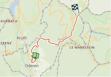
Randonnée Marche de 9,2 km à découvrir à Grand Est, Haut-Rhin, Oderen. Cette randonnée est proposée par Godasses et Grosses Pattes.

Description

Le grand départ du trek alsacien et vosgien, en vue de découvrir la région et sa nature
faune et flore, les habitants les villages les villes ...

on démarre du parking du cercle St marie à oderen.(aller des tilleuls oderen)
pour rejoindre le monument des chiens de traîneaux près du sommet du markstein
et on est parti pour un beau petit d  de plus ou moins 850m sur une longueur de 10km

Profil altimétrique

Photos

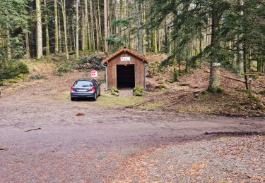
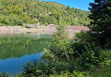
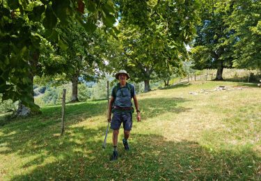
41 photos au total. Cliquez sur une photo pour les afficher toutes dans la galerie.

Localisation

Pays :
France
Région :
Grand Est
Département/Province :
Haut-Rhin
Commune :
Oderen
Localité :
Unknown
Départ:(UTM)
348740 ; 5308512 (32T) N.

Randonnées à proximité

Randonnée Marche Fellering - Felsach _chapelle ST Nicolas_frenz - Photo
Marche
Le grand Claude

Marche

Difficile
(1)
Fellering, Grand Est, Haut-Rhin, France
9,6 km | 16,5 km-effort
3h 45min
Oui
Randonnée Marche Oderen - 68 Chapelle St Nicolas - FA du Felsach (1 + 2) - Photo
Marche

Marche

Moyen
(1)
Oderen, Grand Est, Haut-Rhin, France
10,9 km | 17,9 km-effort
3h 41min
Oui
Randonnée Marche Kruth - barrage de Wildenstein et Grand Ventron - Photo
Marche
egodard

Marche

Moyen
(1)
Kruth, Grand Est, Haut-Rhin, France
13,7 km | 24 km-effort
4h 40min
Oui
Randonnée V.T.T. Metzeral - Breitfirst - Petit Ballon - Col de Firstplan - Wintzenheim - Photo
V.T.T.
sit68000

V.T.T.

Moyen
(1)
Metzeral, Grand Est, Haut-Rhin, France
38 km | 52 km-effort
3h 11min
Non
Randonnée Marche Metzeral - 24 04 14 autour d’Uffrain - Photo
Marche
jmbilger

Marche

Metzeral, Grand Est, Haut-Rhin, France
70 km | 83 km-effort
3h 45min
Non
Randonnée Marche Ventron - Rando des Marcheurs..22/02/2024... - Photo
Marche
boubou68

Marche

Très difficile
Ventron, Grand Est, Vosges, France
19,5 km | 31 km-effort
5h 4min
Oui
Randonnée Marche Ventron - Rando les Marcheurs..Col d'Oderen.18 km..715m D+/- - Photo
Marche
boubou68

Marche

Très difficile
Ventron, Grand Est, Vosges, France
18,6 km | 28 km-effort
4h 38min
Oui
Randonnée Marche Kruth - Rando des Marcheurs 10/08/2023 - Photo
Marche
boubou68

Marche

Très difficile
Kruth, Grand Est, Haut-Rhin, France
23 km | 39 km-effort
5h 48min
Oui
Randonnée Marche Ranspach - Rando des Marcheurs 20/07/2023 - Photo
Marche
boubou68

Marche

Très difficile
Ranspach, Grand Est, Haut-Rhin, France
23 km | 38 km-effort
5h 31min
Oui


Fermer
Mes abonnements