![](/images/other/stat-length.png)
![Randonnée V.T.T. Cristot - D400 - Photo](https://media.geolcdn.com/t/1900/400/ext.pjpeg?maxdim=2&url=https%3A%2F%2Fstatic1.geolcdn.com%2Fsiteimages%2Fupload%2Ffiles%2F1524743154velo.jpg)
D400
yannick-p
Utilisateur
![Longueur](/images/other/stat-length.png)
![Altitude max](https://static1.geolcdn.com/siteimages/upload/files/1508320355ic_sort_altitude_max_24dp.png)
![Dénivelé positif](https://static1.geolcdn.com/siteimages/upload/files/1508320355ic_sort_den_pos_24dp.png)
![Km-Effort](/images/other/stat-length.png)
![Altitude min](https://static1.geolcdn.com/siteimages/upload/files/1508320355ic_sort_altitude_min_24dp.png)
![Dénivelé négatif](https://static1.geolcdn.com/siteimages/upload/files/1508320355ic_sort_den_neg_24dp.png)
![Boucle](https://static1.geolcdn.com/siteimages/upload/files/16400158638029165_repeat_loop_refresh_sync_direction_icon.png)
![V.T.T.](https://static1.geolcdn.com/sitytour/trail-icons/202.png)
8h20
Difficulté : Moyen
![Geocaching](https://static1.geolcdn.com/sitytour/trail-icons/908.png)
8h00
Difficulté : Difficile
![Scannez ce code QR pour ouvrir la randonnée dans l'application SityTrail](https://capi.geolives.com/qq0zvz2zws4bq2lad0pu/sitytour/trails/409100/qr.png?size=200)
Application GPS de randonnée GRATUITE
À propos
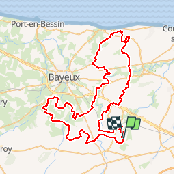
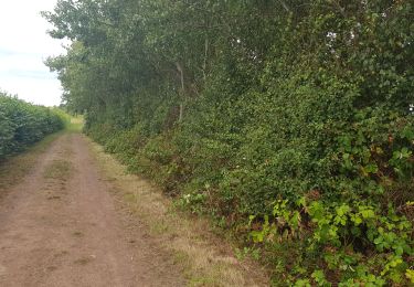
Randonnée V.T.T. de 85 km à découvrir à Normandie, Calvados, Cristot. Cette randonnée est proposée par yannick-p.
Description
Un projet un peu FOU !
https://coord.info/GC57DJJ
Une équipe de passionnés !
La D400 Team
Les Pommes Rebelles ligerchris Alpheratz14 7seven Maxinetto WaF8485 Yannick-p14-61 les vaches pirates Arnodraig The Devil
Tout part d'une envie... puis d'une idée... puis de volontés !
Nous vous proposons, sur un parcours de 85.32 km avec un dénivelé cumulé de 416 m, de trouver 455 caches !
Neuf poseurs, chacun 50 caches... plus quelques unes ! Un an de réflexion, 5 mois de préparation ! Un travail d'équipe !
Plusieurs modes de "balade" :
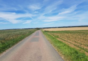
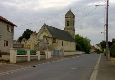
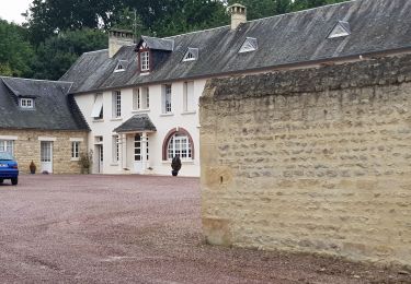
Prendre son temps et découvrir tranquillement la campagne entre Caen et Bayeux
Ne pas prendre son temps et réussir à trouver au moins 400 caches en 24 h et obtenir un Diamant Rare : The Busy Cacher !
The Busy Cacher
Toutes les caches sont simples à débusquer et de taille micro mais la nature est puissante... !
Attention ! Attention : Vous êtes sur le point de télécharger des fichiers qui contiennent des détails supplémentaires nécessaires à la découverte de cette géocache.
En tant que propriétaire de la cache, j'affirme que ces fichiers peuvent être téléchargés sans risques même si ni Groundspeak ni le reviewer n'ont vérifié qu'ils ne comprenaient de contenu malveillant.
Téléchargez ces fichiers à vos risques !
Pour votre préparation "cool" ou "challenge", vous trouverez ci-dessous des liens utiles !
Merci à Konaitusa pour son support et sa disponibilité !
Localisation
Commentaires
Randonnées à proximité
![Randonnée Trail Chouain - 20200712 20,5K Chouain Cristot Audrieu - Photo](https://media.geolcdn.com/t/375/260/ext.jpg?maxdim=2&url=https%3A%2F%2Fmedia.geolcdn.com%2Ff%2F91705b1a-d5d1-4482-972a-1b06d9cea1a1.jpg)
![Trail Trail](https://static1.geolcdn.com/sitytour/trail-icons/104.png)
Trail
![](/images/other/stat-length.png)
![](https://static1.geolcdn.com/siteimages/upload/files/16400158638029165_repeat_loop_refresh_sync_direction_icon.png)
![Randonnée Cheval Audrieu - Le circuit de Valdry - Audrieu - Photo](https://media.geolcdn.com/t/375/260/ext.jpg?maxdim=2&url=https%3A%2F%2Fservices.sitytrail.com%2FGeolivesWS%2FDownloadMedia.ashx%3FTrailID%3D317871%26Media%3D17261_5.jpg)
![Cheval Cheval](https://static1.geolcdn.com/sitytour/trail-icons/300.png)
Cheval
![](/images/other/stat-length.png)
![](https://static1.geolcdn.com/siteimages/upload/files/16400158638029165_repeat_loop_refresh_sync_direction_icon.png)
![Randonnée V.T.T. Audrieu - Le circuit de Valdry - Audrieu - Photo](https://media.geolcdn.com/t/375/260/ext.jpg?maxdim=2&url=https%3A%2F%2Fservices.sitytrail.com%2FGeolivesWS%2FDownloadMedia.ashx%3FTrailID%3D317870%26Media%3D17261_5.jpg)
![V.T.T. V.T.T.](https://static1.geolcdn.com/sitytour/trail-icons/202.png)
V.T.T.
![](/images/other/stat-length.png)
![](https://static1.geolcdn.com/siteimages/upload/files/16400158638029165_repeat_loop_refresh_sync_direction_icon.png)
![Randonnée Marche Audrieu - Le circuit de Valdry - Audrieu - Photo](https://media.geolcdn.com/t/375/260/ext.jpg?maxdim=2&url=https%3A%2F%2Fservices.sitytrail.com%2FGeolivesWS%2FDownloadMedia.ashx%3FTrailID%3D317869%26Media%3D17261_5.jpg)
![Marche Marche](https://static1.geolcdn.com/sitytour/trail-icons/101.png)
Marche
![](/images/other/stat-length.png)
![](https://static1.geolcdn.com/siteimages/upload/files/16400158638029165_repeat_loop_refresh_sync_direction_icon.png)
![Randonnée Trail Chouain - 20190818 Ellon Juaymonday 15 km - Photo](https://media.geolcdn.com/t/375/260/ext.jpg?maxdim=2&url=https%3A%2F%2Fmedia.geolcdn.com%2Ff%2Fbf3ba60c-341f-4556-8373-db57cab42155.jpg)
![Trail Trail](https://static1.geolcdn.com/sitytour/trail-icons/104.png)
Trail
![](/images/other/stat-length.png)
![](https://static1.geolcdn.com/siteimages/upload/files/16400158638029165_repeat_loop_refresh_sync_direction_icon.png)
![Randonnée Marche Chouain - 20190817 Cathy Valy et Bert - Photo](https://media.geolcdn.com/t/375/260/ext.jpg?maxdim=2&url=https%3A%2F%2Fmedia.geolcdn.com%2Ff%2Fc2ae0aa8-1b31-40e1-b298-b9ac57482406.jpg)
![Marche Marche](https://static1.geolcdn.com/sitytour/trail-icons/101.png)
Marche
![](/images/other/stat-length.png)
![](https://static1.geolcdn.com/siteimages/upload/files/16400158638029165_repeat_loop_refresh_sync_direction_icon.png)
![Randonnée Trail Chouain - 20190816 Éoliennes Christot Audrieu Ducy Condé chemin des mûres - Photo](https://media.geolcdn.com/t/375/260/ext.jpg?maxdim=2&url=https%3A%2F%2Fmedia.geolcdn.com%2Ff%2F46cd7f01-b393-4f27-8cc1-9ba9ddab4b5a.jpg)
![Trail Trail](https://static1.geolcdn.com/sitytour/trail-icons/104.png)
Trail
![](/images/other/stat-length.png)
![](https://static1.geolcdn.com/siteimages/upload/files/16400158638029165_repeat_loop_refresh_sync_direction_icon.png)
![Randonnée Marche Chouain - 20190815 chemin des pêcheurs - Photo](https://media.geolcdn.com/t/375/260/ext.jpg?maxdim=2&url=https%3A%2F%2Fmedia.geolcdn.com%2Ff%2Fd07f2500-7356-4fa8-a17e-af0d7d4a31b2.jpg)
![Marche Marche](https://static1.geolcdn.com/sitytour/trail-icons/101.png)
Marche
![](/images/other/stat-length.png)
![](https://static1.geolcdn.com/siteimages/upload/files/16400158638029165_repeat_loop_refresh_sync_direction_icon.png)
![Randonnée Marche Thue et Mue - repérage brouay - Photo](https://media.geolcdn.com/t/375/260/ext.jpg?maxdim=2&url=https%3A%2F%2Fstatic1.geolcdn.com%2Fsiteimages%2Fupload%2Ffiles%2F1553511878bg_sport_marche.png)
![Marche Marche](https://static1.geolcdn.com/sitytour/trail-icons/101.png)
Marche
![](/images/other/stat-length.png)
![](https://static1.geolcdn.com/siteimages/upload/files/16400158638029165_repeat_loop_refresh_sync_direction_icon.png)