Randonnée Marche Saint-Chély-d'Aubrac - Neck de Belvezet - Photo
 edouard_bieber
edouard_bieber

Utilisateur

© OpenStreetMap contributors
Longueur
Longueur
5,7 km
Altitude max
Altitude max
1240 m
Dénivelé positif
Dénivelé positif
149 m
Km-Effort
Km-Effort  
7,7 km
Altitude min
Altitude min
1090 m
Dénivelé négatif
Dénivelé négatif
149 m
Boucle
Boucle
Oui
Date de création :
2018-03-30 00:00:00.0
Dernière modification :
2018-03-30 00:00:00.0

(0 Avis)

Marche
Marche
1h39
Difficulté : Facile

Scannez ce code QR pour ouvrir la randonnée dans l'application SityTrail

Application GPS de randonnée GRATUITE

Logo SityTrail SityTrail

IGN / Instituts géographiques

Télécharger SityTrail sur l'App Store Télécharger SityTrail sur Google Play

Logo SityTrail SityTrail World

Le monde est à vous

Télécharger SityTrail sur l'App Store Télécharger SityTrail sur Google Play Télécharger SityTrail sur Huawei AppGallery

À propos

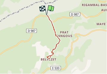
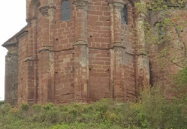
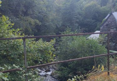
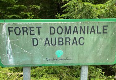
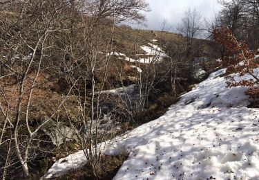
Randonnée Marche de 5,7 km à découvrir à Occitanie, Aveyron, Saint-Chély-d'Aubrac. Cette randonnée est proposée par edouard_bieber.

Description

29.05.2015

Profil altimétrique

Localisation

Pays :
France
Région :
Occitanie
Département/Province :
Aveyron
Commune :
Saint-Chély-d'Aubrac
Localité :
Unknown
Départ:(Dec)
Départ:(UTM)
496160 ; 4940719 (31T) N.

Randonnées à proximité

Randonnée Marche Saint-Chély-d'Aubrac - Aubrac - St Côme d'Olt - Chemin de St-Jacques de Compostelle - Photo
Marche
tracegps

Marche

Très difficile
(1)
Saint-Chély-d'Aubrac, Occitanie, Aveyron, France
23 km | 30 km-effort
5h 0min
Non
Randonnée Marche Saint-Chély-d'Aubrac - La voie romaine - Saint Chély d'Aubrac - Photo
Marche
tracegps

Marche

Moyen
(2)
Saint-Chély-d'Aubrac, Occitanie, Aveyron, France
19 km | 28 km-effort
5h 30min
Oui
Randonnée Marche Curières - Le Devez cascade et forêts  - Photo
Marche
GUIDE
nadinebondoux

Marche

Facile
Curières, Occitanie, Aveyron, France
11 km | 15,4 km-effort
3h 22min
Oui
Randonnée A pied Nasbinals - chemin de Saint-Jacques-de-Compostelle pour randonneurs avec animaux (chien, ane, cheval) ou VTT - Photo
A pied
PRO

A pied

Facile
Nasbinals, Occitanie, Lozère, France
5,7 km | 7,3 km-effort
1h 38min
Non
Randonnée Marche Saint-Chély-d'Aubrac - Saint Chely Espalion Avril 2018 - Photo
Marche
GUIDE
Kargil

Marche

Difficile
Saint-Chély-d'Aubrac, Occitanie, Aveyron, France
25 km | 34 km-effort
7h 26min
Non
Randonnée Marche Saint-Chély-d'Aubrac - Compostelle / Chemin du Puy : de Aubrac à Bonneval - Photo
Marche
webmammuth

Marche

Difficile
Saint-Chély-d'Aubrac, Occitanie, Aveyron, France
33 km | 46 km-effort
11h 0min
Non
Randonnée Marche Curières - Cascade du devèz et fosse à loup - Photo
Marche
GUIDE
Roger Philippe Wallez

Marche

Difficile
Curières, Occitanie, Aveyron, France
10,8 km | 15 km-effort
4h 7min
Oui
Randonnée Raquettes à neige Curières - Mon plus bel Aubrac  - Photo
Raquettes à neige
GUIDE
antignacs

Raquettes à neige

Moyen
Curières, Occitanie, Aveyron, France
12,4 km | 15,7 km-effort
4h 52min
Oui
Randonnée Marche Saint-Chély-d'Aubrac - S’y chely  - Photo
Marche
GUIDE
antignacs

Marche

Difficile
Saint-Chély-d'Aubrac, Occitanie, Aveyron, France
22 km | 31 km-effort
6h 16min
Oui


Fermer
Mes abonnements