


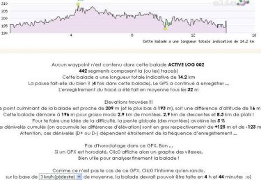
8,9 km | 10 km-effort


Utilisateur


Application GPS de randonnée GRATUITE
 SityTrail
IGN / Instituts géographiques
SityTrail World
Le monde est à vous
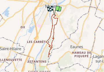
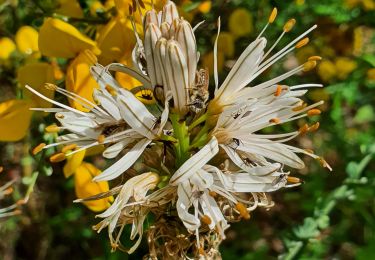
Randonnée Course à pied de 10,7 km à découvrir à Occitanie, Haute-Garonne, Muret. Cette randonnée est proposée par Polo-31.
Petit Parcours de 11Km du TARA Muret Trail du 19/02/2017.
Marche
Marche

V.T.T.

V.T.T.

Marche
Marche
V.T.T.

Marche
Marche