Randonnée Marche Moret-Loing-et-Orvanne - GRP Orvanne - Photo
 micheljannot
micheljannot

Utilisateur

© OpenStreetMap contributors
Longueur
Longueur
73 km
Altitude max
Altitude max
200 m
Dénivelé positif
Dénivelé positif
963 m
Km-Effort
Km-Effort  
86 km
Altitude min
Altitude min
46 m
Dénivelé négatif
Dénivelé négatif
957 m
Boucle
Boucle
Non
Date de création :
2016-07-17 00:00:00.0
Dernière modification :
2016-07-17 00:00:00.0

(0 Avis)

Marche
Marche
18h05
Difficulté : Facile

Scannez ce code QR pour ouvrir la randonnée dans l'application SityTrail

Application GPS de randonnée GRATUITE

Logo SityTrail SityTrail

IGN / Instituts géographiques

Télécharger SityTrail sur l'App Store Télécharger SityTrail sur Google Play

Logo SityTrail SityTrail World

Le monde est à vous

Télécharger SityTrail sur l'App Store Télécharger SityTrail sur Google Play Télécharger SityTrail sur Huawei AppGallery

À propos

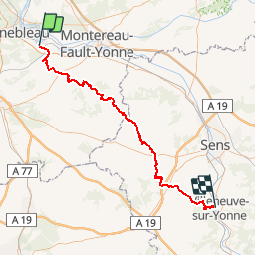
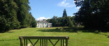
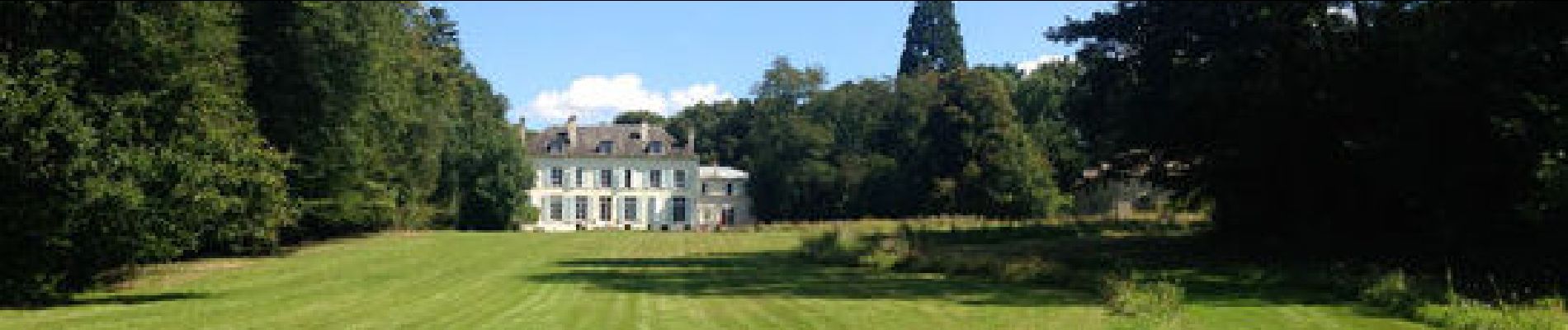
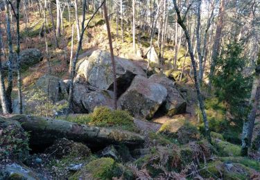
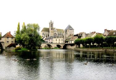
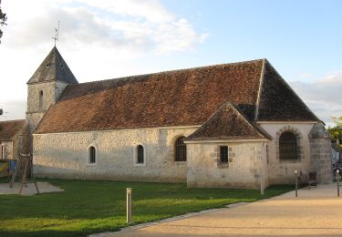
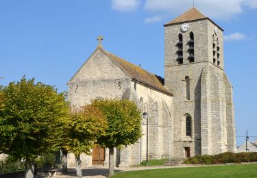
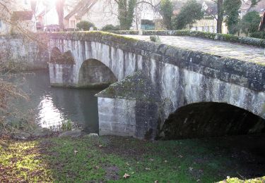
Randonnée Marche de 73 km à découvrir à Île-de-France, Seine-et-Marne, Moret-Loing-et-Orvanne. Cette randonnée est proposée par micheljannot.

Profil altimétrique

Photos

Points d'intérêt

Point d'intérêt Moret-Loing-et-Orvanne - gare de Moret-Veneux les Sablons - Photo
micheljannot
MORET-LOING-ET-ORVANNE 
Point d'intérêt Moret-Loing-et-Orvanne - carrefour GRP Orvanne / GRP Lunain - Photo
micheljannot
MORET-LOING-ET-ORVANNE 
Point d'intérêt Dormelles - carrefour GR11/GRP Orvanne - Photo
micheljannot
Point d'intérêt Dormelles - fortindu 11ème siècle - Photo
micheljannot
Point d'intérêt Blennes - limite BourgogneIle-de-France - Photo
micheljannot
Point d'intérêt Villeneuve-la-Dondagre - passage souterain - Photo
micheljannot
VILLENEUVE-LA-DONDAGRE 
Point d'intérêt Égriselles-le-Bocage - carrefour GR213/GRP Orvanne - Photo
micheljannot
ÉGRISELLES-LE-BOCAGE 
Point d'intérêt Villeneuve-sur-Yonne - gare de Villeneuve-sur-Yonne - Photo
micheljannot
VILLENEUVE-SUR-YONNE 
Point d'intérêt La Belliole - château de séreville - Photo
micheljannot

Localisation

Pays :
France
Région :
Île-de-France
Département/Province :
Seine-et-Marne
Commune :
Moret-Loing-et-Orvanne
Localité :
Veneux-les-Sablons
Départ:(Dec)
Départ:(UTM)
485132 ; 5358419 (31U) N.

Randonnées à proximité

Randonnée Marche Champagne-sur-Seine - GLM-150507 - Champagne - Photo
Marche
randodan

Marche

Facile
(1)
Champagne-sur-Seine, Île-de-France, Seine-et-Marne, France
17,3 km | 20 km-effort
4h 20min
Oui
Randonnée Marche Fontainebleau - viennes carosses - Photo
Marche
Yannick.Boireau

Marche

Très facile
(2)
Fontainebleau, Île-de-France, Seine-et-Marne, France
10,8 km | 14 km-effort
2h 50min
Oui
Randonnée Autre activité Thomery - forêt de fontainebleau  - Photo
Autre activité
bellicaud

Autre activité

Moyen
(1)
Thomery, Île-de-France, Seine-et-Marne, France
20 km | 23 km-effort
5h 40min
Oui
Randonnée A pied Saint-Mammès - Batellerie et foret - Photo
A pied
PRO

A pied

Facile
Saint-Mammès, Île-de-France, Seine-et-Marne, France
8,6 km | 9,9 km-effort
2h 14min
Oui
Randonnée A pied Montigny-sur-Loing - De Kosciusko à Croc Marin - Photo
A pied
PRO

A pied

Moyen
Montigny-sur-Loing, Île-de-France, Seine-et-Marne, France
17,5 km | 21 km-effort
4h 42min
Oui
Randonnée A pied Moret-Loing-et-Orvanne - FR-PR 9 - Photo
A pied
PRO

A pied

Facile
Moret-Loing-et-Orvanne, Île-de-France, Seine-et-Marne, France
5 km | 6 km-effort
1h 22min
Non
Randonnée A pied Moret-Loing-et-Orvanne - Entre Loing et Orvanne - Photo
A pied
PRO

A pied

Facile
Moret-Loing-et-Orvanne, Île-de-France, Seine-et-Marne, France
12,8 km | 15,1 km-effort
3h 26min
Non
Randonnée A pied Thomery - JC 56 Fontainebleau, Thomery, la Malmontagne - Photo
A pied

A pied

Difficile
(1)
Thomery, Île-de-France, Seine-et-Marne, France
25 km | 30 km-effort
6h 18min
Oui
Randonnée Marche Fontainebleau - JC 89 - 22 km - Fontainebleau Rochers d'Avon et Long Rocher - 28 km effort - Photo
Marche

Marche

Difficile
(4)
Fontainebleau, Île-de-France, Seine-et-Marne, France
22 km | 27 km-effort
6h 10min
Oui


Fermer
Mes abonnements