Randonnée Marche Saint-Christophe-sur-Guiers - Le petit Som par La Ruchere - retour par le pas du Loup - Photo

Le petit Som par La Ruchere - retour par le pas du Loup

 patjobou
patjobou

Utilisateur

© OpenStreetMap contributors
Longueur
Longueur
8,9 km
Altitude max
Altitude max
1752 m
Dénivelé positif
Dénivelé positif
638 m
Km-Effort
Km-Effort  
17,6 km
Altitude min
Altitude min
1133 m
Dénivelé négatif
Dénivelé négatif
675 m
Boucle
Boucle
Non
Date de création :
2016-07-15 00:00:00.0
Dernière modification :
2016-07-15 00:00:00.0

(0 Avis)

Marche
Marche
3h44
Difficulté : Moyen

Scannez ce code QR pour ouvrir la randonnée dans l'application SityTrail

Application GPS de randonnée GRATUITE

Logo SityTrail SityTrail

IGN / Instituts géographiques

Télécharger SityTrail sur l'App Store Télécharger SityTrail sur Google Play

Logo SityTrail SityTrail World

Le monde est à vous

Télécharger SityTrail sur l'App Store Télécharger SityTrail sur Google Play Télécharger SityTrail sur Huawei AppGallery

À propos

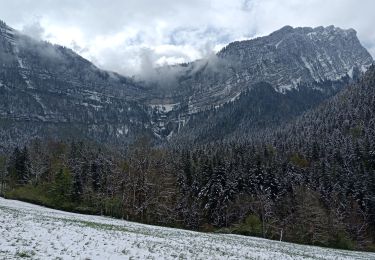
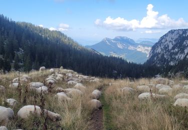
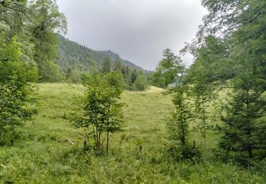
Randonnée Marche de 8,9 km à découvrir à Auvergne-Rhône-Alpes, Isère, Saint-Christophe-sur-Guiers. Cette randonnée est proposée par patjobou.

Description

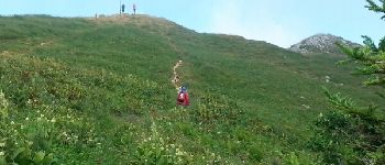
Montée par le Nord sur un itinéraire peu fréquenté.
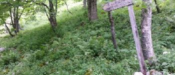
Retour par Bovinant et le Pas de Loup. Pas difficultés particulières malgré un terrain gras.

Profil altimétrique

Photos

Points d'intérêt

Point d'intérêt Saint-Christophe-sur-Guiers - Point 2 - Photo
patjobou
SAINT-CHRISTOPHE-SUR-GUIERS 
Point d'intérêt Saint-Pierre-de-Chartreuse - Point 3 - Photo
patjobou
SAINT-PIERRE-DE-CHARTREUSE 

Localisation

Pays :
France
Région :
Auvergne-Rhône-Alpes
Département/Province :
Isère
Commune :
Saint-Christophe-sur-Guiers
Localité :
Unknown
Départ:(Dec)
Départ:(UTM)
719101 ; 5030968 (31T) N.

Randonnées à proximité

Randonnée Raquettes à neige Saint-Christophe-sur-Guiers - Le Belvédère d'Arpison - Photo
Raquettes à neige
patjobou

Raquettes à neige

Moyen
(1)
Saint-Christophe-sur-Guiers, Auvergne-Rhône-Alpes, Isère, France
11,1 km | 17,4 km-effort
4h 43min
Oui
Randonnée Marche Saint-Pierre-d'Entremont - Le Grand Som 2026m, depuis Saint-Philibert - Photo
Marche
tracegps

Marche

Difficile
(1)
Saint-Pierre-d'Entremont, Auvergne-Rhône-Alpes, Isère, France
11,2 km | 25 km-effort
7h 0min
Oui
Randonnée Marche Saint-Pierre-d'Entremont - Roche Veyrand par les Clapiers, 1429m - Photo
Marche
tracegps

Marche

Difficile
(1)
Saint-Pierre-d'Entremont, Auvergne-Rhône-Alpes, Savoie, France
4,8 km | 14,3 km-effort
4h 10min
Oui
Randonnée Marche Saint-Pierre-de-Chartreuse - Les haberts du Désert de Chartreuse - Photo
Marche
tracegps

Marche

Moyen
(1)
Saint-Pierre-de-Chartreuse, Auvergne-Rhône-Alpes, Isère, France
10,9 km | 21 km-effort
5h 0min
Oui
Randonnée Marche Saint-Christophe-sur-Guiers - Petit Som 1772m,  depuis La Ruchère - Photo
Marche
tracegps

Marche

Moyen
(2)
Saint-Christophe-sur-Guiers, Auvergne-Rhône-Alpes, Isère, France
6 km | 13,2 km-effort
3h 30min
Oui
Randonnée Marche Saint-Christophe-sur-Guiers - Petit Som par le Col de la Ruchère - Photo
Marche
simon.paume

Marche

Moyen
(2)
Saint-Christophe-sur-Guiers, Auvergne-Rhône-Alpes, Isère, France
7,1 km | 15,2 km-effort
3h 5min
Oui
Randonnée Marche Saint-Pierre-d'Entremont - Cirque de Saint Même depuis Saint Pierre d'Entremont - Photo
Marche
chuck

Marche

Moyen
Saint-Pierre-d'Entremont, Auvergne-Rhône-Alpes, Isère, France
10,9 km | 17,2 km-effort
4h 22min
Oui
Randonnée Marche Saint-Pierre-de-Chartreuse - 020923 Grand Som Par le Pas de Suiffière - Photo
Marche
mzonzon05

Marche

Très difficile
Saint-Pierre-de-Chartreuse, Auvergne-Rhône-Alpes, Isère, France
12,9 km | 28 km-effort
6h 50min
Non
Randonnée Marche Saint-Pierre-de-Chartreuse - 38-chartreuse-Haberts-Arpison-16km900m - Photo
Marche
SyMA

Marche

Difficile
Saint-Pierre-de-Chartreuse, Auvergne-Rhône-Alpes, Isère, France
15,7 km | 28 km-effort
6h 19min
Oui


Fermer
Mes abonnements