Randonnée Vélo Tullins - Pont de tullins, st égrève - Photo

Pont de tullins, st égrève

 thierry2thomas
thierry2thomas

Utilisateur

© OpenStreetMap contributors
Longueur
Longueur
17 km
Altitude max
Altitude max
208 m
Dénivelé positif
Dénivelé positif
115 m
Km-Effort
Km-Effort  
18,4 km
Altitude min
Altitude min
183 m
Dénivelé négatif
Dénivelé négatif
96 m
Boucle
Boucle
Non
Date de création :
2014-12-10 00:00:00.0
Dernière modification :
2014-12-10 00:00:00.0

(0 Avis)

Vélo
Vélo
--
Difficulté : Facile

Scannez ce code QR pour ouvrir la randonnée dans l'application SityTrail

Application GPS de randonnée GRATUITE

Logo SityTrail SityTrail

IGN / Instituts géographiques

Télécharger SityTrail sur l'App Store Télécharger SityTrail sur Google Play

Logo SityTrail SityTrail World

Le monde est à vous

Télécharger SityTrail sur l'App Store Télécharger SityTrail sur Google Play Télécharger SityTrail sur Huawei AppGallery

À propos

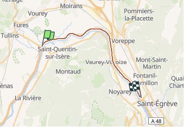
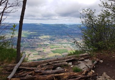
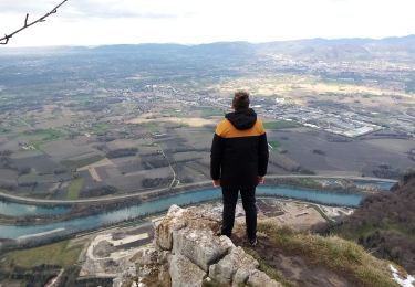
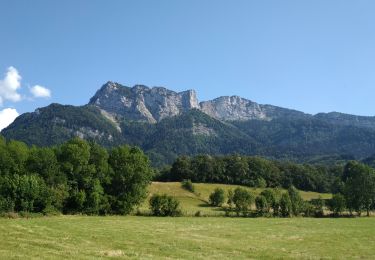
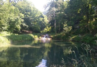
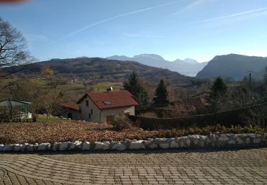
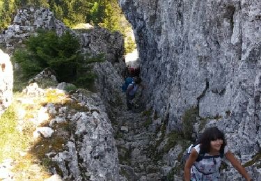
Randonnée Vélo de 17 km à découvrir à Auvergne-Rhône-Alpes, Isère, Tullins. Cette randonnée est proposée par thierry2thomas.

Profil altimétrique

Localisation

Pays :
France
Région :
Auvergne-Rhône-Alpes
Département/Province :
Isère
Commune :
Tullins
Localité :
Unknown
Départ:(Dec)
Départ:(UTM)
698152 ; 5017899 (31T) N.

Randonnées à proximité

Randonnée Marche Saint-Quentin-sur-Isère - Dent de Moirans - Photo
Marche
GuyVachet

Marche

Très difficile
Saint-Quentin-sur-Isère, Auvergne-Rhône-Alpes, Isère, France
14,7 km | 26 km-effort
6h 17min
Oui
Randonnée Marche Saint-Quentin-sur-Isère - 38 St Quentin sur isere - Photo
Marche
himba26100

Marche

Moyen
Saint-Quentin-sur-Isère, Auvergne-Rhône-Alpes, Isère, France
17 km | 28 km-effort
7h 22min
Oui
Randonnée Marche Tullins - Clos des Chartreux Parmenie 2 - Photo
Marche
micoud

Marche

Moyen
Tullins, Auvergne-Rhône-Alpes, Isère, France
14,1 km | 23 km-effort
5h 29min
Oui
Randonnée Marche Montaud - La Dent de Moirans - Photo
Marche
patjobou

Marche

Facile
Montaud, Auvergne-Rhône-Alpes, Isère, France
11 km | 16,4 km-effort
4h 38min
Oui
Randonnée Marche Montaud - La dent de Moirans - Photo
Marche
crocau

Marche

Très facile
(1)
Montaud, Auvergne-Rhône-Alpes, Isère, France
8,9 km | 13,5 km-effort
2h 57min
Oui
Randonnée Marche Montaud - BOUCLE MONTAUD DE T DE MOIRANS - Photo
Marche
floup6138

Marche

Moyen
Montaud, Auvergne-Rhône-Alpes, Isère, France
11,1 km | 16,7 km-effort
3h 12min
Oui
Randonnée Marche Saint-Quentin-sur-Isère - st Quentin montaud boucle - Photo
Marche
floup6138

Marche

Moyen
Saint-Quentin-sur-Isère, Auvergne-Rhône-Alpes, Isère, France
8,9 km | 16,3 km-effort
2h 58min
Oui
Randonnée Marche Montaud - DENT DE MOIRANS GROUPE 1 - Photo
Marche
floup6138

Marche

Difficile
Montaud, Auvergne-Rhône-Alpes, Isère, France
12,7 km | 21 km-effort
4h 14min
Oui
Randonnée Marche Montaud - bec deLorient - Photo
Marche
patchil

Marche

Très facile
(1)
Montaud, Auvergne-Rhône-Alpes, Isère, France
16 km | 30 km-effort
5h 54min
Non


Fermer
Mes abonnements